 |
|
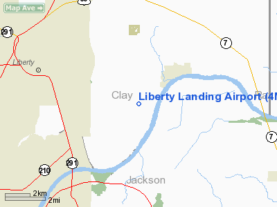
Location & QuickFacts
| FAA Information Effective: | 2008-09-25 |
| Airport Identifier: | 4MO4 |
| Airport Status: | Operational |
| Longitude/Latitude: | 094-20-00.8150W/39-13-00.0130N
-94.333560/39.216670 (Estimated) |
| Elevation: | 720 ft / 219.46 m (Estimated) |
| Land: | 40 acres |
| From nearest city: | 3 nautical miles SW of Liberty, MO |
| Location: | Clay County, MO |
| Magnetic Variation: | 05E (1985) |
Owner & Manager
| Ownership: | Privately owned |
| Owner: | E W Raasch Iii & L F Raasch |
| Address: | 17607 Ne 52nd St
Liberty, MO 64068 |
| Phone number: | 816-781-9196 |
| Manager: | E. Raasch |
| Address: | 17607 Ne 52nd St
Liberty, MO 64068 |
| Phone number: | 816-781-9196 |
Airport Operations and Facilities
| Airport Use: | Private |
| Wind indicator: | Yes |
| Segmented Circle: | Yes |
| Control Tower: | No |
| Landing fee charge: | No |
| Sectional chart: | Kansas City |
| Region: | ACE - Central |
| Boundary ARTCC: | ZKC - Kansas City |
| Tie-in FSS: | COU - Columbia |
| FSS on Airport: | No |
| FSS Toll Free: | 1-800-WX-BRIEF |
Airport Services
Runway Information
Runway 04/22
| Dimension: | 1850 x 36 ft / 563.9 x 11.0 m |
| Surface: | GRVL, |
| |
Runway 04 |
Runway 22 |
| Traffic Pattern: | Right | Left |
|
Radio Navigation Aids
| ID |
Type |
Name |
Ch |
Freq |
Var |
Dist |
| GPH | NDB | Mosby | | 284.00 | 03E | 7.9 nm |
| LXT | NDB | Lesumit | | 263.00 | 04E | 15.5 nm |
| GQ | NDB | Norge | | 517.00 | 05E | 17.7 nm |
| GKB | NDB | Norge | | 517.00 | 05E | 17.7 nm |
| DO | NDB | Dotte | | 359.00 | 05E | 19.4 nm |
| EZZ | NDB | Cameron | | 394.00 | 03E | 30.9 nm |
| AZN | NDB | Amazon | | 233.00 | 06E | 48.1 nm |
| SZL | TACAN | Whiteman | 035X | | 04E | 46.6 nm |
| RIS | VOR/DME | Riverside | 051X | 111.40 | 05E | 13.6 nm |
| OJC | VOR/DME | Johnson County | 077X | 113.00 | 06E | 29.4 nm |
| BQS | VOR/DME | Braymer | 049X | 111.20 | 03E | 32.7 nm |
| ANX | VORTAC | Napoleon | 087X | 114.00 | 07E | 12.0 nm |
| MCI | VORTAC | Kansas City | 079Y | 113.25 | 05E | 19.2 nm |
| MKC | VOT | Kansas City Downtown | | 108.60 | | 13.5 nm |
Images and information placed above are from
http://www.airport-data.com/airport/4MO4/
We thank them for the data!
| General Info
|
| Country |
United States
|
| State |
MISSOURI
|
| FAA ID |
4MO4
|
| Latitude |
39-13-00.013N
|
| Longitude |
094-20-00.815W
|
| Elevation |
720 feet
|
| Near City |
LIBERTY
|
We don't guarantee the information is fresh and accurate. The data may
be wrong or outdated.
For more up-to-date information please refer to other sources.
|
|


