 |
|
Lexington Municipal Airport |
| Lexington Municipal Airport |
| IATA: none – ICAO: none – FAA LID: 4K3 |
| Summary |
| Airport type |
Public use |
| Owner |
Tom Dolphin |
| Serves |
Lexington, Missouri |
| Elevation AMSL |
691 ft / 211 m |
| Coordinates |
39°12′35″N 093°55′41″W / 39.20972°N 93.92806°W / 39.20972; -93.92806 |
| Runways |
| Direction |
Length |
Surface |
| ft |
m |
| 4/22 |
2,925 |
892 |
Asphalt |
| 13/31 |
3,100 |
945 |
Turf |
| 18/36 |
2,250 |
686 |
Turf |
| Statistics (2007) |
| Aircraft operations |
3,375 |
| Based aircraft |
7 |
| Source: Federal Aviation Administration |
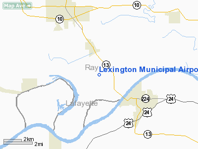
Lexington Municipal Airport (FAA LID: 4K3) is a privately-owned public-use airport located three nautical miles (6 km) northwest of the central business district of Lexington, in Ray County, Missouri, United States.
The airport is located just south of Henrietta, Missouri and is home to the Missouri Valley River Skydivers (MRVS). Skydivers are regularly jumping on weekends, please be aware and monitor your radio if you are in the area. Facilities and aircraft
Lexington Municipal Airport covers an area of 160 acres (65 ha) at an elevation of 691 feet (211 m) above mean sea level. It has three runways: 04-22 is a 2,925 by 40 ft (892 x 12 m) asphalt strip with runway 04 at 47° and 22 at 247°; 13-31 is a grass field measuring 3,100 by 125 ft (945 x 38 m); 18-36 is also grass and measures 2,250 by 125 ft (686 x 38 m). 04-22 markings are well faded, while the other two are not marked. 04-22 has lights, LIRL 122.7 CTAF. This airfield does not have fuel for sale, only for DZ operations.
For the 12-month period ending September 5, 2007, the airport had 3,375 aircraft operations, an average of 281 per month: 89% general aviation, 9% military and 2% air taxi. At that time there were 7 aircraft based at this airport, all single-engine.
Missouri River Valley Skydivers
MRVS is currently operating one Cessna 182, with a few more in maintenance. While MRVS is operating (most weekends 0800L-Sunset), the owner's wife has a snack shack typically open from 1200-1700L, while weather is good.
The above content comes from Wikipedia and is published under free licenses – click here to read more.
Location & QuickFacts
| FAA Information Effective: | 2008-09-25 |
| Airport Identifier: | 4K3 |
| Airport Status: | Operational |
| Longitude/Latitude: | 093-55-40.8000W/39-12-35.2000N
-93.928000/39.209778 (Estimated) |
| Elevation: | 691 ft / 210.62 m (Surveyed) |
| Land: | 160 acres |
| From nearest city: | 3 nautical miles NW of Lexington, MO |
| Location: | Ray County, MO |
| Magnetic Variation: | 04E (1985) |
Owner & Manager
| Ownership: | Privately owned |
| Owner: | Tom Dolphin |
| Address: | 42938 W. 64th Street
Henrietta, MO 64036 |
| Phone number: | 816-290-5415 |
| Manager: | Tom Dolphin |
| Address: | 42938 W. 64th Street
Henrietta, MO 64036 |
| Phone number: | 816-290-5415 |
Airport Operations and Facilities
| Airport Use: | Open to public |
| Wind indicator: | Yes |
| Segmented Circle: | No |
| Control Tower: | No |
| Lighting Schedule: | DUSK-DAWN
ACTVT LIRL RY 04/22 - CTAF. |
| Beacon Color: | Clear-Green (lighted land airport) |
| Landing fee charge: | No |
| Sectional chart: | Kansas City |
| Region: | ACE - Central |
| Boundary ARTCC: | ZKC - Kansas City |
| Tie-in FSS: | COU - Columbia |
| FSS on Airport: | No |
| FSS Toll Free: | 1-800-WX-BRIEF |
| NOTAMs Facility: | COU (NOTAM-d service avaliable) |
Airport Communications
| CTAF: | 122.700 |
| Unicom: | 122.700 |
Airport Services
| Fuel available: | 100LL
100LL UNAVBL INDEFLY. |
| Bottled Oxygen: | NONE |
| Bulk Oxygen: | NONE |
Runway Information
Runway 04/22
| Dimension: | 2925 x 40 ft / 891.5 x 12.2 m |
| Surface: | ASPH, Poor Condition
ROUGH, LARGE PITS IN SFC, CRACKS, TALL GRASS AND WEEDS GROWING IN CRACKS.
MULTIPLE POT HOLES ENTIRE LENGTH OF RUNWAY MARKED BY SMALL SURVEY FLAGS. |
| Edge Lights: | Non-standard lighting system
NSTD LIRL; SPACING OF RY LGTS VARIES FM 240-250 FT; 6 THLD LGTS LCTD 20 FT NE OF RY 22 THLD; ALL THLD LGTS INCORRECT SPACING. |
| |
Runway 04 |
Runway 22 |
| Longitude: | 093-55-49.0890W | 093-55-23.9850W |
| Latitude: | 39-12-24.8920N | 39-12-46.2070N |
| Elevation: | 691.00 ft | 689.00 ft |
| Alignment: | 42 | 127 |
| Traffic Pattern: | Left | Left |
| Obstruction: | 24 ft plines, 315.0 ft from runway, 195 ft left of centerline, 4:1 slope to clear
1-2 FT BRUSH; 0-200 FT FM RY END; 35-250 FT R & 100-200 FT FM RY END; 35-250 FT L. | 34 ft trees, 1368.0 ft from runway, 240 ft left of centerline, 34:1 slope to clear
1-45 FT TREES; 0-80 FT FM RY END 160 FT R; 1-10 FT BRUSH; 100-170 FT FM RY END; 55-115 FT R. |
|
Runway 13/31
| Dimension: | 3100 x 125 ft / 944.9 x 38.1 m |
| Surface: | TURF, Fair Condition
ROUGH, LARGE PITS IN SFC, CRACKS, TALL GRASS AND WEEDS GROWING IN CRACKS.
MULTIPLE POT HOLES ENTIRE LENGTH OF RUNWAY MARKED BY SMALL SURVEY FLAGS. |
| |
Runway 13 |
Runway 31 |
| Longitude: | 093-55-49.6500W | 093-55-26.9400W |
| Latitude: | 39-12-45.9250N | 39-12-24.1540N |
| Elevation: | 690.00 ft | 690.00 ft |
| Traffic Pattern: | Left | Left |
| Obstruction: | 24 ft plines, 320.0 ft from runway, 13:1 slope to clear | 10 ft road, 0.0 ft from runway |
|
Runway 18/36
| Dimension: | 2250 x 125 ft / 685.8 x 38.1 m |
| Surface: | TURF, Fair Condition
ROUGH, LARGE PITS IN SFC, CRACKS, TALL GRASS AND WEEDS GROWING IN CRACKS.
MULTIPLE POT HOLES ENTIRE LENGTH OF RUNWAY MARKED BY SMALL SURVEY FLAGS. |
| |
Runway 18 |
Runway 36 |
| Longitude: | 093-55-49.7950W | 093-55-49.7950W |
| Latitude: | 39-12-46.1720N | 39-12-23.9080N |
| Elevation: | 690.00 ft | 690.00 ft |
| Alignment: | 127 | 0 |
| Traffic Pattern: | Left | Left |
| Obstruction: | 81 ft trees, 3220.0 ft from runway, 225 ft left of centerline, 39:1 slope to clear | 15 ft road, 385.0 ft from runway, 25:1 slope to clear |
|
Radio Navigation Aids
| ID |
Type |
Name |
Ch |
Freq |
Var |
Dist |
| GPH | NDB | Mosby | | 284.00 | 03E | 19.5 nm |
| LXT | NDB | Lesumit | | 263.00 | 04E | 25.5 nm |
| EZZ | NDB | Cameron | | 394.00 | 03E | 35.1 nm |
| GQ | NDB | Norge | | 517.00 | 05E | 35.1 nm |
| GKB | NDB | Norge | | 517.00 | 05E | 35.1 nm |
| PUR | NDB | Marshall | | 371.00 | 03E | 35.6 nm |
| DO | NDB | Dotte | | 359.00 | 05E | 38.3 nm |
| HCK | NDB | Hawks | | 296.00 | 04E | 38.7 nm |
| CHT | NDB | Chillicothe | | 375.00 | 03E | 39.6 nm |
| DMO | NDB | Sedalia | | 281.00 | 03E | 46.4 nm |
| SZL | TACAN | Whiteman | 035X | | 04E | 33.5 nm |
| BQS | VOR/DME | Braymer | 049X | 111.20 | 03E | 25.4 nm |
| RIS | VOR/DME | Riverside | 051X | 111.40 | 05E | 31.6 nm |
| OJC | VOR/DME | Johnson County | 077X | 113.00 | 06E | 43.8 nm |
| ANX | VORTAC | Napoleon | 087X | 114.00 | 07E | 11.6 nm |
| MCI | VORTAC | Kansas City | 079Y | 113.25 | 05E | 37.9 nm |
| MKC | VOT | Kansas City Downtown | | 108.60 | | 31.7 nm |
Remarks
- SPORT AVIATION ACTIVITIES IN PROGRESS ON WEEKENDS.
- BIRDS INVOF ARPT DURING SPRING RAINS & FLOODING.
- TREES IN RY VISIBILITY ZONE BETWEEN RY 22 END AND RY 13 END.
- NTSD RY SAFETY AREA BYD RY 22, 13, 18, & 31 ENDS; INCORRECT TERRAIN GRADES, INSUF LENGTH, DITCH, BRUSH, TREES, POLE, CROPS.
- RY 22 +1-50 FT TALL TREES AND BRUSH FIRST 1,000 FT OF RY 22, 86-250 FT NORTH OF RY PAVEMENT EDGE & 100-250 FT SOUTH OF RY PAVEMENT EDGE.
- E111 PRVDD APCH TO EACH RWY IS MAINTD FOR A MIN 20:1 GLIDE SLOPE & THE TRANSITIONAL SFC IS MAINTD FOR A 7:1 SLOPE.
Images and information placed above are from
http://www.airport-data.com/airport/4K3/
We thank them for the data!
| General Info
|
| Country |
United States
|
| State |
MISSOURI
|
| FAA ID |
4K3
|
| Latitude |
39-12-35.200N
|
| Longitude |
093-55-40.800W
|
| Elevation |
691 feet
|
| Near City |
LEXINGTON
|
We don't guarantee the information is fresh and accurate. The data may
be wrong or outdated.
For more up-to-date information please refer to other sources.
|
|


