 |
|
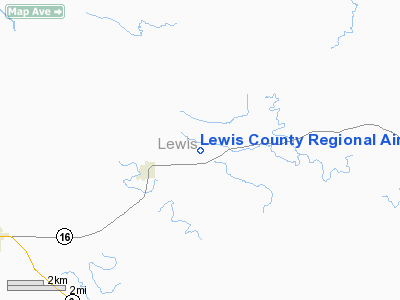
Lewis County Regional Airport |
Location & QuickFacts
| FAA Information Effective: | 2008-09-25 |
| Airport Identifier: | 6M6 |
| Airport Status: | Operational |
| Longitude/Latitude: | 091-40-42.0000W/40-07-45.0000N
-91.678333/40.129167 (Estimated) |
| Elevation: | 675 ft / 205.74 m (Surveyed) |
| Land: | 97 acres |
| From nearest city: | 2 nautical miles NE of Monticello, MO |
| Location: | Lewis County, MO |
| Magnetic Variation: | 01E (2000) |
Owner & Manager
| Ownership: | Publicly owned |
| Owner: | Lewis County Arpt Authority |
| Address: | P.o. Box 85
Canton, MO 63435 |
| Phone number: | 573-767-5466 |
| Manager: | David Lillard
CONTACT PERSON - CHAIRMAN ARPT AUTH. |
| Address: | P.o. Box 85
Canton, MO 63435 |
| Phone number: | 660-462-3660
ALTERNATE PHONE NMBRS 660-341-0756, 573-288-3218. |
Airport Operations and Facilities
| Airport Use: | Open to public |
| Wind indicator: | Yes |
| Segmented Circle: | Yes |
| Control Tower: | No |
| Lighting Schedule: | DUSK-DAWN
ACTVT MIRL RY 18/36 - CTAF. |
| Beacon Color: | Clear-Green (lighted land airport) |
| Sectional chart: | Kansas City |
| Region: | ACE - Central |
| Boundary ARTCC: | ZKC - Kansas City |
| Tie-in FSS: | STL - Saint Louis |
| FSS Toll Free: | 1-800-WX-BRIEF |
| NOTAMs Facility: | STL (NOTAM-d service avaliable) |
| Federal Agreements: | NGY |
Airport Communications
| CTAF: | 122.700 |
| Unicom: | 122.700
UNICOM UNMONITORED. |
Airport Services
| Fuel available: | 100LL
FOR FUEL CALL NUMBER SHOWN AT FUELING AREA. |
Runway Information
Runway 18/36
| Dimension: | 3500 x 60 ft / 1066.8 x 18.3 m |
| Surface: | CONC, Good Condition |
| Weight Limit: | Single wheel: 30000 lbs. |
| Edge Lights: | Medium |
| |
Runway 18 |
Runway 36 |
| Longitude: | 091-40-41.2200W | 091-40-42.3200W |
| Latitude: | 40-08-02.3200N | 40-07-27.7500N |
| Elevation: | 665.00 ft | 675.00 ft |
| Alignment: | 127 | 1 |
| Traffic Pattern: | Left | Left |
| Markings: | Non-precision instrument, Good Condition | Non-precision instrument, Good Condition |
| Crossing Height: | 40.00 ft | 40.00 ft |
| VASI: | 2-light PAPI on left side | 2-light PAPI on left side |
| Visual Glide Angle: | 3.00° | 3.00° |
| Runway End Identifier: | Yes | Yes |
| Obstruction: | 60 ft tree, 2765.0 ft from runway, 406 ft right of centerline, 42:1 slope to clear | 16 ft road, 665.0 ft from runway, 29:1 slope to clear |
|
Radio Navigation Aids
| ID |
Type |
Name |
Ch |
Freq |
Var |
Dist |
| EOK | NDB | Keokuk | | 366.00 | 02E | 23.1 nm |
| UI | NDB | Quincy | | 293.00 | 02E | 24.4 nm |
| HAE | NDB | Hannibal | | 411.00 | 03E | 26.4 nm |
| MPZ | NDB | Mount Pleasant | | 212.00 | 02E | 49.5 nm |
| MCM | VOR/DME | Macon | 076X | 112.90 | 06E | 46.8 nm |
| UIN | VORTAC | Quincy | 083X | 113.60 | 05E | 25.0 nm |
| IRK | VORTAC | Kirksville | 093X | 114.60 | 06E | 42.0 nm |
| BRL | VORTAC | Burlington | 051X | 111.40 | 05E | 49.6 nm |
Remarks
- ULTRALIGHT ACTIVITY ON & INVOF ARPT.
Images and information placed above are from
http://www.airport-data.com/airport/6M6/
We thank them for the data!
| General Info
|
| Country |
United States
|
| State |
MISSOURI
|
| FAA ID |
6M6
|
| Latitude |
40-07-45.000N
|
| Longitude |
091-40-42.000W
|
| Elevation |
674 feet
|
| Near City |
MONTICELLO
|
We don't guarantee the information is fresh and accurate. The data may
be wrong or outdated.
For more up-to-date information please refer to other sources.
|
|


