 |
|
Lee's Summit Municipal Airport |
| Lee's Summit Municipal Airport |
| IATA: none – ICAO: KLXT – FAA LID: LXT |
| Summary |
| Airport type |
Public |
| Owner |
City of Lee's Summit |
| Serves |
Lee's Summit, Missouri |
| Elevation AMSL |
1,004 ft / 306 m |
| Coordinates |
38°57′34.9″N 094°22′16.9″W / 38.959694°N 94.371361°W / 38.959694; -94.371361 |
| Runways |
| Direction |
Length |
Surface |
| ft |
m |
| 11/29 |
3,800 |
1,158 |
Concrete |
| 18/36 |
4,016 |
1,224 |
Concrete |
| Statistics (2006) |
| Aircraft operations |
92,040 |
| Based aircraft |
156 |
| Source: Federal Aviation Administration |
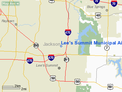
Lee's Summit Municipal Airport is a public use airport in Jackson County, Missouri, United States. It is owned by the City of Lee's Summit and is located three nautical miles (5.56 km) north of its central business district. According to the FAA's National Plan of Integrated Airport Systems for 2007-2011, it is categorized as a reliever airport.
Although most U.S. airports use the same three-letter location identifier for the FAA and IATA, Lee's Summit Municipal Airport is assigned LXT by the FAA but has no designation from the IATA.
Facilities and aircraft
Lee's Summit Municipal Airport covers an area of 433 acres (175 ha) at an elevation of 1,004 feet (306 m) above mean sea level. It has two concrete runways: 11/29 measuring 3,800 by 75 feet (1,158 x 23 m) and 18/36 measuring 4,016 by 75 feet (1,224 x 23 m).
For the 12-month period ending October 31, 2009, the airport had 43,950 aircraft operations, an average of 120 per day: 96% general aviation, 3% air taxi, and 1% [military aviation]. This data indicates a drop of 52% in operatiosn from the 2006 period cited below. At this time there were 146 aircraft based at this airport: 90% single-[[aircraft engine[engine]], 7% multi-engine and 3% Jet engine.
For the 12-month period ending November 30, 2006, the airport had 92,040 aircraft operations, an average of 252 per day: 96% general aviation, 3% air taxi, and 1% military aviation. At that time there were 156 aircraft based at this airport: 88% single-engine, 9% multi-engine and 3% jet engine.
The above content comes from Wikipedia and is published under free licenses – click here to read more.
Location & QuickFacts
| FAA Information Effective: | 2008-09-25 |
| Airport Identifier: | LXT |
| Airport Status: | Operational |
| Longitude/Latitude: | 094-22-16.9000W/38-57-34.9000N
-94.371361/38.959694 (Estimated) |
| Elevation: | 1004 ft / 306.02 m (Surveyed) |
| Land: | 433 acres |
| From nearest city: | 3 nautical miles N of Lee's Summit, MO |
| Location: | Jackson County, MO |
| Magnetic Variation: | 04E (1995) |
Owner & Manager
| Ownership: | Publicly owned |
| Owner: | City Of Lee's Summit |
| Address: | City Hall, 220 S.e. Green
Lees Summit, MO 64063 |
| Phone number: | 816-969-1000 |
| Manager: | John Ohrazda |
| Address: | 2751 Ne Douglas Rd
Lees Summit, MO 64064 |
| Phone number: | 816-969-1180 |
Airport Operations and Facilities
| Airport Use: | Open to public |
| Wind indicator: | Yes |
| Segmented Circle: | Yes |
| Control Tower: | No |
| Lighting Schedule: | DUSK-DAWN
MIRL RYS 11/29 & 18/36 PRESET ON LOW INTST DUSK-2200; FOR HIGHER INTST AFT 2200 ACTVT - CTAF. FOR REIL RYS 18; 36; 11 & 29; PAPI RYS 11 & 29; VASI RY 36 - CTAF. VASI RY 18 ON CONTINUOUSLY. |
| Beacon Color: | Clear-Green (lighted land airport) |
| Landing fee charge: | No |
| Sectional chart: | Kansas City |
| Region: | ACE - Central |
| Boundary ARTCC: | ZKC - Kansas City |
| Tie-in FSS: | COU - Columbia |
| FSS on Airport: | No |
| FSS Toll Free: | 1-800-WX-BRIEF |
| NOTAMs Facility: | LXT (NOTAM-d service avaliable) |
| Federal Agreements: | NGY |
Airport Communications
| CTAF: | 122.800 |
| Unicom: | 122.800 |
Airport Services
| Fuel available: | 100LLA MOGAS |
| Airframe Repair: | MAJOR |
| Power Plant Repair: | MAJOR |
| Bottled Oxygen: | LOW |
| Bulk Oxygen: | NONE |
Runway Information
Runway 11/29
| Dimension: | 3800 x 75 ft / 1158.2 x 22.9 m |
| Surface: | CONC, Good Condition |
| Weight Limit: | Single wheel: 30000 lbs.
Dual wheel: 30000 lbs. |
| Edge Lights: | Medium |
| |
Runway 11 |
Runway 29 |
| Longitude: | 094-22-29.4371W | 094-21-45.2853W |
| Latitude: | 38-57-36.6055N | 38-57-21.6939N |
| Elevation: | 993.00 ft | 1001.00 ft |
| Alignment: | 113 | 127 |
| Traffic Pattern: | Right | Left |
| Markings: | Non-precision instrument, Good Condition | Non-precision instrument, Good Condition |
| Crossing Height: | 45.00 ft | 40.00 ft |
| VASI: | 4-light PAPI on left side | 4-light PAPI on right side |
| Visual Glide Angle: | 3.00° | 3.00° |
| Runway End Identifier: | Yes | Yes |
| Obstruction: | 19 ft tree, 845.0 ft from runway, 25 ft right of centerline, 33:1 slope to clear | 19 ft tree, 510.0 ft from runway, 200 ft right of centerline, 16:1 slope to clear |
|
Runway 18/36
| Dimension: | 4016 x 75 ft / 1224.1 x 22.9 m |
| Surface: | CONC, Good Condition |
| Weight Limit: | Single wheel: 30000 lbs.
Dual wheel: 30000 lbs. |
| Edge Lights: | Medium |
| |
Runway 18 |
Runway 36 |
| Longitude: | 094-22-24.4033W | 094-22-27.4085W |
| Latitude: | 38-58-00.2317N | 38-57-20.6132N |
| Elevation: | 995.00 ft | 992.00 ft |
| Alignment: | 127 | 3 |
| Traffic Pattern: | Left | Right |
| Markings: | Non-precision instrument, Good Condition | Non-precision instrument, Good Condition |
| Crossing Height: | 31.00 ft | 31.00 ft |
| VASI: | 4-box on left side | 4-box on left side |
| Visual Glide Angle: | 3.50° | 3.50° |
| Runway End Identifier: | Yes | Yes |
| Obstruction: | 20 ft tree, 610.0 ft from runway, 160 ft left of centerline, 20:1 slope to clear
RWY 18 +1-14 FT FNC, HGH GND, ELECTRICAL BOXES, 0-200 FT FM RY END, 215-250 FT L. | , 50:1 slope to clear |
|
Radio Navigation Aids
| ID |
Type |
Name |
Ch |
Freq |
Var |
Dist |
| GQ | NDB | Norge | | 517.00 | 05E | 14.6 nm |
| GKB | NDB | Norge | | 517.00 | 05E | 14.6 nm |
| GPH | NDB | Mosby | | 284.00 | 03E | 23.4 nm |
| DO | NDB | Dotte | | 359.00 | 05E | 23.6 nm |
| HCK | NDB | Hawks | | 296.00 | 04E | 42.4 nm |
| EZZ | NDB | Cameron | | 394.00 | 03E | 46.5 nm |
| GLY | NDB | Golden Valley | | 388.00 | 04E | 48.4 nm |
| SZL | TACAN | Whiteman | 035X | | 04E | 40.7 nm |
| RIS | VOR/DME | Riverside | 051X | 111.40 | 05E | 14.3 nm |
| OJC | VOR/DME | Johnson County | 077X | 113.00 | 06E | 18.5 nm |
| BQS | VOR/DME | Braymer | 049X | 111.20 | 03E | 46.5 nm |
| ANX | VORTAC | Napoleon | 087X | 114.00 | 07E | 14.0 nm |
| MCI | VORTAC | Kansas City | 079Y | 113.25 | 05E | 26.0 nm |
| BUM | VORTAC | Butler | 106X | 115.90 | 07E | 41.7 nm |
| MKC | VOT | Kansas City Downtown | | 108.60 | | 14.4 nm |
Remarks
- NO RIGHT TURNS UNDER 2500 FT MSL OR WITHIN 3 MI OF THE ARPT WHEN DEPARTING ON RY 29.
- NO LEFT TURNS UNDER 1500 FT MSL OR WITHIN 1/2 MI OF THE END OF THE RY WHEN DEPARTING ON RY 18.
- NO LEFT TURNS UNDER 2500 FT MSL OR WITHIN 3 MI OF THE ARPT DEPARTING ON RY 36.
- WILDLIFE ON & INVOF ARPT.
- WHEN WINDS ARE LESS THAN 5 KNOTS USE RY 18.
- AER 18,36 & 29 ARE NOT MUTUALLY VISIBLE DUE TO TERRAIN & TREES.
Images and information placed above are from
http://www.airport-data.com/airport/LXT/
We thank them for the data!
| General Info
|
| Country |
United States
|
| State |
MISSOURI
|
| FAA ID |
LXT
|
| Latitude |
38-57-35.100N
|
| Longitude |
094-22-17.700W
|
| Elevation |
1004 feet
|
| Near City |
LEE'S SUMMIT
|
We don't guarantee the information is fresh and accurate. The data may
be wrong or outdated.
For more up-to-date information please refer to other sources.
|
|


