 |
|
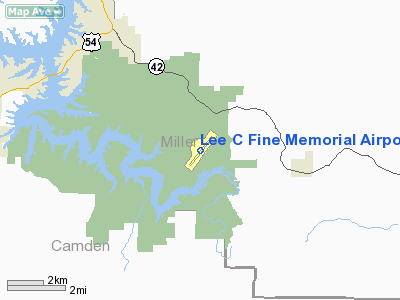
Lee C Fine Memorial Airport |
| Lee C. Fine Memorial Airport |
| IATA: AIZ – ICAO: KAIZ |
| Summary |
| Airport type |
Public |
| Operator |
City of Osage Beach |
| Location |
Lake Ozark, Missouri |
| Elevation AMSL |
869 ft / 264.9 m |
| Coordinates |
38°05′45.72″N 92°32′58.15″W / 38.0960333°N 92.5494861°W / 38.0960333; -92.5494861Coordinates: 38°05′45.72″N 92°32′58.15″W / 38.0960333°N 92.5494861°W / 38.0960333; -92.5494861 |
| Runways |
| Direction |
Length |
Surface |
| ft |
m |
| 3/21 |
6,497 |
1,980 |
Asphalt |
Lee C. Fine Memorial Airport (IATA: AIZ, ICAO: KAIZ) a public airport located in Lake of the Ozarks State Park in Kaiser, Missouri. This airport is owned by the city of Osage Beach.
Facilities
Lee C. Fine Memorial Airport covers 610 acres (247 ha) and has one runway:
- Runway 3/21: 6,497 x 100 ft (1,980 x 30 m), Surface: Asphalt
The above content comes from Wikipedia and is published under free licenses – click here to read more.
Location & QuickFacts
| FAA Information Effective: | 2008-09-25 |
| Airport Identifier: | AIZ |
| Airport Status: | Operational |
| Longitude/Latitude: | 092-32-58.1550W/38-05-45.7260N
-92.549488/38.096035 (Estimated) |
| Elevation: | 869 ft / 264.87 m (Estimated) |
| Land: | 215 acres |
| From nearest city: | 3 nautical miles SE of Kaiser Lake Ozark, MO |
| Location: | Miller County, MO |
| Magnetic Variation: | 05E (1980) |
Owner & Manager
| Ownership: | Publicly owned |
| Owner: | City Of Osage Beach |
| Address: | 1000 City Parkway-city Hall
Osage Beach, MO 65065 |
| Phone number: | 573-302-2000 |
| Manager: | Mr. Philip F. Phillips |
| Address: | 1000 City Parkway-city Hall
Osage Beach, MO 65065 |
| Phone number: | 573-302-2003
ARPT PHONE 573-348-5251. |
Airport Operations and Facilities
| Airport Use: | Open to public |
| Wind indicator: | Yes |
| Segmented Circle: | Yes |
| Control Tower: | No |
| Lighting Schedule: | DUSK-DAWN
ACTVT MIRL RY 03/21 & VASI RYS 03 & 21 - CTAF. |
| Beacon Color: | Clear-Green (lighted land airport) |
| Landing fee charge: | No |
| Sectional chart: | Kansas City |
| Region: | ACE - Central |
| Boundary ARTCC: | ZKC - Kansas City |
| Tie-in FSS: | COU - Columbia |
| FSS on Airport: | No |
| FSS Toll Free: | 1-800-WX-BRIEF |
| NOTAMs Facility: | AIZ (NOTAM-d service avaliable) |
| Federal Agreements: | NGY |
Airport Communications
| CTAF: | 122.800 |
| Unicom: | 122.800 |
Airport Services
| Fuel available: | 100LLA |
| Airframe Repair: | NONE |
| Power Plant Repair: | NONE |
Runway Information
Runway 03/21
| Dimension: | 6497 x 100 ft / 1980.3 x 30.5 m |
| Surface: | ASPH, Fair Condition
VARIOUS AREAS WITH GRASS & WEEDS GROWING IN CRACKS. |
| Surface Treatment: | Aggregate Friction Seal Coat |
| Weight Limit: | Single wheel: 55000 lbs.
Dual wheel: 70000 lbs.
Dual tandem wheel: 215000 lbs. |
| Edge Lights: | Medium |
| |
Runway 03 |
Runway 21 |
| Longitude: | 092-33-22.6130W | 092-32-33.6220W |
| Latitude: | 38-05-20.0950N | 38-06-11.3420N |
| Elevation: | 863.00 ft | 869.00 ft |
| Alignment: | 37 | 127 |
| ILS Type: | | LOCALIZER
|
| Traffic Pattern: | Left | Left |
| Markings: | Non-precision instrument, Poor Condition
MARKINGS FADED. | Non-precision instrument, Poor Condition
MARKINGS FADED. |
| Crossing Height: | 55.00 ft | 42.00 ft |
| VASI: | 4-box on left side | 4-box on left side |
| Visual Glide Angle: | 3.00° | 3.00° |
| Obstruction: | 45 ft tree, 1361.0 ft from runway, 327 ft right of centerline, 25:1 slope to clear | 17 ft trees, 1000.0 ft from runway, 47:1 slope to clear |
|
Radio Navigation Aids
| ID |
Type |
Name |
Ch |
Freq |
Var |
Dist |
| AIZ | NDB | Kaiser | | 377.00 | 05E | 0.2 nm |
| BHN | NDB | Buckhorn | | 391.00 | 03E | 31.9 nm |
| IEB | NDB | Lebanon | | 414.00 | 03E | 32.0 nm |
| JE | NDB | Algoa | | 397.00 | 03E | 35.3 nm |
| ONH | NDB | Noah | | 515.00 | 03E | 35.6 nm |
| DMO | NDB | Sedalia | | 281.00 | 03E | 47.0 nm |
| TBN | VOR | Forney | | 110.00 | 03E | 28.8 nm |
| SHY | VOR/DME | Sunshine | 021X | 108.40 | 05E | 4.2 nm |
| VIH | VOR/DME | Vichy | 124X | 117.70 | 06E | 40.0 nm |
| COU | VOR/DME | Columbia | 039X | 110.20 | 03E | 45.7 nm |
| MAP | VORTAC | Maples | 081X | 113.40 | 06E | 47.2 nm |
| JEF | VOT | Jefferson City | | 112.00 | | 35.2 nm |
Remarks
- BIRDS & DEER ON & INVOF ARPT; ARPT IN STATE PARK.
- PARALLEL TWY & RY 21 TURNAROUND LIMITED TO ACFT WEIGHING ONLY 12,500 LBS OR LESS. ACFT OVER 12,500 LBS USE TWYS B & C ONLY.
- DISTANCE REMAINING MARKERS ON SE SIDE OF RY 03/21.
- BANNER TOWING ON WEEKENDS FM MAY-SEPT.
Images and information placed above are from
http://www.airport-data.com/airport/AIZ/
We thank them for the data!
| General Info
|
| Country |
United States
|
| State |
MISSOURI
|
| FAA ID |
AIZ
|
| Latitude |
38-05-45.726N
|
| Longitude |
092-32-58.155W
|
| Elevation |
869 feet
|
| Near City |
KAISER LAKE OZARK
|
We don't guarantee the information is fresh and accurate. The data may
be wrong or outdated.
For more up-to-date information please refer to other sources.
|
|


