 |
|
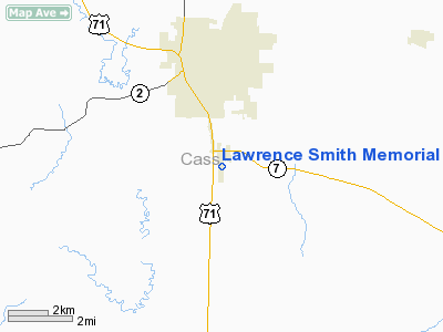
Lawrence Smith Memorial Airport |
Location & QuickFacts
| FAA Information Effective: | 2008-09-25 |
| Airport Identifier: | LRY |
| Airport Status: | Operational |
| Longitude/Latitude: | 094-20-36.7000W/38-36-36.7000N
-94.343528/38.610194 (Estimated) |
| Elevation: | 915 ft / 278.89 m (Surveyed) |
| Land: | 126 acres |
| From nearest city: | 3 nautical miles S of Harrisonville, MO |
| Location: | Cass County, MO |
| Magnetic Variation: | 04E (1995) |
Owner & Manager
| Ownership: | Publicly owned |
| Owner: | City Of Harisonville |
| Address: | Po Box 367, 300 E. Pearl St.
Harrisonville, MO 64701 |
| Phone number: | 816-380-8900 |
| Manager: | James Green |
| Address: | 27503 St Rt 7 S
Harrisonville, MO 64701 |
| Phone number: | 816-380-5039 |
Airport Operations and Facilities
| Airport Use: | Open to public |
| Wind indicator: | Yes |
| Segmented Circle: | Yes |
| Control Tower: | No |
| Lighting Schedule: | DUSK-DAWN
ACTVT MIRL RY 17/35, PAPI RYS 17 & 35 - CTAF. |
| Beacon Color: | Clear-Green (lighted land airport) |
| Landing fee charge: | No |
| Sectional chart: | Kansas City |
| Region: | ACE - Central |
| Boundary ARTCC: | ZKC - Kansas City |
| Tie-in FSS: | COU - Columbia |
| FSS on Airport: | No |
| FSS Toll Free: | 1-800-WX-BRIEF |
| NOTAMs Facility: | COU (NOTAM-d service avaliable) |
| Federal Agreements: | NGY |
Airport Communications
| CTAF: | 123.000 |
| Unicom: | 123.000 |
Airport Services
| Fuel available: | 100LL
24-HR SELF SVC FUEL. |
| Airframe Repair: | NONE |
| Power Plant Repair: | NONE |
| Bottled Oxygen: | NONE |
| Bulk Oxygen: | NONE |
Runway Information
Runway 17/35
| Dimension: | 4000 x 75 ft / 1219.2 x 22.9 m |
| Surface: | ASPH, Good Condition |
| Weight Limit: | Single wheel: 12500 lbs. |
| Edge Lights: | Medium |
| |
Runway 17 |
Runway 35 |
| Longitude: | 094-20-37.9599W | 094-20-35.4486W |
| Latitude: | 38-36-56.4627N | 38-36-16.9730N |
| Elevation: | 915.00 ft | 875.00 ft |
| Alignment: | 127 | 127 |
| Traffic Pattern: | Right | Left |
| Markings: | Non-precision instrument, Fair Condition | Non-precision instrument, Fair Condition |
| Crossing Height: | 27.00 ft | 25.00 ft |
| VASI: | 4-light PAPI on left side | 4-light PAPI on left side |
| Visual Glide Angle: | 4.00° | 3.00° |
| Obstruction: | 70 ft tree, 2634.0 ft from runway, 60 ft left of centerline, 34:1 slope to clear | 35 ft tree, 1039.0 ft from runway, 152 ft right of centerline, 23:1 slope to clear |
| Decleard distances: | Take off run available 4000.00 ft
Take off distance available 4000.00 ft
Actual stop distance available 4000.00 ft
Landing distance available 4000.00 ft
| Take off run available 4000.00 ft
Take off distance available 4000.00 ft
Actual stop distance available 4000.00 ft
Landing distance available 4000.00 ft
|
|
Radio Navigation Aids
| ID |
Type |
Name |
Ch |
Freq |
Var |
Dist |
| LXT | NDB | Lesumit | | 263.00 | 04E | 21.1 nm |
| GQ | NDB | Norge | | 517.00 | 05E | 30.8 nm |
| GKB | NDB | Norge | | 517.00 | 05E | 30.8 nm |
| GLY | NDB | Golden Valley | | 388.00 | 04E | 34.5 nm |
| HCK | NDB | Hawks | | 296.00 | 04E | 36.2 nm |
| DO | NDB | Dotte | | 359.00 | 05E | 41.3 nm |
| GPH | NDB | Mosby | | 284.00 | 03E | 44.3 nm |
| EAD | NDB | Nevada | | 209.00 | 06E | 45.2 nm |
| SZL | TACAN | Whiteman | 035X | | 04E | 38.0 nm |
| OJC | VOR/DME | Johnson County | 077X | 113.00 | 06E | 23.1 nm |
| RIS | VOR/DME | Riverside | 051X | 111.40 | 05E | 32.9 nm |
| BUM | VORTAC | Butler | 106X | 115.90 | 07E | 21.4 nm |
| ANX | VORTAC | Napoleon | 087X | 114.00 | 07E | 30.8 nm |
| MCI | VORTAC | Kansas City | 079Y | 113.25 | 05E | 44.6 nm |
| MKC | VOT | Kansas City Downtown | | 108.60 | | 33.1 nm |
Remarks
- ULTRALIGHTS ON & INVOF ARPT.
- AIR AMBULANCE HELICOPTER OPS ON AND INVOF ARPT.
- BE ALERT TO PARACHUTE OPS ON AND INVOF ARPT.
Images and information placed above are from
http://www.airport-data.com/airport/LRY/
We thank them for the data!
| General Info
|
| Country |
United States
|
| State |
MISSOURI
|
| FAA ID |
LRY
|
| Latitude |
38-36-39.680N
|
| Longitude |
094-20-31.670W
|
| Elevation |
915 feet
|
| Near City |
HARRISONVILLE
|
We don't guarantee the information is fresh and accurate. The data may
be wrong or outdated.
For more up-to-date information please refer to other sources.
|
|


