 |
|
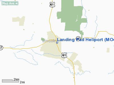
Location & QuickFacts
| FAA Information Effective: | 2008-09-25 |
| Airport Identifier: | MO41 |
| Airport Status: | Operational |
| Longitude/Latitude: | 090-57-47.9990W/38-58-56.6730N
-90.963333/38.982409 (Estimated) |
| Elevation: | 520 ft / 158.50 m (Estimated) |
| Land: | 0 acres |
| From nearest city: | 0 nautical miles N of Troy, MO |
| Location: | Lincoln County, MO |
| Magnetic Variation: | 01E (1995) |
Owner & Manager
| Ownership: | Privately owned |
| Owner: | Lincoln County Memorial Hosp. |
| Address: | 1000 East Cherry Street
Troy, MO 63379 |
| Phone number: | 314-528-8551 |
| Manager: | Lincoln County Memorial Hosp. |
| Address: | 1000 East Cherry Street
Troy, MO 63379 |
| Phone number: | 314-528-8551 |
Airport Operations and Facilities
| Airport Use: | Private
MEDICAL USE. |
| Wind indicator: | Yes |
| Segmented Circle: | No |
| Control Tower: | No |
| Lighting Schedule: | PHONE REQ
FOR FLOOD LGTS CALL 314-528-8551. |
| Sectional chart: | St Louis |
| Region: | ACE - Central |
| Boundary ARTCC: | ZKC - Kansas City |
| Tie-in FSS: | STL - Saint Louis |
| FSS on Airport: | No |
| FSS Toll Free: | 1-800-WX-BRIEF |
Runway Information
Helipad H1
| Dimension: | 50 x 50 ft / 15.2 x 15.2 m |
| Surface: | CONC, |
| |
Runway H1 |
Runway |
| Traffic Pattern: | Left | Left |
|
Radio Navigation Aids
| ID |
Type |
Name |
Ch |
Freq |
Var |
Dist |
| LM | NDB | Oblio | | 338.00 | 00E | 25.3 nm |
| PPQ | NDB | Pittsfield | | 344.00 | 02E | 40.4 nm |
| CVM | NDB | Civic Memorial | | 263.00 | 02E | 42.8 nm |
| UUV | NDB | Sullivan | | 356.00 | 02E | 45.9 nm |
| FTT | NDB | Guthrie | | 317.00 | 03E | 49.4 nm |
| CSX | VOR/DME | Cardinal | 111Y | 116.45 | 00E | 31.4 nm |
| FTZ | VORTAC | Foristell | 045X | 110.80 | 05E | 17.3 nm |
| STL | VORTAC | St Louis | 121X | 117.40 | 01E | 23.7 nm |
| SUS | VOT | Spirit Of St Louis | | 112.20 | | 24.1 nm |
| STL | VOT | St Louis Lambert | | 111.00 | | 31.5 nm |
Remarks
- OWNER DESIRES HELIPORT NOT BE CHARTED.
- PRVDD PENETRATIONS TO FATU; HELIPORT APCH SFC & HELIPORT TRANSITIONAL SFCS.
Images and information placed above are from
http://www.airport-data.com/airport/MO41/
We thank them for the data!
| General Info
|
| Country |
United States
|
| State |
MISSOURI
|
| FAA ID |
MO41
|
| Latitude |
38-58-56.673N
|
| Longitude |
090-57-47.999W
|
| Elevation |
520 feet
|
| Near City |
TROY
|
We don't guarantee the information is fresh and accurate. The data may
be wrong or outdated.
For more up-to-date information please refer to other sources.
|
|


