 |
|
| Lamar Municipal Airport |
| IATA: none – ICAO: KLLU – FAA LID: LLU |
| Summary |
| Airport type |
Public |
| Owner |
City of Lamar |
| Serves |
Lamar, Missouri |
| Elevation AMSL |
1,009 ft / 308 m |
| Coordinates |
37°29′22″N 094°18′41″W / 37.48944°N 94.31139°W / 37.48944; -94.31139 |
| Runways |
| Direction |
Length |
Surface |
| ft |
m |
| 3/21 |
2,902 |
885 |
Asphalt |
| Statistics (2005) |
| Aircraft operations |
4,080 |
| Based aircraft |
20 |
| Source: Federal Aviation Administration |
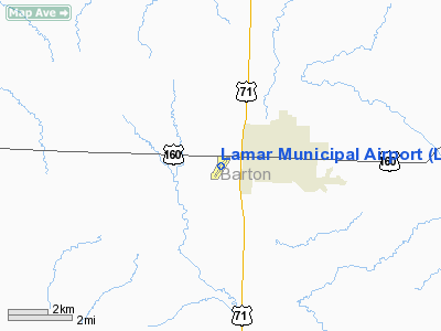
Lamar Municipal Airport (ICAO: KLLU, FAA LID: LLU) is a city-owned, public-use airport located two miles (3 km) southwest of the central business district of Lamar, a city in Barton County, Missouri, United States.
Although most U.S. airports use the same three-letter location identifier for the FAA and IATA, Lamar Municipal Airport is assigned LLU by the FAA but has no designation from the IATA (which assigned LLU to Alluitsup Paa, Greenland).
Facilities and aircraft
Lamar Municipal Airport covers an area of 105 acres (42 ha) and has one runway designated 3/21 with a 2,902 x 60 ft (885 x 18 m) asphalt surface. For the 12-month period ending August 31, 2005, the airport had 4,080 aircraft operations, an average of 11 per day: 96% general aviation, 4% air taxi and <1% military. At that time there were 20 aircraft based at this airport: 85% single-engine and 15% ultralight.
The above content comes from Wikipedia and is published under free licenses – click here to read more.
Location & QuickFacts
| FAA Information Effective: | 2008-09-25 |
| Airport Identifier: | LLU |
| Airport Status: | Operational |
| Longitude/Latitude: | 094-18-41.4160W/37-29-22.1730N
-94.311504/37.489493 (Estimated) |
| Elevation: | 1009 ft / 307.54 m (Surveyed) |
| Land: | 105 acres |
| From nearest city: | 2 nautical miles SW of Lamar, MO |
| Location: | Barton County, MO |
| Magnetic Variation: | 05E (1985) |
Owner & Manager
| Ownership: | Publicly owned |
| Owner: | City Of Lamar |
| Address: | 1104 Broadway
Lamar, MO 64759 |
| Phone number: | 417-682-5554 |
| Manager: | Lynn Calton |
| Address: | 1104 Broadway
Lamar, MO 64759 |
| Phone number: | 417-682-5554 |
Airport Operations and Facilities
| Airport Use: | Open to public |
| Wind indicator: | Yes |
| Segmented Circle: | Yes |
| Control Tower: | No |
| Lighting Schedule: | DUSK-DAWN
TO ACTVT RWY 03/21 MIRL - CTAF. |
| Beacon Color: | Clear-Green (lighted land airport) |
| Landing fee charge: | No |
| Sectional chart: | Kansas City |
| Region: | ACE - Central |
| Boundary ARTCC: | ZKC - Kansas City |
| Tie-in FSS: | COU - Columbia |
| FSS on Airport: | No |
| FSS Toll Free: | 1-800-WX-BRIEF |
| NOTAMs Facility: | COU (NOTAM-d service avaliable) |
| Federal Agreements: | NGY |
Airport Communications
Airport Services
| Fuel available: | 100LLMOGAS
FOR FUEL CTC NUMBER POSTED AT FUELING AREA. |
| Airframe Repair: | NONE |
| Power Plant Repair: | NONE |
| Bottled Oxygen: | NONE |
| Bulk Oxygen: | NONE |
Runway Information
Runway 03/21
| Dimension: | 2902 x 60 ft / 884.5 x 18.3 m |
| Surface: | ASPH, |
| Surface Treatment: | Aggregate Friction Seal Coat |
| Edge Lights: | Medium |
| |
Runway 03 |
Runway 21 |
| Longitude: | 094-18-51.1100W | 094-18-31.6970W |
| Latitude: | 37-29-10.1120N | 37-29-34.2760N |
| Elevation: | 1008.00 ft | 997.00 ft |
| Alignment: | 33 | 127 |
| Traffic Pattern: | Left | Left |
| Markings: | Non-precision instrument, Good Condition | Non-precision instrument, Good Condition |
| Obstruction: | 42 ft pline, 1274.0 ft from runway, 25:1 slope to clear | 37 ft trees, 962.0 ft from runway, 144 ft right of centerline, 20:1 slope to clear |
|
Radio Navigation Aids
| ID |
Type |
Name |
Ch |
Freq |
Var |
Dist |
| LLU | NDB | Spring River | | 356.00 | 05E | 0.2 nm |
| PTS | NDB | Pittsburg | | 365.00 | 05E | 20.0 nm |
| EAD | NDB | Nevada | | 209.00 | 06E | 22.2 nm |
| FSK | NDB | Fort Scott | | 379.00 | 05E | 28.4 nm |
| ILJ | NDB | Willard | | 254.00 | 03E | 43.1 nm |
| EOS | VOR/DME | Neosho | 120X | 117.30 | 07E | 39.3 nm |
| OSW | VORTAC | Oswego | 123X | 117.60 | 08E | 47.1 nm |
| SGF | VORTAC | Springfield | 116X | 116.90 | 04E | 47.3 nm |
| BUM | VORTAC | Butler | 106X | 115.90 | 07E | 47.8 nm |
Images and information placed above are from
http://www.airport-data.com/airport/LLU/
We thank them for the data!
| General Info
|
| Country |
United States
|
| State |
MISSOURI
|
| FAA ID |
LLU
|
| Latitude |
37-29-22.173N
|
| Longitude |
094-18-41.416W
|
| Elevation |
1009 feet
|
| Near City |
LAMAR
|
We don't guarantee the information is fresh and accurate. The data may
be wrong or outdated.
For more up-to-date information please refer to other sources.
|
|


