 |
|
Location & QuickFacts
| FAA Information Effective: | 2008-09-25 |
| Airport Identifier: | MU22 |
| Airport Status: | Operational |
| Longitude/Latitude: | 093-18-11.6760W/37-10-59.1770N
-93.303243/37.183105 (Estimated) |
| Elevation: | 1285 ft / 391.67 m (Estimated) |
| Land: | 2 acres |
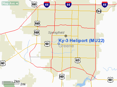
| From nearest city: | 0 nautical miles N of Springfield, MO |
| Location: | Greene County, MO |
| Magnetic Variation: | 04E (1985) |
Owner & Manager
| Ownership: | Privately owned |
| Owner: | Television Station Ky-3 Inc |
| Address: | Kytv 999 W Sunshine
Springfield, MO 65807 |
| Phone number: | 417-831-1535 |
| Manager: | Gary Dehaven |
| Address: | Kytv 999 W. Sunshine
Springfield, MO 65807 |
| Phone number: | 417-866-2766 |
Airport Operations and Facilities
| Airport Use: | Private |
| Wind indicator: | Yes |
| Segmented Circle: | No |
| Control Tower: | No |
| Landing fee charge: | No |
| Sectional chart: | Kansas City |
| Region: | ACE - Central |
| Boundary ARTCC: | ZKC - Kansas City |
| Tie-in FSS: | COU - Columbia |
| FSS on Airport: | No |
| FSS Toll Free: | 1-800-WX-BRIEF |
Runway Information
Helipad H1
| Dimension: | 400 x 300 ft / 121.9 x 91.4 m |
| Surface: | TURF, |
| |
Runway H1 |
Runway |
| Traffic Pattern: | Left | Left |
|
Radio Navigation Aids
| ID |
Type |
Name |
Ch |
Freq |
Var |
Dist |
| ILJ | NDB | Willard | | 254.00 | 03E | 9.6 nm |
| AOV | NDB | Bilmart | | 341.00 | 02E | 32.6 nm |
| PLK | NDB | Point Lookout/dcmsnd | | 204.00 | 03E | 33.6 nm |
| IEB | NDB | Lebanon | | 414.00 | 03E | 38.7 nm |
| SGF | VORTAC | Springfield | 116X | 116.90 | 04E | 10.5 nm |
| DGD | VORTAC | Dogwood | 031X | 109.40 | 06E | 22.6 nm |
Remarks
- PRVDD TKOFS & LNDGS FROM SE CLKWS TO SW ARE PROHIBITED; SPHERICAL OBS MKRS TO BE PLACED ON GUY WIRES OF 290' TWR 300' S OF LNDG AREA; APCH/DEP PATHS TO LNDG AREA ARE MAINTD FOR MIN 8:1 GLIDE SLOPE & TRSNL SFC BE MAINTD FOR MIN 2:1 SLOPE.
Images and information placed above are from
http://www.airport-data.com/airport/MU22/
We thank them for the data!
| General Info
|
| Country |
United States
|
| State |
MISSOURI
|
| FAA ID |
MU22
|
| Latitude |
37-10-59.177N
|
| Longitude |
093-18-11.676W
|
| Elevation |
1285 feet
|
| Near City |
SPRINGFIELD
|
We don't guarantee the information is fresh and accurate. The data may
be wrong or outdated.
For more up-to-date information please refer to other sources.
|
|


