 |
|
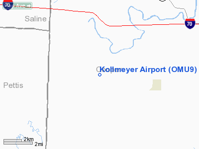
Location & QuickFacts
| FAA Information Effective: | 2008-09-25 |
| Airport Identifier: | OMU9 |
| Airport Status: | Operational |
| Longitude/Latitude: | 092-59-07.7030W/38-53-03.0730N
-92.985473/38.884187 (Estimated) |
| Elevation: | 810 ft / 246.89 m (Estimated) |
| Land: | 0 acres |
| From nearest city: | 4 nautical miles W of Pilot Grove, MO |
| Location: | Cooper County, MO |
| Magnetic Variation: | 03E (1995) |
Owner & Manager
| Ownership: | Privately owned |
| Owner: | Randall Kollmeyer |
| Address: | 3115 Southwood Terrace
Jefferson City, MO 65101 |
| Phone number: | 314-659-8921 |
| Manager: | Randall Kollmeyer |
| Address: | 3115 Southwood Terrace
Jefferson City, MO 65101 |
| Phone number: | 314-659-8921 |
Airport Operations and Facilities
| Airport Use: | Private |
| Wind indicator: | Yes |
| Segmented Circle: | No |
| Control Tower: | No |
| Sectional chart: | Kansas City |
| Region: | ACE - Central |
| Boundary ARTCC: | ZKC - Kansas City |
| Tie-in FSS: | COU - Columbia |
| FSS on Airport: | No |
| FSS Toll Free: | 1-800-WX-BRIEF |
Runway Information
Runway 13/31
| Dimension: | 1900 x 75 ft / 579.1 x 22.9 m |
| Surface: | TURF, |
| |
Runway 13 |
Runway 31 |
| Traffic Pattern: | Left | Left |
|
Radio Navigation Aids
| ID |
Type |
Name |
Ch |
Freq |
Var |
Dist |
| PUR | NDB | Marshall | | 371.00 | 03E | 13.7 nm |
| DMO | NDB | Sedalia | | 281.00 | 03E | 14.0 nm |
| VER | NDB | Viertel | | 347.00 | 02E | 14.6 nm |
| HCK | NDB | Hawks | | 296.00 | 04E | 31.5 nm |
| ONH | NDB | Noah | | 515.00 | 03E | 37.8 nm |
| GLY | NDB | Golden Valley | | 388.00 | 04E | 45.6 nm |
| FTT | NDB | Guthrie | | 317.00 | 03E | 46.0 nm |
| JE | NDB | Algoa | | 397.00 | 03E | 47.4 nm |
| SZL | TACAN | Whiteman | 035X | | 04E | 27.9 nm |
| COU | VOR/DME | Columbia | 039X | 110.20 | 03E | 36.2 nm |
| HLV | VORTAC | Hallsville | 089X | 114.20 | 06E | 42.4 nm |
| JEF | VOT | Jefferson City | | 112.00 | | 43.1 nm |
Remarks
- PRVDD A CLEAR APCH TO EACH RY FOR A 20:1 GLIDE SLOPE & A CLEAR TRANSITIONAL SFC FOR A 7:1 SLOPE.
Images and information placed above are from
http://www.airport-data.com/airport/OMU9/
We thank them for the data!
| General Info
|
| Country |
United States
|
| State |
MISSOURI
|
| FAA ID |
OMU9
|
| Latitude |
38-53-03.073N
|
| Longitude |
092-59-07.703W
|
| Elevation |
810 feet
|
| Near City |
PILOT GROVE
|
We don't guarantee the information is fresh and accurate. The data may
be wrong or outdated.
For more up-to-date information please refer to other sources.
|
|


