 |
|
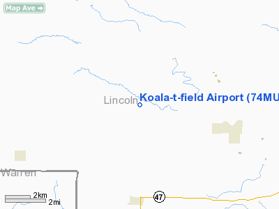
Location & QuickFacts
| FAA Information Effective: | 2008-09-25 |
| Airport Identifier: | 74MU |
| Airport Status: | Operational |
| Longitude/Latitude: | 091-07-49.5270W/39-02-24.1600N
-91.130424/39.040044 (Estimated) |
| Elevation: | 690 ft / 210.31 m (Estimated) |
| Land: | 4 acres |
| From nearest city: | 5 nautical miles N of Hawkpoint, MO |
| Location: | Lincoln County, MO |
| Magnetic Variation: | 02E (1995) |
Owner & Manager
| Ownership: | Privately owned |
| Owner: | John & Maureen F Mordica, Jr |
| Address: | 1530 Hwy D; Po Box 188
Hawk Point, MO 63349 |
| Phone number: | 636-338-4189 |
| Manager: | John & Maureen F Mordica, Jr |
| Address: | 1530 Hwy D; Po Box 188
Hawk Point, MO 63349 |
| Phone number: | 636-338-4189 |
Airport Operations and Facilities
| Airport Use: | Private |
| Segmented Circle: | No |
| Control Tower: | No |
| Sectional chart: | Kansas City |
| Region: | ACE - Central |
| Boundary ARTCC: | ZKC - Kansas City |
| Tie-in FSS: | STL - Saint Louis |
| FSS on Airport: | No |
| FSS Toll Free: | 1-800-WX-BRIEF |
Runway Information
Runway 01/19
| Dimension: | 1800 x 40 ft / 548.6 x 12.2 m |
| Surface: | TURF, |
| |
Runway 01 |
Runway 19 |
| Traffic Pattern: | Left | Left |
| Obstruction: | 25 ft pline, 300.0 ft from runway | 30 ft trees, 300.0 ft from runway |
|
Radio Navigation Aids
| ID |
Type |
Name |
Ch |
Freq |
Var |
Dist |
| LM | NDB | Oblio | | 338.00 | 00E | 33.9 nm |
| PPQ | NDB | Pittsfield | | 344.00 | 02E | 39.5 nm |
| FTT | NDB | Guthrie | | 317.00 | 03E | 42.6 nm |
| HAE | NDB | Hannibal | | 411.00 | 03E | 43.9 nm |
| UUV | NDB | Sullivan | | 356.00 | 02E | 48.4 nm |
| CSX | VOR/DME | Cardinal | 111Y | 116.45 | 00E | 39.9 nm |
| FTZ | VORTAC | Foristell | 045X | 110.80 | 05E | 22.1 nm |
| STL | VORTAC | St Louis | 121X | 117.40 | 01E | 32.2 nm |
| HLV | VORTAC | Hallsville | 089X | 114.20 | 06E | 46.8 nm |
| UIN | VORTAC | Quincy | 083X | 113.60 | 05E | 49.0 nm |
| SUS | VOT | Spirit Of St Louis | | 112.20 | | 31.9 nm |
| STL | VOT | St Louis Lambert | | 111.00 | | 40.0 nm |
Remarks
- PRVDD BOTH APCHS ARE CLEAR 20:1; TRANSITIONAL SFCS MAINTAINED AT 7:1.
Images and information placed above are from
http://www.airport-data.com/airport/74MU/
We thank them for the data!
| General Info
|
| Country |
United States
|
| State |
MISSOURI
|
| FAA ID |
74MU
|
| Latitude |
39-02-24.160N
|
| Longitude |
091-07-49.527W
|
| Elevation |
690 feet
|
| Near City |
HAWKPOINT
|
We don't guarantee the information is fresh and accurate. The data may
be wrong or outdated.
For more up-to-date information please refer to other sources.
|
|


