|
|
Kirksville Regional Airport |
| Kirksville Regional Airport |
 |
| IATA: IRK – ICAO: KIRK – FAA LID: IRK |
| Summary |
| Airport type |
Public |
| Owner |
City of Kirksville |
| Serves |
Kirksville, Missouri |
| Location |
Millard, Missouri |
| Elevation AMSL |
966 ft / 294 m |
| Coordinates |
40°05′37″N 092°32′42″W / 40.09361°N 92.545°W / 40.09361; -92.545 |
| Runways |
| Direction |
Length |
Surface |
| ft |
m |
| 18/36 |
6,005 |
1,830 |
Concrete |
| 9/27 |
1,393 |
425 |
Turf |
| Statistics (2008) |
| Aircraft operations |
6,650 |
| Based aircraft |
41 |
| Source: Federal Aviation Administration |
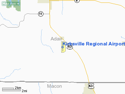
Kirksville Regional Airport (IATA: IRK, ICAO: KIRK, FAA LID: IRK) is a public airport located 6 nautical miles (11 km) southeast of the central business district of Kirksville, a city in Adair County, Missouri, United States. The airport is located in unincorporated Adair County and is owned by the City of Kirksville. It is mostly used for general aviation, but is also served by one commercial airline. Service is subsidized by the Essential Air Service program.
Air Choice One began scheduled flight operations twice daily, to and from Lambert-St. Louis International Airport during July 2009. Scheduled operations are currently subsidized by the Essential Air Service Act. Previously service was operated by Air Midwest (operating as US Airways Express) to Kansas City International Airport and by RegionsAir (operating as American Connection) with flights to Lambert-St. Louis International Airport. History
Aviation in the Kirksville area began in the Kirksville area within a few years of the Wright brothers historic flight. Local resident Nick Sparling is credited as being Adair County's first aviator, in 1909. In 1924, Roy B. "Cap" Dodson started the first airport in the area, located on the north edge of Kirksville. However, an airfield at the present location of Kirksville Regional Airport wasn't created until 1930 when the Federal Aviation Administration built a series of emergency landing strips across the nation. With America's entry into World War Two the Kirksville Municipal Airport, as it had been declared in the late 1930s, received an major upgrade from the Civilian Pilots Training Program and the US Army Air Corps War Training Service. In 1942 a paved all-weather landing strip, hangars, a control tower and small restaurant were constructed. A post-war boom in commercial aviation finally reached Kirksville in 1961 when Ozark Airlines began regular air service. The plane must have been a familiar sight to many area World War Two veterans, as Ozark used the venerable Douglas DC-3, the civilian counterpart to the famed C-47 'Gooney Bird', now decked out in Ozark's white and evergreen instead of Army Air Corps colors. The Ozark route began in Kansas City, Missouri with intermediate stops in Kirksville, Ottumwa and Cedar Rapids, Iowa, Moline, Illinois, and terminated in Chicago. With the arrival of Ozark's DC-3's also came upgrades to the airport facilities. The original paved runway was rebuilt and lengthened to accommodate the larger aircraft, and a shorter, turf, runway was retained for the use of small private planes. Still more improvements came as result of a bond issue approved by Kirksville voters in 1967. A new six-thousand foot concrete runway was constructed, as well as a new terminal building and improved hangar facilities. The longer runway was necessary to accommodate Ozark Airlines switch from the DC-3 to a newer, faster Fairchild prop-jet with larger passenger capacity. It was also in the 1960s that Ozark Airlines switched Kirksville service from a Kansas City-Chicago route to a Des Moines-to-St. Louis one. With the airport improvements also came a new name, Clarence Cannon Memorial Airport—chosen to honor long-time US Congressman Clarence Cannon of Missouri who had done much to help secure air service and funding for the airport. Despite the nearly one million dollars in facility upgrades and a steady flow of passengers in and out of Kirksville, Ozark Airlines found the route to be financially untenable by the mid-1970s, with their final departure coming on April 23, 1976. Fortunately a local pilot and dentist, Dr. Steven Barber, has established a small commuter air service, Horizon Airways, in 1972. Horizon was able to help fill the void left by Ozarks departure, eventually expanding to five aircraft and service to both Kansas City and St. Louis.
Facilities and aircraft
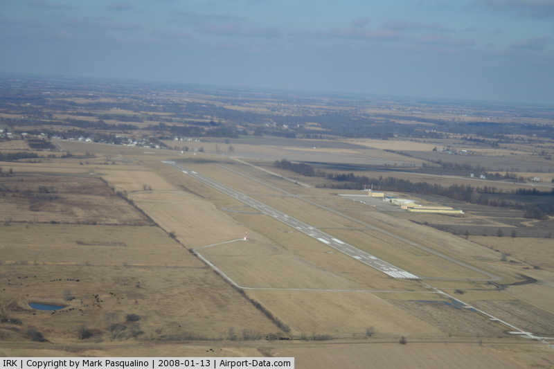
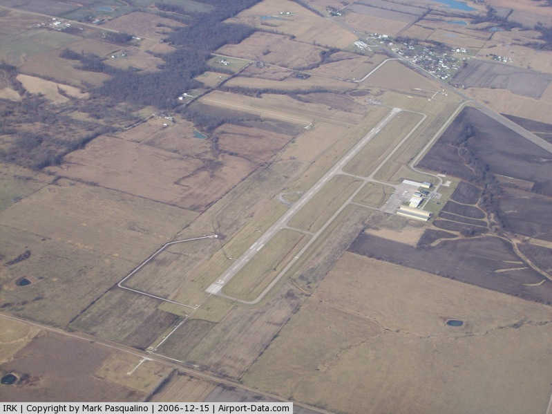
Kirksville Regional Airport covers an area of 409 acres (166 ha) which contains two runways: 18/36 has concrete paved surface measuring 6,005 x 100 ft (1,830 x 30 m), and 9/27 has a turf surface measuring 1,393 x 100 ft (425 x 30 m)..For the 12-month period ending June 30, 2006, the airport had 8,350 aircraft operations, an average of 22 per day: 78% general aviation, 14% scheduled commercial, 6% air taxi and 2% military. There are 34 aircraft based at this airport: 97% single engine and 3% multi-engine.
Airlines and destinations
| Airlines |
Destinations |
| Cape Air |
St. Louis |
Incidents
- On October 19, 2004, Corporate Airlines Flight 5966 crashed on approach to Kirksville. Thirteen individuals died and two sustained injuries. The National Transportation Safety Board determined pilot error to be the cause of the accident.
- On May 12, 2005 a Midwest Airlines Boeing 717 made an emergency landing at Kirksville Regional Airport after experiencing severe turbulence while en route from Kansas City, Missouri to Washington, D.C. A safe landing was made, with all 76 passengers and 4 crew unharmed. To date this is the largest aircraft to ever land at Kirksville Regional.
The above content comes from Wikipedia and is published under free licenses – click here to read more.
|
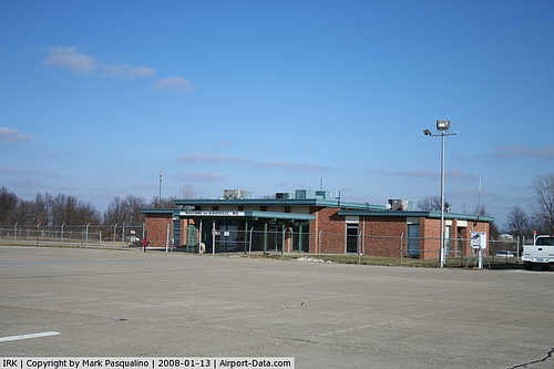 |
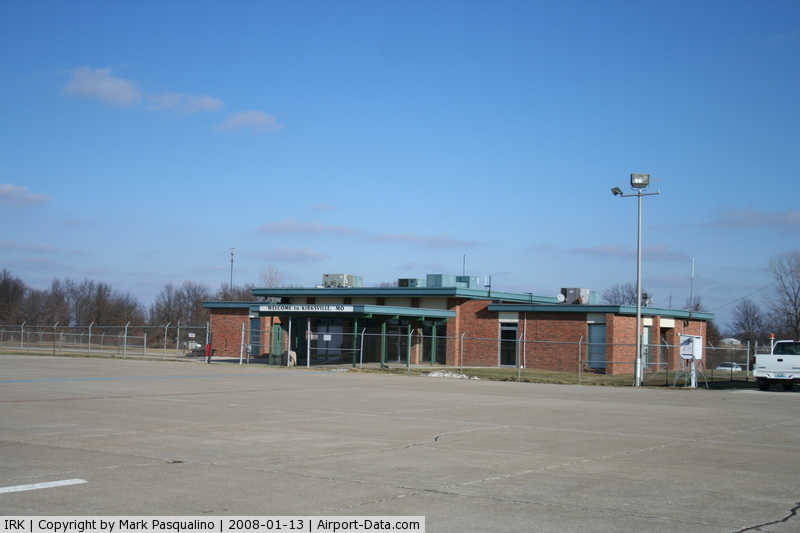
(Click on the photo to enlarge) |
|
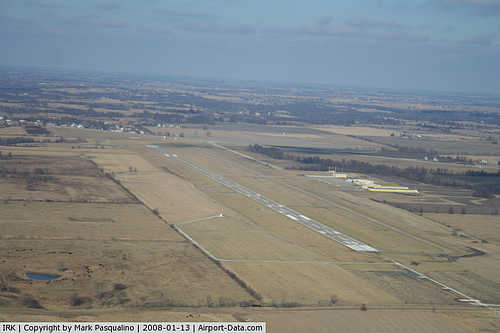 |
(Click on the photo to enlarge) |
|
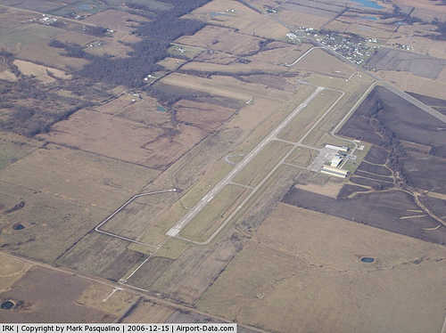 |
(Click on the photo to enlarge) |
Location & QuickFacts
| FAA Information Effective: | 2008-09-25 |
| Airport Identifier: | IRK |
| Airport Status: | Operational |
| Longitude/Latitude: | 092-32-41.7000W/40-05-36.6000N
-92.544917/40.093500 (Estimated) |
| Elevation: | 966 ft / 294.44 m (Surveyed) |
| Land: | 409 acres |
| From nearest city: | 6 nautical miles SE of Kirksville, MO |
| Location: | Adair County, MO |
| Magnetic Variation: | 03E (1990) |
Owner & Manager
| Ownership: | Publicly owned |
| Owner: | City Of Kirksville |
| Address: | 27161 Airport Trail
Kirksville, MO 63501 |
| Phone number: | 660-665-5020 |
| Manager: | Mr. David Hall |
| Address: | 27161 Airport Trail
Kirksville, MO 63501 |
| Phone number: | 660-665-5020
ARPT MAINT NR 660-665-5020. |
Airport Operations and Facilities
| Airport Use: | Open to public |
| Wind indicator: | Yes |
| Segmented Circle: | Yes |
| Control Tower: | No |
| Lighting Schedule: | DUSK-DAWN
ACTVT MIRL RY 18/36; VASI RYS 18 & 36; REIL RY 18 & MALSR RY 36 - CTAF. |
| Beacon Color: | Clear-Green (lighted land airport) |
| Landing fee charge: | No |
| Sectional chart: | Chicago |
| Region: | ACE - Central |
| Boundary ARTCC: | ZKC - Kansas City |
| Tie-in FSS: | COU - Columbia |
| FSS on Airport: | No |
| FSS Toll Free: | 1-800-WX-BRIEF |
| NOTAMs Facility: | IRK (NOTAM-d service avaliable) |
| Certification type/date: | III A S 05/19 |
| Federal Agreements: | NGY |
Airport Communications
| CTAF: | 122.800 |
| Unicom: | 122.800 |
Airport Services
| Fuel available: | 100LLA
24 HR SELF-SVC CREDIT CARD FOR FUEL(100LL ONLY) |
| Airframe Repair: | MAJOR |
| Power Plant Repair: | MAJOR |
| Bottled Oxygen: | NONE |
| Bulk Oxygen: | NONE |
Runway Information
Runway 09/27
| Dimension: | 1393 x 100 ft / 424.6 x 30.5 m |
| Surface: | TURF, Good Condition |
| |
Runway 09 |
Runway 27 |
| Longitude: | 092-33-00.4428W | 092-32-42.5145W |
| Latitude: | 40-05-52.0977N | 40-05-51.9365N |
| Elevation: | 965.00 ft | 965.00 ft |
| Alignment: | 91 | 127 |
| Traffic Pattern: | Left | Left |
| Obstruction: | 72 ft trees, 1440.0 ft from runway, 20:1 slope to clear | 47 ft trees, 1240.0 ft from runway, 26:1 slope to clear |
|
Runway 18/36
| Dimension: | 6005 x 100 ft / 1830.3 x 30.5 m |
| Surface: | CONC, Good Condition |
| Weight Limit: | Single wheel: 30000 lbs.
Dual wheel: 48000 lbs.
Dual tandem wheel: 85000 lbs. |
| Edge Lights: | Medium |
| |
Runway 18 |
Runway 36 |
| Longitude: | 092-32-39.1220W | 092-32-39.7777W |
| Latitude: | 40-06-02.6387N | 40-05-03.3047N |
| Elevation: | 966.00 ft | 964.00 ft |
| Alignment: | 127 | 0 |
| ILS Type: | | ILS/DME
|
| Traffic Pattern: | Left | Left |
| Markings: | Non-precision instrument, Good Condition | Precision instrument, Good Condition |
| Crossing Height: | 33.00 ft | 54.00 ft |
| VASI: | 4-box on left side | 4-box on left side |
| Visual Glide Angle: | 3.00° | 3.00° |
| Approach lights: | | MALSR |
| Runway End Identifier: | Yes | |
| Obstruction: | 30 ft pole, 1000.0 ft from runway, 500 ft left of centerline, 26:1 slope to clear | 25 ft pole, 1225.0 ft from runway, 400 ft right of centerline, 41:1 slope to clear |
|
Radio Navigation Aids
| ID |
Type |
Name |
Ch |
Freq |
Var |
Dist |
| BZK | NDB | Brookfield | | 383.00 | 03E | 32.7 nm |
| TVK | NDB | Centerville | | 290.00 | 04E | 39.2 nm |
| BEX | NDB | Bloomfield | | 269.00 | 02E | 39.5 nm |
| CHT | NDB | Chillicothe | | 375.00 | 03E | 47.7 nm |
| TRX | NDB | Trenton | | 400.00 | 03E | 48.2 nm |
| MCM | VOR/DME | Macon | 076X | 112.90 | 06E | 26.6 nm |
| IRK | VORTAC | Kirksville | 093X | 114.60 | 06E | 3.3 nm |
Images and information placed above are from
http://www.airport-data.com/airport/IRK/
We thank them for the data!
| General Info
|
| Country |
United States
|
| State |
MISSOURI
|
| FAA ID |
IRK
|
| Latitude |
40-05-37.120N
|
| Longitude |
092-32-41.889W
|
| Elevation |
966 feet
|
| Near City |
KIRKSVILLE
|
We don't guarantee the information is fresh and accurate. The data may
be wrong or outdated.
For more up-to-date information please refer to other sources.
|
|