 |
|
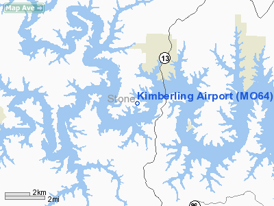
Location & QuickFacts
| FAA Information Effective: | 2008-09-25 |
| Airport Identifier: | MO64 |
| Airport Status: | Operational |
| Longitude/Latitude: | 093-26-40.6720W/36-36-35.2280N
-93.444631/36.609786 (Estimated) |
| Elevation: | 1050 ft / 320.04 m (Estimated) |
| Land: | 0 acres |
| From nearest city: | 2 nautical miles W of Kimberling City, MO |
| Location: | Stone County, MO |
| Magnetic Variation: | 04E (1985) |
Owner & Manager
| Ownership: | Privately owned |
| Owner: | Kimberling Arpt, Inc. |
| Address: | 170 Bonanza Dr
Kimberling City, MO 65686 |
| Phone number: | 417-235-9691 |
| Manager: | R.a. (al) Halley |
| Address: | 170 Bonanza Dr
Kimberling City, MO 65686 |
| Phone number: | 417-235-9691 |
Airport Operations and Facilities
| Airport Use: | Private |
| Wind indicator: | Yes |
| Segmented Circle: | No |
| Control Tower: | No |
| Landing fee charge: | No |
| Sectional chart: | Kansas City |
| Region: | ACE - Central |
| Boundary ARTCC: | ZME - Memphis |
| Tie-in FSS: | COU - Columbia |
| FSS Toll Free: | 1-800-WX-BRIEF |
Airport Services
| Airframe Repair: | NONE |
| Power Plant Repair: | NONE |
Runway Information
Runway 12/30
| Dimension: | 2600 x 25 ft / 792.5 x 7.6 m |
| Surface: | ASPH, Good Condition |
| |
Runway 12 |
Runway 30 |
| Longitude: | 093-26-49.8000W | 093-26-26.1000W |
| Latitude: | 36-36-43.6200N | 36-36-26.5800N |
| Elevation: | 1050.00 ft | 1050.00 ft |
| Traffic Pattern: | Left | Left |
| Obstruction: | 400 ft trees, 2635.0 ft from runway | 515 ft trees, 1757.0 ft from runway |
|
Radio Navigation Aids
| ID |
Type |
Name |
Ch |
Freq |
Var |
Dist |
| PLK | NDB | Point Lookout/dcmsnd | | 204.00 | 03E | 10.4 nm |
| ILJ | NDB | Willard | | 254.00 | 03E | 41.5 nm |
| AOV | NDB | Bilmart | | 341.00 | 02E | 42.8 nm |
| HRO | VOR/DME | Harrison | 072X | 112.50 | 04E | 20.8 nm |
| EOS | VOR/DME | Neosho | 120X | 117.30 | 07E | 49.8 nm |
| DAK | VOR/DME | Drake | 025X | 108.80 | 07E | 49.9 nm |
| DGD | VORTAC | Dogwood | 031X | 109.40 | 06E | 36.9 nm |
| RZC | VORTAC | Razorback | 111X | 116.40 | 04E | 39.3 nm |
| SGF | VORTAC | Springfield | 116X | 116.90 | 04E | 45.2 nm |
Remarks
- RISING TERRAIN NW & SE.
- DOWNDRAFTS PREVALENT AT OR BLO TREETOP LEVEL W/ SOUTHERLY WINDS.
- NO LINE OF SIGHT BWTN RY ENDS.
Images and information placed above are from
http://www.airport-data.com/airport/MO64/
We thank them for the data!
| General Info
|
| Country |
United States
|
| State |
MISSOURI
|
| FAA ID |
MO64
|
| Latitude |
36-36-35.228N
|
| Longitude |
093-26-40.672W
|
| Elevation |
1000 feet
|
| Near City |
KIMBERLING CITY
|
We don't guarantee the information is fresh and accurate. The data may
be wrong or outdated.
For more up-to-date information please refer to other sources.
|
|


