 |
|
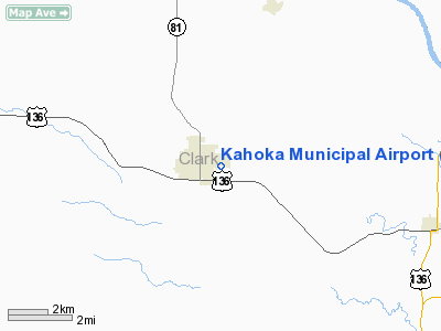
Location & QuickFacts
| FAA Information Effective: | 2008-09-25 |
| Airport Identifier: | 0H7 |
| Airport Status: | Operational |
| Longitude/Latitude: | 091-42-24.0000W/40-25-18.2000N
-91.706667/40.421722 (Estimated) |
| Elevation: | 700 ft / 213.36 m (Estimated) |
| Land: | 6 acres |
| From nearest city: | 1 nautical miles E of Kahoka, MO |
| Location: | Clark County, MO |
| Magnetic Variation: | 03E (1985) |
Owner & Manager
| Ownership: | Publicly owned |
| Owner: | City Of Kahoka |
| Address: | 250 North Morgan
Kahoka, MO 63445 |
| Phone number: | 660-727-3711 |
| Manager: | Jim Sherwood |
| Address: | 250 N Morgan
Kahoka, MO 63445 |
| Phone number: | 660-727-2512 |
Airport Operations and Facilities
| Airport Use: | Open to public |
| Wind indicator: | Yes |
| Segmented Circle: | No |
| Control Tower: | No |
| Landing fee charge: | No |
| Sectional chart: | Chicago |
| Region: | ACE - Central |
| Boundary ARTCC: | ZKC - Kansas City |
| Tie-in FSS: | COU - Columbia |
| FSS on Airport: | No |
| FSS Toll Free: | 1-800-WX-BRIEF |
| NOTAMs Facility: | COU (NOTAM-d service avaliable) |
Airport Communications
Airport Services
| Airframe Repair: | NONE |
| Power Plant Repair: | NONE |
| Bottled Oxygen: | NONE |
| Bulk Oxygen: | NONE |
Runway Information
Runway 10/28
| Dimension: | 2680 x 115 ft / 816.9 x 35.1 m |
| Surface: | TURF, Good Condition
FM RY 28 THLD TO 800 FT W S EDGE OF RY 1-2 FT HIGHER THAN NH EDGE. |
| |
Runway 10 |
Runway 28 |
| Longitude: | 091-42-41.0700W | 091-42-06.8900W |
| Latitude: | 40-25-20.3900N | 40-25-15.9800N |
| Traffic Pattern: | Left | Left |
| Displaced threshold: | 318.00 ft
DSPLCD THLD MKD WITH THREE LARGE YELLOW CONES ON EACH SIDE OF RY. | 260.00 ft
DSPLCD THLD MKD WITH THREE LARGE YELLOW CONES ON EACH SIDE OF RY. |
| Obstruction: | 16 ft road, 16.0 ft from runway, 1:1 slope to clear
APCH SLOPE 20:1 TO DSPLCD THLD; +27 FT TREE, 150 FT FM RY END, 80 FT R, 17:1 BSD ON DSPLCD THLD. | 10 ft road, 42.0 ft from runway, 4:1 slope to clear
APCH SLOPE 28:1 BSD ON DSPLCD THLD; +25 FT TREES, 400 FT FM RY END, 140 FT L, 16:1 BSD ON DSPLCD THLD. |
|
Radio Navigation Aids
| ID |
Type |
Name |
Ch |
Freq |
Var |
Dist |
| EOK | NDB | Keokuk | | 366.00 | 02E | 12.8 nm |
| MPZ | NDB | Mount Pleasant | | 212.00 | 02E | 32.6 nm |
| FFL | NDB | Fairfield | | 332.00 | 03E | 37.7 nm |
| UI | NDB | Quincy | | 293.00 | 02E | 38.3 nm |
| BEX | NDB | Bloomfield | | 269.00 | 02E | 38.3 nm |
| HAE | NDB | Hannibal | | 411.00 | 03E | 43.4 nm |
| OTM | VOR/DME | Ottumwa | 053X | 111.60 | 06E | 46.1 nm |
| UIN | VORTAC | Quincy | 083X | 113.60 | 05E | 39.7 nm |
| BRL | VORTAC | Burlington | 051X | 111.40 | 05E | 40.0 nm |
| IRK | VORTAC | Kirksville | 093X | 114.60 | 06E | 44.1 nm |
Remarks
- NUMEROUS TALL OBJECTS WITHIN TRANSITIONAL SURFACE ALONG THE ENTIRE SOUTH EDGE OF THE RWY.
- RWY 10/28 SOFT AFTER HEAVY RAINS. CALL 660-727-3711 FOR RWY CONDITIONS.
- USE CAUTION DURING SPRING AND SUMMER MONTHS DUE TO FARM IRRIGATION SYSTEM ALONG NORTH RWY EDGE.
- EXISTED PRIOR TO 1959.
Images and information placed above are from
http://www.airport-data.com/airport/0H7/
We thank them for the data!
| General Info
|
| Country |
United States
|
| State |
MISSOURI
|
| FAA ID |
0H7
|
| Latitude |
40-25-17.910N
|
| Longitude |
091-42-22.840W
|
| Elevation |
700 feet
|
| Near City |
KAHOKA
|
We don't guarantee the information is fresh and accurate. The data may
be wrong or outdated.
For more up-to-date information please refer to other sources.
|
|


