 |
|
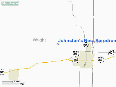
Johnston's Nest Aerodrome Airport |
Location & QuickFacts
| FAA Information Effective: | 2008-09-25 |
| Airport Identifier: | MO80 |
| Airport Status: | Operational |
| Longitude/Latitude: | 092-19-24.5840W/37-09-38.1860N
-92.323496/37.160607 (Estimated) |
| Elevation: | 1482 ft / 451.71 m (Estimated) |
| Land: | 20 acres |
| From nearest city: | 6 nautical miles SE of Mountain Grove, MO |
| Location: | Wright County, MO |
| Magnetic Variation: | 04E (1985) |
Owner & Manager
| Ownership: | Privately owned |
| Owner: | Bob Johnston |
| Address: | Rt 3 Box 266aa
Mountain Grove, MO 65711 |
| Phone number: | 417-926-4221 |
| Manager: | Bob Johnston |
| Address: | Rt 3 Box 266aa
Mountain Grove, MO 65711 |
| Phone number: | 417-926-4221 |
Airport Operations and Facilities
| Airport Use: | Private |
| Wind indicator: | Yes |
| Segmented Circle: | No |
| Control Tower: | No |
| Sectional chart: | Kansas City |
| Region: | ACE - Central |
| Boundary ARTCC: | ZKC - Kansas City |
| Tie-in FSS: | COU - Columbia |
| FSS on Airport: | No |
| FSS Toll Free: | 1-800-WX-BRIEF |
Airport Services
Runway Information
Runway 16/34
| Dimension: | 2500 x 200 ft / 762.0 x 61.0 m |
| Surface: | TURF, Good Condition |
| |
Runway 16 |
Runway 34 |
| Traffic Pattern: | Left | Left |
| Obstruction: | | 3 ft fence, 100.0 ft from runway |
|
Radio Navigation Aids
| ID |
Type |
Name |
Ch |
Freq |
Var |
Dist |
| AOV | NDB | Bilmart | | 341.00 | 02E | 20.5 nm |
| UNO | NDB | Pomona | | 335.00 | 02E | 26.4 nm |
| IEB | NDB | Lebanon | | 414.00 | 03E | 29.4 nm |
| MNF | NDB | Mountain View | | 365.00 | 03E | 31.0 nm |
| BHN | NDB | Buckhorn | | 391.00 | 03E | 33.9 nm |
| TBN | VOR | Forney | | 110.00 | 03E | 36.1 nm |
| HUW | VOR/DME | Hutton | 053X | 111.60 | 02E | 26.7 nm |
| DGD | VORTAC | Dogwood | 031X | 109.40 | 06E | 27.8 nm |
| MAP | VORTAC | Maples | 081X | 113.40 | 06E | 36.4 nm |
| SGF | VORTAC | Springfield | 116X | 116.90 | 04E | 49.8 nm |
Remarks
- APCH TO EACH RY MAINTAINED FOR MINIMUM 20:1 GLIDE SLOPE, TRANSITIONAL SFC MAINTAINED FOR 7:1 SLOPE; USERS ARE AWARE OF AIR TRAFFIC AT MT GROVE MEM'L ARPT.
Images and information placed above are from
http://www.airport-data.com/airport/MO80/
We thank them for the data!
| General Info
|
| Country |
United States
|
| State |
MISSOURI
|
| FAA ID |
MO80
|
| Latitude |
37-09-38.186N
|
| Longitude |
092-19-24.584W
|
| Elevation |
1482 feet
|
| Near City |
MOUNTAIN GROVE
|
We don't guarantee the information is fresh and accurate. The data may
be wrong or outdated.
For more up-to-date information please refer to other sources.
|
|


