 |
|
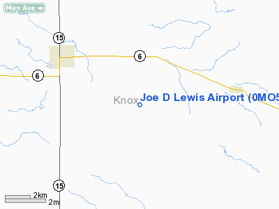
Location & QuickFacts
| FAA Information Effective: | 2008-09-25 |
| Airport Identifier: | 0MO5 |
| Airport Status: | Operational |
| Longitude/Latitude: | 092-06-00.6430W/40-08-00.1410N
-92.100179/40.133373 (Estimated) |
| Elevation: | 780 ft / 237.74 m (Estimated) |
| Land: | 5 acres |
| From nearest city: | 4 nautical miles SE of Edina, MO |
| Location: | Knox County, MO |
| Magnetic Variation: | 03E (1985) |
Owner & Manager
| Ownership: | Privately owned |
| Owner: | Joe D Lewis |
| Address: | Route 3
Edina, MO 63537 |
| Phone number: | 816-397-3300 |
| Manager: | Joe D Lewis |
| Address: | Route 3
Edina, MO 63537 |
| Phone number: | 816-397-3300 |
Airport Operations and Facilities
| Airport Use: | Private |
| Segmented Circle: | No |
| Control Tower: | No |
| Landing fee charge: | No |
| Sectional chart: | Chicago |
| Region: | ACE - Central |
| Boundary ARTCC: | ZKC - Kansas City |
| Tie-in FSS: | COU - Columbia |
| FSS on Airport: | No |
| FSS Toll Free: | 1-800-WX-BRIEF |
Airport Services
| Airframe Repair: | NONE |
| Power Plant Repair: | NONE |
Runway Information
Runway N/S
| Dimension: | 1800 x 60 ft / 548.6 x 18.3 m |
| Surface: | TURF, |
| |
Runway N |
Runway S |
| Traffic Pattern: | Left | Left |
| Obstruction: | | 20 ft pline, 300.0 ft from runway |
|
Radio Navigation Aids
| ID |
Type |
Name |
Ch |
Freq |
Var |
Dist |
| EOK | NDB | Keokuk | | 366.00 | 02E | 36.5 nm |
| HAE | NDB | Hannibal | | 411.00 | 03E | 38.7 nm |
| BEX | NDB | Bloomfield | | 269.00 | 02E | 39.7 nm |
| UI | NDB | Quincy | | 293.00 | 02E | 41.7 nm |
| TVK | NDB | Centerville | | 290.00 | 04E | 49.5 nm |
| MCM | VOR/DME | Macon | 076X | 112.90 | 06E | 33.8 nm |
| IRK | VORTAC | Kirksville | 093X | 114.60 | 06E | 22.6 nm |
| UIN | VORTAC | Quincy | 083X | 113.60 | 05E | 41.5 nm |
Remarks
- PROVIDED THE APCH TO EACH RWY IS MAINTAINED FOR A MINIMUM 20:1 GLIDE SLOPE AND TRANSITIONAL SURFACE MAINTAINED FOR A 7:1 SLOPE.
Images and information placed above are from
http://www.airport-data.com/airport/0MO5/
We thank them for the data!
| General Info
|
| Country |
United States
|
| State |
MISSOURI
|
| FAA ID |
0MO5
|
| Latitude |
40-08-00.141N
|
| Longitude |
092-06-00.643W
|
| Elevation |
780 feet
|
| Near City |
EDINA
|
We don't guarantee the information is fresh and accurate. The data may
be wrong or outdated.
For more up-to-date information please refer to other sources.
|
|


