 |
|
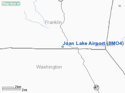
Location & QuickFacts
| FAA Information Effective: | 2008-09-25 |
| Airport Identifier: | 8MO4 |
| Airport Status: | Operational |
| Longitude/Latitude: | 090-52-00.4840W/38-12-30.1840N
-90.866801/38.208384 (Estimated) |
| Elevation: | 800 ft / 243.84 m (Estimated) |
| Land: | 0 acres |
| From nearest city: | 3 nautical miles NW of Richwoods, MO |
| Location: | Franklin County, MO |
| Magnetic Variation: | 02E (1985) |
Owner & Manager
| Ownership: | Privately owned |
| Owner: | Rich Stieren |
| Address: | 10611 Leebur Dr
St Louis, MO 63128 |
| Phone number: | 573-843-4305 |
| Address: |
|
Airport Operations and Facilities
| Airport Use: | Private |
| Wind indicator: | Yes |
| Segmented Circle: | No |
| Control Tower: | No |
| Landing fee charge: | No |
| Sectional chart: | St Louis |
| Region: | ACE - Central |
| Boundary ARTCC: | ZKC - Kansas City |
| Tie-in FSS: | STL - Saint Louis |
| FSS on Airport: | No |
| FSS Toll Free: | 1-800-WX-BRIEF |
Airport Services
| Airframe Repair: | NONE |
| Power Plant Repair: | NONE |
Runway Information
Runway 06/24
| Dimension: | 2000 x 100 ft / 609.6 x 30.5 m |
| Surface: | TURF, |
| |
Runway 06 |
Runway 24 |
| Traffic Pattern: | Left | Left |
|
Radio Navigation Aids
| ID |
Type |
Name |
Ch |
Freq |
Var |
Dist |
| UUV | NDB | Sullivan | | 356.00 | 02E | 14.1 nm |
| FES | NDB | Festus | | 269.00 | 01E | 22.6 nm |
| UBX | NDB | Cuba | | 380.00 | 01E | 27.9 nm |
| PRI | NDB | Perrine | | 367.00 | 02E | 33.8 nm |
| LM | NDB | Oblio | | 338.00 | 00E | 40.1 nm |
| VIH | VOR/DME | Vichy | 124X | 117.70 | 06E | 39.8 nm |
| CSX | VOR/DME | Cardinal | 111Y | 116.45 | 00E | 40.5 nm |
| FTZ | VORTAC | Foristell | 045X | 110.80 | 05E | 29.6 nm |
| STL | VORTAC | St Louis | 121X | 117.40 | 01E | 43.2 nm |
| FAM | VORTAC | Farmington | 104X | 115.70 | 01E | 44.0 nm |
| SUS | VOT | Spirit Of St Louis | | 112.20 | | 29.1 nm |
| STL | VOT | St Louis Lambert | | 111.00 | | 40.2 nm |
Remarks
Images and information placed above are from
http://www.airport-data.com/airport/8MO4/
We thank them for the data!
| General Info
|
| Country |
United States
|
| State |
MISSOURI
|
| FAA ID |
8MO4
|
| Latitude |
38-12-30.184N
|
| Longitude |
090-52-00.484W
|
| Elevation |
800 feet
|
| Near City |
RICHWOODS
|
We don't guarantee the information is fresh and accurate. The data may
be wrong or outdated.
For more up-to-date information please refer to other sources.
|
|


