|
|
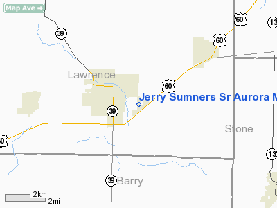
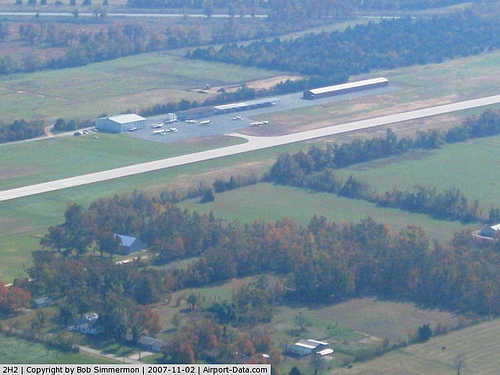
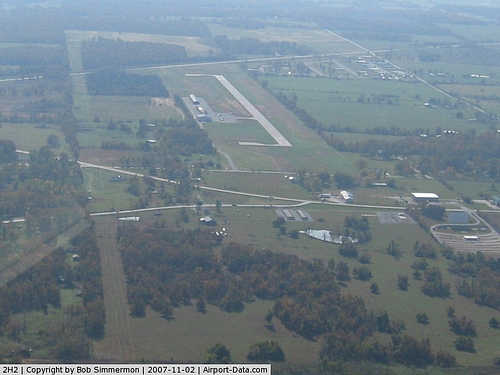
Jerry Sumners Sr Aurora Municipal Airport |
|
 |
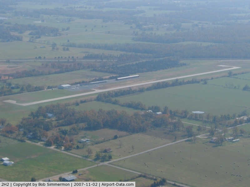
(Click on the photo to enlarge) |
|
 |
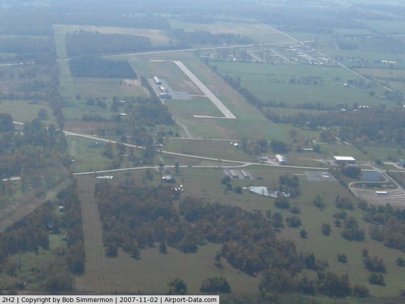
(Click on the photo to enlarge) |
|
 |
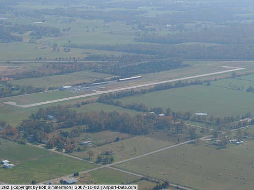
(Click on the photo to enlarge) |
Location & QuickFacts
| FAA Information Effective: | 2008-09-25 |
| Airport Identifier: | 2H2 |
| Airport Status: | Operational |
| Longitude/Latitude: | 093-41-43.1200W/36-57-44.3080N
-93.695311/36.962308 (Estimated) |
| Elevation: | 1434 ft / 437.08 m (Surveyed) |
| Land: | 75 acres |
| From nearest city: | 2 nautical miles SE of Aurora, MO |
| Location: | Lawrence County, MO |
| Magnetic Variation: | 03E (2000) |
Owner & Manager
| Ownership: | Publicly owned |
| Owner: | City Of Aurora |
| Address: | P.o. Box 30 - 2 W. Pleasant
Aurora, MO 65605 |
| Phone number: | 417-678-5121 |
| Manager: | Justin Richmond |
| Address: | P.o. Box 506-1526 E. Highland
Aurora, MO 65605 |
| Phone number: | 417-678-3000 |
Airport Operations and Facilities
| Airport Use: | Open to public |
| Wind indicator: | Yes |
| Segmented Circle: | Yes |
| Control Tower: | No |
| Lighting Schedule: | DUSK-DAWN
ACTVT MIRL RY 18/36-CTAF. |
| Beacon Color: | Clear-Green (lighted land airport) |
| Landing fee charge: | No |
| Sectional chart: | Kansas City |
| Region: | ACE - Central |
| Boundary ARTCC: | ZKC - Kansas City |
| Tie-in FSS: | COU - Columbia |
| FSS on Airport: | No |
| FSS Toll Free: | 1-800-WX-BRIEF |
| NOTAMs Facility: | COU (NOTAM-d service avaliable) |
| Federal Agreements: | NY1 |
Airport Communications
| CTAF: | 122.800 |
| Unicom: | 122.800 |
Airport Services
| Fuel available: | 100LL |
| Airframe Repair: | MAJOR |
| Power Plant Repair: | MAJOR |
| Bottled Oxygen: | NONE |
| Bulk Oxygen: | NONE |
Runway Information
Runway 18/36
| Dimension: | 3002 x 60 ft / 915.0 x 18.3 m |
| Surface: | ASPH, Good Condition |
| Edge Lights: | Medium |
| |
Runway 18 |
Runway 36 |
| Longitude: | 093-41-42.7500W | 093-41-43.5700W |
| Latitude: | 36-57-59.1220N | 36-57-29.4500N |
| Elevation: | 1434.00 ft | 1426.00 ft |
| Alignment: | 127 | 1 |
| Traffic Pattern: | Left | Right |
| Markings: | Non-precision instrument, Fair Condition | Non-precision instrument, Fair Condition |
| Obstruction: | 42 ft trees, 775.0 ft from runway, 13:1 slope to clear | 45 ft trees, 695.0 ft from runway, 250 ft right of centerline, 11:1 slope to clear |
|
Radio Navigation Aids
| ID |
Type |
Name |
Ch |
Freq |
Var |
Dist |
| ILJ | NDB | Willard | | 254.00 | 03E | 23.7 nm |
| PLK | NDB | Point Lookout/dcmsnd | | 204.00 | 03E | 30.1 nm |
| LLU | NDB | Spring River | | 356.00 | 05E | 43.1 nm |
| AOV | NDB | Bilmart | | 341.00 | 02E | 48.9 nm |
| EOS | VOR/DME | Neosho | 120X | 117.30 | 07E | 36.3 nm |
| HRO | VOR/DME | Harrison | 072X | 112.50 | 04E | 45.2 nm |
| SGF | VORTAC | Springfield | 116X | 116.90 | 04E | 29.3 nm |
| DGD | VORTAC | Dogwood | 031X | 109.40 | 06E | 39.5 nm |
| RZC | VORTAC | Razorback | 111X | 116.40 | 04E | 47.7 nm |
Remarks
- MECHANIC ON DUTY; MON THRU SAT; MAJOR POWERPLANT REPAIR AVBL CALL 417-678-3000.
Images and information placed above are from
http://www.airport-data.com/airport/2H2/
We thank them for the data!
| General Info
|
| Country |
United States
|
| State |
MISSOURI
|
| FAA ID |
2H2
|
| Time |
UTC-6(-5DT)
|
| Latitude |
36.962307
36° 57' 44.31" N
|
| Longitude |
-93.695311
093° 41' 43.12" W
|
| Elevation |
1434 feet
437 meters
|
| Type |
Civil
|
| Magnetic Variation |
002° E (01/06)
|
| Beacon |
Yes
|
| Operating Agency |
U.S.CIVIL AIRPORT WHEREIN PERMIT COVERS USE BY TRANSIT MILITARY AIRCRAFT
|
| Near City |
Aurora
|
| Operating Hours |
SEE REMARKS FOR OPERATING HOURS OR COMMUNICATIONS FOR POSSIBLE HOURS
|
| Daylight Saving Time |
Second Sunday in March at 0200 to first Sunday in November at 0200 local time (Exception Arizona and that portion of Indiana in the Eastern Time Zone)
|
We don't guarantee the information is fresh and accurate. The data may
be wrong or outdated.
For more up-to-date information please refer to other sources.
|
|