 |
|
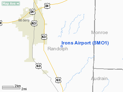
Location & QuickFacts
| FAA Information Effective: | 2008-09-25 |
| Airport Identifier: | 5MO1 |
| Airport Status: | Operational |
| Longitude/Latitude: | 092-22-34.6460W/39-23-03.1320N
-92.376291/39.384203 (Estimated) |
| Elevation: | 860 ft / 262.13 m (Estimated) |
| Land: | 0 acres |
| From nearest city: | 3 nautical miles SE of Moberly, MO |
| Location: | Randolph County, MO |
| Magnetic Variation: | 03E (1985) |
Owner & Manager
| Ownership: | Privately owned |
| Owner: | Robert Irons |
| Address: | Rte 1
Moberly, MO 65270 |
| Phone number: | 816-263-6813 |
| Address: |
|
Airport Operations and Facilities
| Airport Use: | Private |
| Wind indicator: | Yes |
| Segmented Circle: | No |
| Control Tower: | No |
| Landing fee charge: | No |
| Sectional chart: | Kansas City |
| Region: | ACE - Central |
| Boundary ARTCC: | ZKC - Kansas City |
| Tie-in FSS: | COU - Columbia |
| FSS on Airport: | No |
| FSS Toll Free: | 1-800-WX-BRIEF |
Airport Services
| Airframe Repair: | NONE |
| Power Plant Repair: | NONE |
Runway Information
Runway 04/22
| Dimension: | 2600 x 100 ft / 792.5 x 30.5 m |
| Surface: | TURF, |
| |
Runway 04 |
Runway 22 |
| Traffic Pattern: | Left | Left |
|
Radio Navigation Aids
| ID |
Type |
Name |
Ch |
Freq |
Var |
Dist |
| VER | NDB | Viertel | | 347.00 | 02E | 29.8 nm |
| FTT | NDB | Guthrie | | 317.00 | 03E | 36.9 nm |
| BZK | NDB | Brookfield | | 383.00 | 03E | 40.9 nm |
| PUR | NDB | Marshall | | 371.00 | 03E | 43.4 nm |
| ONH | NDB | Noah | | 515.00 | 03E | 45.3 nm |
| HAE | NDB | Hannibal | | 411.00 | 03E | 47.7 nm |
| MCM | VOR/DME | Macon | 076X | 112.90 | 06E | 16.9 nm |
| COU | VOR/DME | Columbia | 039X | 110.20 | 03E | 35.2 nm |
| HLV | VORTAC | Hallsville | 089X | 114.20 | 06E | 19.9 nm |
| IRK | VORTAC | Kirksville | 093X | 114.60 | 06E | 46.2 nm |
| JEF | VOT | Jefferson City | | 112.00 | | 49.0 nm |
Images and information placed above are from
http://www.airport-data.com/airport/5MO1/
We thank them for the data!
| General Info
|
| Country |
United States
|
| State |
MISSOURI
|
| FAA ID |
5MO1
|
| Latitude |
39-23-03.132N
|
| Longitude |
092-22-34.646W
|
| Elevation |
860 feet
|
| Near City |
MOBERLY
|
We don't guarantee the information is fresh and accurate. The data may
be wrong or outdated.
For more up-to-date information please refer to other sources.
|
|


