 |
|
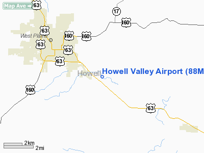
Location & QuickFacts
| FAA Information Effective: | 2008-09-25 |
| Airport Identifier: | 88MO |
| Airport Status: | Operational |
| Longitude/Latitude: | 091-48-09.5310W/36-42-06.2160N
-91.802648/36.701727 (Estimated) |
| Elevation: | 950 ft / 289.56 m (Estimated) |
| Land: | 30 acres |
| From nearest city: | 2 nautical miles SE of West Plains, MO |
| Location: | Howell County, MO |
| Magnetic Variation: | 03E (1985) |
Owner & Manager
| Ownership: | Privately owned |
| Owner: | Kenneth & Janet Dills |
| Address: | 9343 County Road 8890
West Plains, MO 65775-9109 |
| Phone number: | 417-257-7758 |
| Manager: | Kenneth Dills |
| Address: | 9343 County Road 8890
West Plains, MO 65775-9109 |
| Phone number: | 417-257-7758 |
Airport Operations and Facilities
| Airport Use: | Private |
| Segmented Circle: | No |
| Control Tower: | No |
| Landing fee charge: | Yes |
| Sectional chart: | Kansas City |
| Region: | ACE - Central |
| Boundary ARTCC: | ZME - Memphis |
| Tie-in FSS: | COU - Columbia |
| FSS on Airport: | No |
| FSS Toll Free: | 1-800-WX-BRIEF |
Runway Information
Runway 15/33
| Dimension: | 2400 x 30 ft / 731.5 x 9.1 m |
| Surface: | TURF, |
| |
Runway 15 |
Runway 33 |
| Traffic Pattern: | Left | Left |
| Displaced threshold: | 400.00 ft | 0.00 ft |
| Obstruction: | | 15 ft road, 0.0 ft from runway |
|
Radio Navigation Aids
| ID |
Type |
Name |
Ch |
Freq |
Var |
Dist |
| UNO | NDB | Pomona | | 335.00 | 02E | 11.6 nm |
| MNF | NDB | Mountain View | | 365.00 | 03E | 18.1 nm |
| AJX | NDB | Ash Flat | | 344.00 | 03E | 32.7 nm |
| AOV | NDB | Bilmart | | 341.00 | 02E | 45.1 nm |
| HUW | VOR/DME | Hutton | 053X | 111.60 | 02E | 11.2 nm |
| FLP | VOR/DME | Flippin | 075X | 112.80 | 03E | 39.8 nm |
Remarks
- OWNER DESIRES ARPT NOT BE CHARTED.
- CONDL: PROVIDED APPROACH TO EACH RWY IS MAINTAINED FOR A MIN 20:1 GLIDE SLOPE & THE TRANSITIONAL SURFACE BE MAINTAINED FOR A 7:1 SLOPE.
Images and information placed above are from
http://www.airport-data.com/airport/88MO/
We thank them for the data!
| General Info
|
| Country |
United States
|
| State |
MISSOURI
|
| FAA ID |
88MO
|
| Latitude |
36-42-06.216N
|
| Longitude |
091-48-09.531W
|
| Elevation |
950 feet
|
| Near City |
WEST PLAINS
|
We don't guarantee the information is fresh and accurate. The data may
be wrong or outdated.
For more up-to-date information please refer to other sources.
|
|


