 |
|
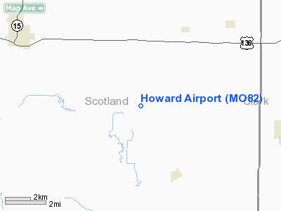
Location & QuickFacts
| FAA Information Effective: | 2008-09-25 |
| Airport Identifier: | MO82 |
| Airport Status: | Operational |
| Longitude/Latitude: | 092-03-24.6380W/40-24-32.1300N
-92.056844/40.408925 (Estimated) |
| Elevation: | 740 ft / 225.55 m (Estimated) |
| Land: | 3 acres |
| From nearest city: | 3 nautical miles NW of Gorin, MO |
| Location: | Scotland County, MO |
| Magnetic Variation: | 03E (1985) |
Owner & Manager
| Ownership: | Privately owned |
| Owner: | Alvin R Howard |
| Address: | Rt 1
Gorin, MO 63543 |
| Phone number: | 816-465-2779 |
| Manager: | Alvin R. Howard |
| Address: | Rt 1
Gorin, MO 63543 |
| Phone number: | 816-465-2779 |
Airport Operations and Facilities
| Airport Use: | Private |
| Segmented Circle: | No |
| Control Tower: | No |
| Landing fee charge: | No |
| Sectional chart: | Chicago |
| Region: | ACE - Central |
| Boundary ARTCC: | ZKC - Kansas City |
| Tie-in FSS: | COU - Columbia |
| FSS on Airport: | No |
| FSS Toll Free: | 1-800-WX-BRIEF |
Airport Services
| Fuel available: | 80 |
| Airframe Repair: | NONE |
| Power Plant Repair: | NONE |
| Bottled Oxygen: | NONE |
| Bulk Oxygen: | NONE |
Runway Information
Runway 09/27
| Dimension: | 2050 x 55 ft / 624.8 x 16.8 m |
| Surface: | TURF, Fair Condition |
| |
Runway 09 |
Runway 27 |
| Traffic Pattern: | Left | Left |
| Markings: | None, | None, |
| Runway End Identifier: | No | No |
| Centerline Lights: | No | No |
| Touchdown Lights: | No | No |
| Obstruction: | 7 ft gnd, 25 ft left of centerline
TREES 175' LEFT OF RWY CNTRLN EXTDD. | 4 ft fence, 0.0 ft from runway
TREE 150' LEFT OF RWY CNTRLN EXTDD. |
|
Radio Navigation Aids
| ID |
Type |
Name |
Ch |
Freq |
Var |
Dist |
| BEX | NDB | Bloomfield | | 269.00 | 02E | 26.4 nm |
| EOK | NDB | Keokuk | | 366.00 | 02E | 28.7 nm |
| FFL | NDB | Fairfield | | 332.00 | 03E | 36.3 nm |
| MPZ | NDB | Mount Pleasant | | 212.00 | 02E | 40.7 nm |
| TVK | NDB | Centerville | | 290.00 | 04E | 42.0 nm |
| UI | NDB | Quincy | | 293.00 | 02E | 48.4 nm |
| HAE | NDB | Hannibal | | 411.00 | 03E | 49.6 nm |
| OTM | VOR/DME | Ottumwa | 053X | 111.60 | 06E | 39.2 nm |
| MCM | VOR/DME | Macon | 076X | 112.90 | 06E | 49.4 nm |
| IRK | VORTAC | Kirksville | 093X | 114.60 | 06E | 29.5 nm |
| UIN | VORTAC | Quincy | 083X | 113.60 | 05E | 49.1 nm |
Remarks
- RWY END 09 VERY UNEVEN; CAUTION - RWY 09/27 ROLLING AND UNEVEN.
- HAY BALES, VEHICLES, CROPS & HIGH GND IN PRIM SFC.
Images and information placed above are from
http://www.airport-data.com/airport/MO82/
We thank them for the data!
| General Info
|
| Country |
United States
|
| State |
MISSOURI
|
| FAA ID |
MO82
|
| Latitude |
40-24-32.130N
|
| Longitude |
092-03-24.638W
|
| Elevation |
740 feet
|
| Near City |
GORIN
|
We don't guarantee the information is fresh and accurate. The data may
be wrong or outdated.
For more up-to-date information please refer to other sources.
|
|


