 |
|
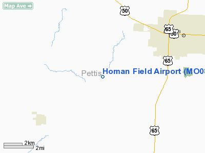
Location & QuickFacts
| FAA Information Effective: | 2008-09-25 |
| Airport Identifier: | MO08 |
| Airport Status: | Operational |
| Longitude/Latitude: | 093-19-57.7480W/38-39-46.0590N
-93.332708/38.662794 (Estimated) |
| Elevation: | 885 ft / 269.75 m (Estimated) |
| Land: | 0 acres |
| From nearest city: | 5 nautical miles SW of Sedalia, MO |
| Location: | Pettis County, MO |
| Magnetic Variation: | 03E (1995) |
Owner & Manager
| Ownership: | Privately owned |
| Owner: | Steve & Cheryl Homan |
| Address: | 19394 Arnett Road
Sedalia, MO 65301 |
| Phone number: | 816-827-4750 |
| Manager: | Steve & Cheryl Homan |
| Address: | 19394 Arnett Road
Sedalia, MO 65301 |
| Phone number: | 816-827-4750 |
Airport Operations and Facilities
| Airport Use: | Private |
| Segmented Circle: | No |
| Control Tower: | No |
| Sectional chart: | Kansas City |
| Region: | ACE - Central |
| Boundary ARTCC: | ZKC - Kansas City |
| Tie-in FSS: | COU - Columbia |
| FSS on Airport: | No |
| FSS Toll Free: | 1-800-WX-BRIEF |
Runway Information
Runway 18/36
| Dimension: | 1000 x 60 ft / 304.8 x 18.3 m |
| Surface: | TURF, |
| |
Runway 18 |
Runway 36 |
| Traffic Pattern: | Left | Left |
| Displaced threshold: | 0.00 ft | 300.00 ft |
| Obstruction: | | 40 ft plines, 164.0 ft from runway |
|
Radio Navigation Aids
| ID |
Type |
Name |
Ch |
Freq |
Var |
Dist |
| DMO | NDB | Sedalia | | 281.00 | 03E | 7.7 nm |
| HCK | NDB | Hawks | | 296.00 | 04E | 11.4 nm |
| PUR | NDB | Marshall | | 371.00 | 03E | 23.7 nm |
| GLY | NDB | Golden Valley | | 388.00 | 04E | 24.7 nm |
| VER | NDB | Viertel | | 347.00 | 02E | 34.9 nm |
| SZL | TACAN | Whiteman | 035X | | 04E | 11.1 nm |
| ANX | VORTAC | Napoleon | 087X | 114.00 | 07E | 45.4 nm |
Remarks
- PRVDD 20:1 APCH & 7:1 TRANSITIONAL SLOPES ARE MAINTAINED.
Images and information placed above are from
http://www.airport-data.com/airport/MO08/
We thank them for the data!
| General Info
|
| Country |
United States
|
| State |
MISSOURI
|
| FAA ID |
MO08
|
| Latitude |
38-39-46.059N
|
| Longitude |
093-19-57.748W
|
| Elevation |
885 feet
|
| Near City |
SEDALIA
|
We don't guarantee the information is fresh and accurate. The data may
be wrong or outdated.
For more up-to-date information please refer to other sources.
|
|


