 |
|
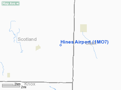
Location & QuickFacts
| FAA Information Effective: | 2008-09-25 |
| Airport Identifier: | 1MO7 |
| Airport Status: | Operational |
| Longitude/Latitude: | 091-58-30.6270W/40-21-50.1360N
-91.975174/40.363927 (Estimated) |
| Elevation: | 750 ft / 228.60 m (Estimated) |
| Land: | 0 acres |
| From nearest city: | 3 nautical miles E of Gorin, MO |
| Location: | Scotland County, MO |
| Magnetic Variation: | 03E (1985) |
Owner & Manager
| Ownership: | Privately owned |
| Owner: | Gilbert Hines |
| Address: |
Gorin, MO 63543 |
| Phone number: | 816-282-3490 |
| Manager: | Gilbert Hines |
| Address: | 47b Box
Gorin, MO 63543 |
| Phone number: | 816-282-3490 |
Airport Operations and Facilities
| Airport Use: | Private |
| Wind indicator: | No |
| Segmented Circle: | No |
| Control Tower: | No |
| Landing fee charge: | No |
| Sectional chart: | Chicago |
| Region: | ACE - Central |
| Boundary ARTCC: | ZKC - Kansas City |
| Tie-in FSS: | COU - Columbia |
| FSS on Airport: | No |
| FSS Toll Free: | 1-800-WX-BRIEF |
Airport Services
| Airframe Repair: | NONE |
| Power Plant Repair: | NONE |
Runway Information
Runway N/S
| Dimension: | 1600 x 100 ft / 487.7 x 30.5 m |
| Surface: | TURF, |
| |
Runway N |
Runway S |
| Traffic Pattern: | Left | Left |
|
Radio Navigation Aids
| ID |
Type |
Name |
Ch |
Freq |
Var |
Dist |
| EOK | NDB | Keokuk | | 366.00 | 02E | 25.5 nm |
| BEX | NDB | Bloomfield | | 269.00 | 02E | 30.9 nm |
| FFL | NDB | Fairfield | | 332.00 | 03E | 38.9 nm |
| MPZ | NDB | Mount Pleasant | | 212.00 | 02E | 40.8 nm |
| UI | NDB | Quincy | | 293.00 | 02E | 43.8 nm |
| HAE | NDB | Hannibal | | 411.00 | 03E | 45.3 nm |
| TVK | NDB | Centerville | | 290.00 | 04E | 46.5 nm |
| OTM | VOR/DME | Ottumwa | 053X | 111.60 | 06E | 43.1 nm |
| MCM | VOR/DME | Macon | 076X | 112.90 | 06E | 48.6 nm |
| IRK | VORTAC | Kirksville | 093X | 114.60 | 06E | 31.5 nm |
| UIN | VORTAC | Quincy | 083X | 113.60 | 05E | 44.6 nm |
Images and information placed above are from
http://www.airport-data.com/airport/1MO7/
We thank them for the data!
| General Info
|
| Country |
United States
|
| State |
MISSOURI
|
| FAA ID |
1MO7
|
| Latitude |
40-21-50.136N
|
| Longitude |
091-58-30.627W
|
| Elevation |
750 feet
|
| Near City |
GORIN
|
We don't guarantee the information is fresh and accurate. The data may
be wrong or outdated.
For more up-to-date information please refer to other sources.
|
|


