 |
|
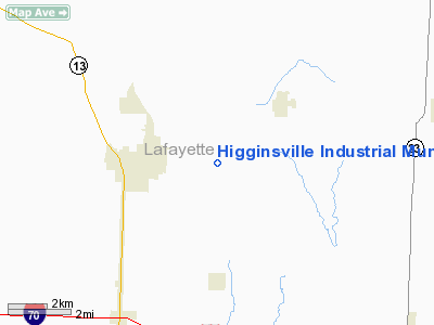
Higginsville Industrial Municipal Airport |
Location & QuickFacts
| FAA Information Effective: | 2008-09-25 |
| Airport Identifier: | HIG |
| Airport Status: | Operational |
| Longitude/Latitude: | 093-40-38.5000W/39-04-20.8000N
-93.677361/39.072444 (Estimated) |
| Elevation: | 840 ft / 256.03 m (Surveyed) |
| Land: | 200 acres |
| From nearest city: | 2 nautical miles E of Higginsville, MO |
| Location: | Lafayette County, MO |
| Magnetic Variation: | 02E (2005) |
Owner & Manager
| Ownership: | Publicly owned |
| Owner: | City Of Higginsville |
| Address: | 1922 Main St Box 110
Higginsville, MO 64037 |
| Phone number: | 660-584-2106 |
| Manager: | Kelly Ralston
636-688-0121 (PERSONAL) |
| Address: | 11667 Airport Road
Higginsville, MO 64037
KELLY'S FLYING SERVICE |
| Phone number: | 660-584-3221
PERSONAL NUMBER 636-688-0121 |
Airport Operations and Facilities
| Airport Use: | Open to public |
| Wind indicator: | Yes |
| Segmented Circle: | No |
| Control Tower: | No |
| Lighting Schedule: | DUSK-DAWN
ACTVT MIRL RY 16/34; PAPI & REIL RYS 16 & 34 - CTAF. |
| Beacon Color: | Clear-Green (lighted land airport) |
| Landing fee charge: | No |
| Sectional chart: | Kansas City |
| Region: | ACE - Central |
| Boundary ARTCC: | ZKC - Kansas City |
| Tie-in FSS: | COU - Columbia |
| FSS on Airport: | No |
| FSS Toll Free: | 1-800-WX-BRIEF |
| NOTAMs Facility: | COU (NOTAM-d service avaliable) |
| Federal Agreements: | NGY |
Airport Communications
| CTAF: | 122.800 |
| Unicom: | 122.800 |
Airport Services
| Fuel available: | 100LL
FOR SVC AFT HRS, CALL NBRS POSTED ON TERMINAL DOOR. |
| Airframe Repair: | MAJOR |
| Power Plant Repair: | MAJOR |
| Bottled Oxygen: | NONE |
| Bulk Oxygen: | NONE |
Runway Information
Runway 16/34
| Dimension: | 4400 x 75 ft / 1341.1 x 22.9 m |
| Surface: | ASPH, Good Condition |
| Weight Limit: | Single wheel: 12500 lbs.
Dual wheel: 16000 lbs. |
| Edge Lights: | Medium |
| |
Runway 16 |
Runway 34 |
| Longitude: | 093-40-45.5000W | 093-40-31.5000W |
| Latitude: | 39-04-41.9000N | 39-03-59.8000N |
| Elevation: | 840.00 ft | 796.00 ft |
| Alignment: | 127 | 127 |
| Traffic Pattern: | Left | Left |
| Markings: | Non-precision instrument, Good Condition | Non-precision instrument, Good Condition |
| Crossing Height: | 31.00 ft | 39.00 ft |
| VASI: | 4-light PAPI on left side | 4-light PAPI on left side |
| Visual Glide Angle: | 3.00° | 3.00° |
| Runway End Identifier: | Yes | Yes |
| Obstruction: | 3 ft gnd, 200.0 ft from runway, 125 ft left of centerline
+1-4' GND, 0-200' FM RY END, 125' R; +1-2' GND, 0-200' FM RY END, 0-125' L. | 13 ft tree, 755.0 ft from runway, 320 ft right of centerline, 42:1 slope to clear |
| Decleard distances: | Take off run available 4400.00 ft
Take off distance available 4400.00 ft
Actual stop distance available 4400.00 ft
Landing distance available 4400.00 ft
| Take off run available 4400.00 ft
Take off distance available 4400.00 ft
Actual stop distance available 4400.00 ft
Landing distance available 4400.00 ft
|
|
Radio Navigation Aids
| ID |
Type |
Name |
Ch |
Freq |
Var |
Dist |
| PUR | NDB | Marshall | | 371.00 | 03E | 22.6 nm |
| HCK | NDB | Hawks | | 296.00 | 04E | 27.1 nm |
| DMO | NDB | Sedalia | | 281.00 | 03E | 32.2 nm |
| LXT | NDB | Lesumit | | 263.00 | 04E | 33.1 nm |
| GPH | NDB | Mosby | | 284.00 | 03E | 33.6 nm |
| GLY | NDB | Golden Valley | | 388.00 | 04E | 42.9 nm |
| CHT | NDB | Chillicothe | | 375.00 | 03E | 43.2 nm |
| GQ | NDB | Norge | | 517.00 | 05E | 45.7 nm |
| GKB | NDB | Norge | | 517.00 | 05E | 45.7 nm |
| VER | NDB | Viertel | | 347.00 | 02E | 47.0 nm |
| EZZ | NDB | Cameron | | 394.00 | 03E | 48.2 nm |
| BZK | NDB | Brookfield | | 383.00 | 03E | 49.2 nm |
| SZL | TACAN | Whiteman | 035X | | 04E | 21.1 nm |
| BQS | VOR/DME | Braymer | 049X | 111.20 | 03E | 34.8 nm |
| RIS | VOR/DME | Riverside | 051X | 111.40 | 05E | 43.0 nm |
| ANX | VORTAC | Napoleon | 087X | 114.00 | 07E | 21.1 nm |
| MKC | VOT | Kansas City Downtown | | 108.60 | | 43.1 nm |
Remarks
- WILDLIFE ON & INVOF ARPT.
Images and information placed above are from
http://www.airport-data.com/airport/HIG/
We thank them for the data!
| General Info
|
| Country |
United States
|
| State |
MISSOURI
|
| FAA ID |
HIG
|
| Latitude |
39-04-24.047N
|
| Longitude |
093-40-37.779W
|
| Elevation |
830 feet
|
| Near City |
HIGGINSVILLE
|
We don't guarantee the information is fresh and accurate. The data may
be wrong or outdated.
For more up-to-date information please refer to other sources.
|
|


