 |
|
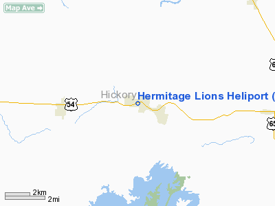
Location & QuickFacts
| FAA Information Effective: | 2008-09-25 |
| Airport Identifier: | 3M1 |
| Airport Status: | Operational |
| Longitude/Latitude: | 093-20-01.0000W/37-56-50.0000N
-93.333611/37.947222 (Estimated) |
| Elevation: | 902 ft / 274.93 m (Estimated) |
| Land: | 3 acres |
| From nearest city: | 0 nautical miles N of Hermitage, MO |
| Location: | Hickory County, MO |
| Magnetic Variation: | 04E (1990) |
Owner & Manager
| Ownership: | Privately owned |
| Owner: | Hermitage Lions Club |
| Address: | P.o. Box 131
Hermitage, MO 65668 |
| Phone number: | 417-745-6404 |
| Manager: | Don Ginnings |
| Address: | P.o. Box 131
Hermitage, MO 65668 |
| Phone number: | 417-745-6404 |
Airport Operations and Facilities
| Airport Use: | Open to public |
| Wind indicator: | Yes |
| Segmented Circle: | No |
| Control Tower: | No |
| Lighting Schedule: | PHONE REQ
FOR PERIMETER LGTS CALL 417-745-6415. |
| Sectional chart: | Kansas City |
| Region: | ACE - Central |
| Boundary ARTCC: | ZKC - Kansas City |
| Tie-in FSS: | COU - Columbia |
| FSS on Airport: | No |
| FSS Toll Free: | 1-800-WX-BRIEF |
| NOTAMs Facility: | COU |
Airport Communications
Runway Information
Helipad H1
| Dimension: | 40 x 40 ft / 12.2 x 12.2 m |
| Surface: | CONC, Fair Condition |
| |
Runway H1 |
Runway |
| Traffic Pattern: | Left | Left |
| Markings: | Nonstandard, Poor Condition
MARKINGS FADED. | ,
MARKINGS FADED.
MKD WITH SMALL WHITE 'H'. MARKINGS IN POOR COND. |
| Obstruction: | 36 ft pline, 70.0 ft from runway, 1:1 slope to clear | |
|
Radio Navigation Aids
| ID |
Type |
Name |
Ch |
Freq |
Var |
Dist |
| GLY | NDB | Golden Valley | | 388.00 | 04E | 29.8 nm |
| AIZ | NDB | Kaiser | | 377.00 | 05E | 38.0 nm |
| IEB | NDB | Lebanon | | 414.00 | 03E | 39.2 nm |
| ILJ | NDB | Willard | | 254.00 | 03E | 39.3 nm |
| HCK | NDB | Hawks | | 296.00 | 04E | 42.5 nm |
| DMO | NDB | Sedalia | | 281.00 | 03E | 46.1 nm |
| EAD | NDB | Nevada | | 209.00 | 06E | 46.3 nm |
| SZL | TACAN | Whiteman | 035X | | 04E | 48.5 nm |
| SHY | VOR/DME | Sunshine | 021X | 108.40 | 05E | 35.1 nm |
| SGF | VORTAC | Springfield | 116X | 116.90 | 04E | 35.5 nm |
Remarks
- LNDGS FROM THE SOUTH ARE RECOMMENDED.
- PRVDD A CLEAR APCH/DEP PATHS TO THE LNDG AREA FOR A MIN 8:1 GS; A CLEAR TRANSITIONAL SFC FOR A MIN 22:1 SLOPE. THE HELIPAD MKGS OR BNDRY LGTS SHUD BE LOWERED TO A MIN HGT TO PRECLUDE THE PSBLTY OF A TAIL ROTOR STRIKE. THE ORANGE MKRS ON THE OVERHEAD ELEC PLINES N OF PAD SHOULD BE MAINTAINED.
Images and information placed above are from
http://www.airport-data.com/airport/3M1/
We thank them for the data!
| General Info
|
| Country |
United States
|
| State |
MISSOURI
|
| FAA ID |
3M1
|
| Latitude |
37-56-50.000N
|
| Longitude |
093-20-01.000W
|
| Elevation |
902 feet
|
| Near City |
HERMITAGE
|
We don't guarantee the information is fresh and accurate. The data may
be wrong or outdated.
For more up-to-date information please refer to other sources.
|
|


