 |
|
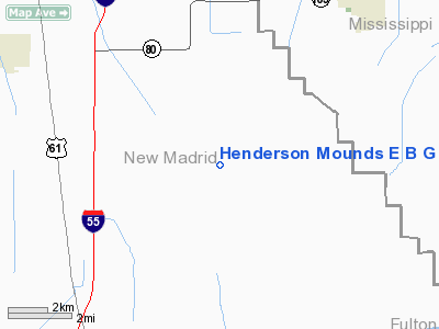
Henderson Mounds E B G Airport |
Location & QuickFacts
| FAA Information Effective: | 2008-09-25 |
| Airport Identifier: | MO57 |
| Airport Status: | Operational |
| Longitude/Latitude: | 089-28-00.2720W/36-42-25.2050N
-89.466742/36.707001 (Estimated) |
| Elevation: | 295 ft / 89.92 m (Estimated) |
| Land: | 0 acres |
| From nearest city: | 3 nautical miles NE of East Prairie, MO |
| Location: | New Madrid County, MO |
| Magnetic Variation: | 02E (1985) |
Owner & Manager
| Ownership: | Privately owned |
| Owner: | E B Gee Jr |
| Address: | Po Box 147
Blytheville, AR 72315 |
| Phone number: | 501-763-7027 |
| Address: |
|
Airport Operations and Facilities
| Airport Use: | Private |
| Wind indicator: | Yes |
| Segmented Circle: | No |
| Control Tower: | No |
| Landing fee charge: | No |
| Sectional chart: | St Louis |
| Region: | ACE - Central |
| Boundary ARTCC: | ZME - Memphis |
| Tie-in FSS: | COU - Columbia |
| FSS on Airport: | No |
| FSS Toll Free: | 1-800-WX-BRIEF |
Airport Services
| Airframe Repair: | NONE |
| Power Plant Repair: | NONE |
Runway Information
Runway N/S
| Dimension: | 2500 x 75 ft / 762.0 x 22.9 m |
| Surface: | TURF, |
| |
Runway N |
Runway S |
| Traffic Pattern: | Left | Left |
|
Radio Navigation Aids
| ID |
Type |
Name |
Ch |
Freq |
Var |
Dist |
| CHQ | NDB | Charleston | | 208.00 | 01E | 9.8 nm |
| DXE | NDB | Dexter | | 423.00 | 00E | 23.3 nm |
| CIR | NDB | Cairo | | 397.00 | 00E | 24.3 nm |
| UC | NDB | Obion | | 212.00 | 00E | 33.5 nm |
| TKX | NDB | Kennett | | 358.00 | 00E | 39.9 nm |
| FD | NDB | Earli | | 278.00 | 03E | 41.6 nm |
| GGK | NDB | Mayfield | | 401.00 | 00E | 42.1 nm |
| DNT | NDB | Nally Dunston | | 343.00 | 01W | 42.9 nm |
| BDD | NDB | Bellgrade | | 254.00 | 00E | 46.5 nm |
| IUI | NDB | Hicks | | 350.00 | 01E | 49.5 nm |
| CGI | VOR/DME | Cape Girardeau | 076X | 112.90 | 01E | 31.7 nm |
| MAW | VORTAC | Malden | 049X | 111.20 | 03E | 23.3 nm |
| CNG | VORTAC | Cunningham | 078X | 113.10 | 03E | 35.3 nm |
| DYR | VORTAC | Dyersburg | 115X | 116.80 | 03E | 42.0 nm |
Back to top Back to home
Images and information placed above are from
http://www.airport-data.com/airport/MO57/
We thank them for the data!
| General Info
|
| Country |
United States
|
| State |
MISSOURI
|
| FAA ID |
MO57
|
| Latitude |
36-42-25.205N
|
| Longitude |
089-28-00.272W
|
| Elevation |
295 feet
|
| Near City |
EAST PRAIRIE
|
We don't guarantee the information is fresh and accurate. The data may
be wrong or outdated.
For more up-to-date information please refer to other sources.
|
|


