 |
|
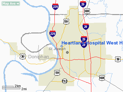
Heartland Hospital West Heliport |
Location & QuickFacts
| FAA Information Effective: | 2008-09-25 |
| Airport Identifier: | 63MO |
| Airport Status: | Operational |
| Longitude/Latitude: | 094-51-00.8760W/39-46-09.9790N
-94.850243/39.769439 (Estimated) |
| Elevation: | 966 ft / 294.44 m (Estimated) |
| Land: | 0 acres |
| From nearest city: | 0 nautical miles N of St Joseph, MO |
| Location: | Buchanan County, MO |
| Magnetic Variation: | 05E (1985) |
Owner & Manager
| Ownership: | Privately owned |
| Owner: | Heartland Hospital West |
| Address: | 7th To 9th On Faraon
St Joseph, MO 64501 |
| Phone number: | 816-271-7201 |
| Manager: | Jeffrey Langdon |
| Address: | 7th To 9th On Faraon
St Joseph, MO 64501 |
| Phone number: | 816-271-7201 |
Airport Operations and Facilities
| Airport Use: | Private
MEDICAL. |
| Wind indicator: | Yes |
| Segmented Circle: | No |
| Control Tower: | No |
| Lighting Schedule: | DUSK-DAWN |
| Beacon Color: | Clear-Yellow (lighted seaplan base) |
| Landing fee charge: | No |
| Sectional chart: | Kansas City |
| Region: | ACE - Central |
| Boundary ARTCC: | ZKC - Kansas City |
| Tie-in FSS: | COU - Columbia |
| FSS on Airport: | No |
| FSS Toll Free: | 1-800-WX-BRIEF |
Runway Information
Helipad H1
| Dimension: | 20 x 20 ft / 6.1 x 6.1 m |
| Surface: | ASPH,
ROOFTOP FACILITY. |
| |
Runway H1 |
Runway |
| Traffic Pattern: | Left | Left |
|
Radio Navigation Aids
| ID |
Type |
Name |
Ch |
Freq |
Var |
Dist |
| AZN | NDB | Amazon | | 233.00 | 06E | 7.4 nm |
| EZZ | NDB | Cameron | | 394.00 | 03E | 26.8 nm |
| DO | NDB | Dotte | | 359.00 | 05E | 33.3 nm |
| EVU | NDB | Emville | | 317.00 | 05E | 34.9 nm |
| GPH | NDB | Mosby | | 284.00 | 03E | 35.8 nm |
| FNB | NDB | Brenner | | 404.00 | 05E | 38.6 nm |
| GQ | NDB | Norge | | 517.00 | 05E | 43.5 nm |
| GKB | NDB | Norge | | 517.00 | 05E | 43.5 nm |
| RBA | VOR/DME | Robinson | 019X | 108.20 | 04E | 26.9 nm |
| RIS | VOR/DME | Riverside | 051X | 111.40 | 05E | 40.8 nm |
| BQS | VOR/DME | Braymer | 049X | 111.20 | 03E | 45.9 nm |
| STJ | VORTAC | St Joseph | 102X | 115.50 | 08E | 12.0 nm |
| MCI | VORTAC | Kansas City | 079Y | 113.25 | 05E | 29.6 nm |
| TOP | VORTAC | Topeka | 125X | 117.80 | 05E | 50.0 nm |
| MKC | VOT | Kansas City Downtown | | 108.60 | | 40.6 nm |
Remarks
- OWNER DOES NOT WANT CHARTING.
- PROVIDED THE APPROACH/DEPARTURE PATHS TO LANDING AREA ARE MAINTAINED FOR A MINIMUM 8:1 GLIDE SLOPE AND THE TRANSITIONAL SURFACE BE MAINTAINED FOR A MINIMUM 2:1 SLOPE.
Images and information placed above are from
http://www.airport-data.com/airport/63MO/
We thank them for the data!
| General Info
|
| Country |
United States
|
| State |
MISSOURI
|
| FAA ID |
63MO
|
| Latitude |
39-46-09.979N
|
| Longitude |
094-51-00.876W
|
| Elevation |
966 feet
|
| Near City |
ST JOSEPH
|
We don't guarantee the information is fresh and accurate. The data may
be wrong or outdated.
For more up-to-date information please refer to other sources.
|
|


