 |
|
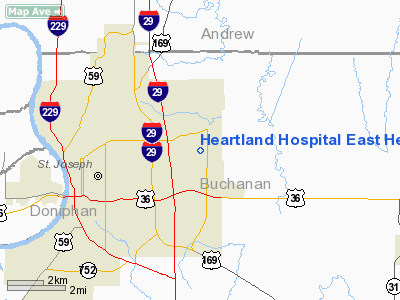
Heartland Hospital East Heliport |
Location & QuickFacts
| FAA Information Effective: | 2008-09-25 |
| Airport Identifier: | MO48 |
| Airport Status: | Operational |
| Longitude/Latitude: | 094-46-18.8680W/39-46-18.9800N
-94.771908/39.771939 (Estimated) |
| Elevation: | 923 ft / 281.33 m (Estimated) |
| Land: | 0 acres |
| From nearest city: | 0 nautical miles N of St. Joseph, MO |
| Location: | Buchanan County, MO |
| Magnetic Variation: | 04E (1995) |
Owner & Manager
| Ownership: | Privately owned |
| Owner: | Hearland Hospital East |
| Address: | 5325 Faraon
St Joseph, MO 64506 |
| Phone number: | 816-271-6000 |
| Manager: | James W. Evans |
| Address: | 5325 Faraon
St Joseph, MO 64506 |
| Phone number: | 816-271-6000 |
Airport Operations and Facilities
| Airport Use: | Private
MEDICAL USE. |
| Segmented Circle: | No |
| Control Tower: | No |
| Region: | ACE - Central |
| Boundary ARTCC: | ZKC - Kansas City |
| Tie-in FSS: | COU - Columbia |
| FSS Toll Free: | 1-800-WX-BRIEF |
Runway Information
Helipad H1
| Dimension: | 40 x 40 ft / 12.2 x 12.2 m |
| Surface: | CONC, |
| |
Runway H1 |
Runway |
| Traffic Pattern: | Left | Left |
|
Radio Navigation Aids
| ID |
Type |
Name |
Ch |
Freq |
Var |
Dist |
| AZN | NDB | Amazon | | 233.00 | 06E | 9.2 nm |
| EZZ | NDB | Cameron | | 394.00 | 03E | 23.2 nm |
| DO | NDB | Dotte | | 359.00 | 05E | 33.1 nm |
| GPH | NDB | Mosby | | 284.00 | 03E | 33.4 nm |
| EVU | NDB | Emville | | 317.00 | 05E | 35.3 nm |
| FNB | NDB | Brenner | | 404.00 | 05E | 41.8 nm |
| GQ | NDB | Norge | | 517.00 | 05E | 43.1 nm |
| GKB | NDB | Norge | | 517.00 | 05E | 43.1 nm |
| RBA | VOR/DME | Robinson | 019X | 108.20 | 04E | 30.4 nm |
| RIS | VOR/DME | Riverside | 051X | 111.40 | 05E | 40.0 nm |
| BQS | VOR/DME | Braymer | 049X | 111.20 | 03E | 42.3 nm |
| STJ | VORTAC | St Joseph | 102X | 115.50 | 08E | 13.4 nm |
| MCI | VORTAC | Kansas City | 079Y | 113.25 | 05E | 29.3 nm |
| MKC | VOT | Kansas City Downtown | | 108.60 | | 39.8 nm |
Remarks
- SEE AIRSPACE LETTER DATED 3/24/97.
Images and information placed above are from
http://www.airport-data.com/airport/MO48/
We thank them for the data!
| General Info
|
| Country |
United States
|
| State |
MISSOURI
|
| FAA ID |
MO48
|
| Latitude |
39-46-18.980N
|
| Longitude |
094-46-18.868W
|
| Elevation |
923 feet
|
| Near City |
ST. JOSEPH
|
We don't guarantee the information is fresh and accurate. The data may
be wrong or outdated.
For more up-to-date information please refer to other sources.
|
|


