 |
|
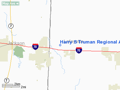
Harry S Truman Regional Airport |
Location & QuickFacts
| FAA Information Effective: | 2008-09-25 |
| Airport Identifier: | 2M1 |
| Airport Status: | Operational |
| Longitude/Latitude: | 094-05-11.4000W/39-01-10.7000N
-94.086500/39.019639 (Estimated) |
| Elevation: | 860 ft / 262.13 m (Estimated) |
| Land: | 260 acres |
| From nearest city: | 2 nautical miles NW of Bates City, MO |
| Location: | Lafayette County, MO |
| Magnetic Variation: | 05E (1985) |
Owner & Manager
| Ownership: | Privately owned |
| Owner: | White Holdings, Ltd. |
| Address: | 1 Lafayette Sq Po Box 198
Bates City, MO 64011 |
| Phone number: | 816-690-8800 |
| Manager: | Terry White |
| Address: | 1 Lafayette Sq Box 198
Bates City, MO 64011 |
| Phone number: | 816-690-8800 |
Airport Operations and Facilities
| Airport Use: | Open to public |
| Wind indicator: | Yes |
| Segmented Circle: | No |
| Control Tower: | No |
| Sectional chart: | Kansas City |
| Region: | ACE - Central |
| Boundary ARTCC: | ZKC - Kansas City |
| Tie-in FSS: | COU - Columbia |
| FSS Toll Free: | 1-800-WX-BRIEF |
| NOTAMs Facility: | COU (NOTAM-d service avaliable) |
Airport Communications
| CTAF: | 122.800 |
| Unicom: | 122.800 |
Airport Services
Runway Information
Runway 03/21
| Dimension: | 4400 x 70 ft / 1341.1 x 21.3 m
WIDTH VARIANCE 70-80 FT. |
| Surface: | GRAVEL, Fair Condition |
| |
Runway 03 |
Runway 21 |
| Longitude: | 094-05-25.3600W | 094-04-57.4900W |
| Latitude: | 39-00-51.8900N | 39-01-29.5700N |
| Traffic Pattern: | Left | Left |
| Obstruction: | 54 ft trees, 324.0 ft from runway, 95 ft right of centerline, 6:1 slope to clear | 30 ft tree, 135.0 ft from runway, 105 ft left of centerline, 4:1 slope to clear |
|
Radio Navigation Aids
| ID |
Type |
Name |
Ch |
Freq |
Var |
Dist |
| LXT | NDB | Lesumit | | 263.00 | 04E | 13.8 nm |
| GPH | NDB | Mosby | | 284.00 | 03E | 22.2 nm |
| GQ | NDB | Norge | | 517.00 | 05E | 26.7 nm |
| GKB | NDB | Norge | | 517.00 | 05E | 26.7 nm |
| DO | NDB | Dotte | | 359.00 | 05E | 33.2 nm |
| HCK | NDB | Hawks | | 296.00 | 04E | 33.6 nm |
| PUR | NDB | Marshall | | 371.00 | 03E | 41.6 nm |
| EZZ | NDB | Cameron | | 394.00 | 03E | 43.5 nm |
| GLY | NDB | Golden Valley | | 388.00 | 04E | 44.0 nm |
| DMO | NDB | Sedalia | | 281.00 | 03E | 46.6 nm |
| SZL | TACAN | Whiteman | 035X | | 04E | 30.3 nm |
| RIS | VOR/DME | Riverside | 051X | 111.40 | 05E | 24.6 nm |
| OJC | VOR/DME | Johnson County | 077X | 113.00 | 06E | 32.3 nm |
| BQS | VOR/DME | Braymer | 049X | 111.20 | 03E | 38.0 nm |
| ANX | VORTAC | Napoleon | 087X | 114.00 | 07E | 5.0 nm |
| MCI | VORTAC | Kansas City | 079Y | 113.25 | 05E | 34.3 nm |
| BUM | VORTAC | Butler | 106X | 115.90 | 07E | 48.7 nm |
| MKC | VOT | Kansas City Downtown | | 108.60 | | 24.7 nm |
Remarks
- MIGATORY BIRDS ON & INVOF ARPT DURING FALL AND WINTER.
- RY 03/21 INSUFFICIENT RY SAFETY AREA LENGTHS BEYOND EACH RY END. RY 3 END HAS STEEP SLOPE WITH FENCE, TREES, & ROAD. RY 21 END HAS FENCE, TREES, & ROAD.
- PRVDD APCHS ARE MAINTD FOR A MINIMUM 20:1 GLIDE SLOPE & TRSNL SFCS FOR A 7:1 SLOPE.
Images and information placed above are from
http://www.airport-data.com/airport/2M1/
We thank them for the data!
| General Info
|
| Country |
United States
|
| State |
MISSOURI
|
| FAA ID |
2M1
|
| Latitude |
39-01-05.027N
|
| Longitude |
094-05-13.805W
|
| Elevation |
860 feet
|
| Near City |
BATES CITY
|
We don't guarantee the information is fresh and accurate. The data may
be wrong or outdated.
For more up-to-date information please refer to other sources.
|
|


