 |
|
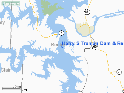
Harry S Truman Dam & Reservoir Seaplane Base |
Location & QuickFacts
| FAA Information Effective: | 2008-09-25 |
| Airport Identifier: | 75U |
| Airport Status: | Operational |
| Longitude/Latitude: | 093-25-00.7370W/38-13-00.0930N
-93.416871/38.216693 (Estimated) |
| Elevation: | 706 ft / 215.19 m (Estimated) |
| Land: | 0 acres |
| From nearest city: | 1 nautical miles E of Warsaw, MO |
| Location: | Benton County, MO |
| Magnetic Variation: | 04E (1985) |
Owner & Manager
| Ownership: | Publicly owned |
| Owner: | U.s. Army Corps Of Engineers |
| Address: | 700 Federal Bldg
Kansas City, M0 64106-2896 |
| Phone number: | 816-389-3595 |
| Manager: | Bob Marchi
OPERATIONS PROJECT MANAGER |
| Address: | 15968 Truman Road
Warsaw, MO 65355 |
| Phone number: | 816-389-3595
EXTENSION 1214. |
Airport Operations and Facilities
| Airport Use: | Open to public |
| Segmented Circle: | No |
| Control Tower: | No |
| Sectional chart: | Kansas City |
| Region: | ACE - Central |
| Boundary ARTCC: | ZKC - Kansas City |
| Tie-in FSS: | COU - Columbia |
| FSS on Airport: | No |
| FSS Toll Free: | 1-800-WX-BRIEF |
| NOTAMs Facility: | COU (NOTAM-d service avaliable) |
Airport Communications
Runway Information
Runway ALL/WAY
| Dimension: | 15000 x 4000 ft / 4572.0 x 1219.2 m |
| Surface: | WATER, |
| |
Runway ALL |
Runway WAY |
| Traffic Pattern: | Left | Left |
|
Radio Navigation Aids
| ID |
Type |
Name |
Ch |
Freq |
Var |
Dist |
| GLY | NDB | Golden Valley | | 388.00 | 04E | 15.2 nm |
| HCK | NDB | Hawks | | 296.00 | 04E | 25.8 nm |
| DMO | NDB | Sedalia | | 281.00 | 03E | 31.4 nm |
| AIZ | NDB | Kaiser | | 377.00 | 05E | 41.5 nm |
| EAD | NDB | Nevada | | 209.00 | 06E | 47.1 nm |
| SZL | TACAN | Whiteman | 035X | | 04E | 31.8 nm |
| SHY | VOR/DME | Sunshine | 021X | 108.40 | 05E | 39.9 nm |
Remarks
- SEAPLANE BASE IS LCTD UNDER THE TRUMAN C MOA BASE 500 FT AGL. CONTACT WHITEMAN APCH ON FREQ 127.45.
- DEBRIS ON & INVOF LAKE DURING FLOODINGS.
- NO BUOYS SHOWING LANDING AREAS.
- REMAIN 1000 FT CLEAR OF DAM OR ANY BRIDGE.
- CALL FOR ICE CONDITIONS IN WINTER MONTHS.
Images and information placed above are from
http://www.airport-data.com/airport/75U/
We thank them for the data!
| General Info
|
| Country |
United States
|
| State |
MISSOURI
|
| FAA ID |
75U
|
| Latitude |
38-13-00.093N
|
| Longitude |
093-25-00.737W
|
| Elevation |
706 feet
|
| Near City |
WARSAW
|
We don't guarantee the information is fresh and accurate. The data may
be wrong or outdated.
For more up-to-date information please refer to other sources.
|
|


