 |
|
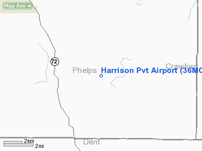
Location & QuickFacts
| FAA Information Effective: | 2008-09-25 |
| Airport Identifier: | 36MO |
| Airport Status: | Operational |
| Longitude/Latitude: | 091-38-48.5500W/37-51-10.1500N
-91.646819/37.852819 (Estimated) |
| Elevation: | 1050 ft / 320.04 m (Estimated) |
| Land: | 10 acres |
| From nearest city: | 12 nautical miles SE of Rolla, MO |
| Location: | Phelps County, MO |
| Magnetic Variation: | 01E (2000) |
Owner & Manager
| Ownership: | Privately owned |
| Owner: | Steve Harrison |
| Address: | 18810 Ct Rd 4110
Rolla, MO 65401 |
| Phone number: | 573-364-0700 |
| Manager: | Steve Harrison |
| Address: | 18810 Ct Rd 4110
Rolla, MO 65401 |
| Phone number: | 573-364-0700 |
Airport Operations and Facilities
| Airport Use: | Private |
| Segmented Circle: | No |
| Control Tower: | No |
| Sectional chart: | Kansas City |
| Region: | ACE - Central |
| Boundary ARTCC: | ZKC - Kansas City |
| Tie-in FSS: | COU - Columbia |
| FSS Toll Free: | 1-800-WX-BRIEF |
Runway Information
Runway 09/27
| Dimension: | 2750 x 150 ft / 838.2 x 45.7 m |
| Surface: | TURF, |
| |
Runway 09 |
Runway 27 |
| Traffic Pattern: | Left | Left |
| Obstruction: | 40 ft trees, 600.0 ft from runway | 40 ft trees, 300.0 ft from runway |
|
Radio Navigation Aids
| ID |
Type |
Name |
Ch |
Freq |
Var |
Dist |
| UBX | NDB | Cuba | | 380.00 | 01E | 16.5 nm |
| BHN | NDB | Buckhorn | | 391.00 | 03E | 23.6 nm |
| UUV | NDB | Sullivan | | 356.00 | 02E | 32.4 nm |
| AIZ | NDB | Kaiser | | 377.00 | 05E | 45.4 nm |
| JE | NDB | Algoa | | 397.00 | 03E | 46.4 nm |
| TBN | VOR | Forney | | 110.00 | 03E | 24.3 nm |
| VIH | VOR/DME | Vichy | 124X | 117.70 | 06E | 18.3 nm |
| SHY | VOR/DME | Sunshine | 021X | 108.40 | 05E | 46.7 nm |
| MAP | VORTAC | Maples | 081X | 113.40 | 06E | 17.1 nm |
Remarks
- OWNER DESIRES ARPT NOT BE CHARTED.
- PRVDD A CLEAR APCH TO EA RY FOR A 20:1 GLIDE SLOPE & A CLEAR TRANSITIONAL SFC FOR A 7:1 SLOPE.
Images and information placed above are from
http://www.airport-data.com/airport/36MO/
We thank them for the data!
| General Info
|
| Country |
United States
|
| State |
MISSOURI
|
| FAA ID |
36MO
|
| Latitude |
37-51-10.150N
|
| Longitude |
091-38-48.550W
|
| Elevation |
1050 feet
|
| Near City |
ROLLA
|
We don't guarantee the information is fresh and accurate. The data may
be wrong or outdated.
For more up-to-date information please refer to other sources.
|
|


