 |
|
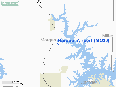
Location & QuickFacts
| FAA Information Effective: | 2008-09-25 |
| Airport Identifier: | MO30 |
| Airport Status: | Operational |
| Longitude/Latitude: | 092-48-41.3346W/38-16-11.4683N
-92.811482/38.269852 (Estimated) |
| Elevation: | 823 ft / 250.85 m (Estimated) |
| Land: | 10 acres |
| From nearest city: | 3 nautical miles SE of Gravois Mills, MO |
| Location: | Morgan County, MO |
| Magnetic Variation: | 04E (1985) |
Owner & Manager
| Ownership: | Privately owned |
| Owner: | Dick Lilienthal |
| Address: | 28364 Kettle
Gravios Mills, MO 65037 |
| Phone number: | 573-372-3858 |
| Manager: | Dick Lilienthal |
| Address: | 28364 Kettle
Gravios Mills, MO 65037 |
| Phone number: | 573-372-3858 |
Airport Operations and Facilities
| Airport Use: | Private |
| Wind indicator: | No |
| Segmented Circle: | No |
| Control Tower: | No |
| Landing fee charge: | Yes |
| Sectional chart: | Kansas City |
| Region: | ACE - Central |
| Boundary ARTCC: | ZKC - Kansas City |
| Tie-in FSS: | COU - Columbia |
| FSS on Airport: | No |
| FSS Toll Free: | 1-800-WX-BRIEF |
Runway Information
Runway 06/24
| Dimension: | 2545 x 45 ft / 775.7 x 13.7 m |
| Surface: | ASPH, Poor Condition
RWY 6/24; LOOSE AGGREGATE, CRACKS. |
| |
Runway 06 |
Runway 24 |
| Traffic Pattern: | Left | Left |
| Markings: | Nonstandard, Poor Condition
RWY 6; MARKINGS FADED. | Nonstandard, Poor Condition
RWY 24; MARKINGS FADED. |
| Obstruction: | 33 ft trees, 200.0 ft from runway, 65 ft left of centerline
+1-32 FT BRUSH; TREES; HIGH GROUND; ROAD & POWER LINES 0-200 FT FROM THLD LEFT & RIGHT. | 38 ft trees, 230.0 ft from runway, 90 ft left of centerline
RWY 24 1-45 FT BRUSH, TREES, METAL STAKES 0-190 FT FM THLD 40-125 FT L & R. |
|
Radio Navigation Aids
| ID |
Type |
Name |
Ch |
Freq |
Var |
Dist |
| AIZ | NDB | Kaiser | | 377.00 | 05E | 16.0 nm |
| DMO | NDB | Sedalia | | 281.00 | 03E | 31.3 nm |
| ONH | NDB | Noah | | 515.00 | 03E | 34.6 nm |
| JE | NDB | Algoa | | 397.00 | 03E | 38.6 nm |
| VER | NDB | Viertel | | 347.00 | 02E | 41.3 nm |
| GLY | NDB | Golden Valley | | 388.00 | 04E | 41.5 nm |
| HCK | NDB | Hawks | | 296.00 | 04E | 41.8 nm |
| IEB | NDB | Lebanon | | 414.00 | 03E | 42.6 nm |
| BHN | NDB | Buckhorn | | 391.00 | 03E | 48.0 nm |
| PUR | NDB | Marshall | | 371.00 | 03E | 49.8 nm |
| SZL | TACAN | Whiteman | 035X | | 04E | 44.6 nm |
| TBN | VOR | Forney | | 110.00 | 03E | 44.9 nm |
| SHY | VOR/DME | Sunshine | 021X | 108.40 | 05E | 17.0 nm |
| COU | VOR/DME | Columbia | 039X | 110.20 | 03E | 42.8 nm |
| JEF | VOT | Jefferson City | | 112.00 | | 36.6 nm |
Remarks
- WILDLIFE ON & INVOF ARPT.
- TALL BRUSH & TREES LCTD ALONG SIDE OF RY IN RY PRIM SFC. & SAFETY AREAS. CLOSEST BRUSH & TREES LCTD 30 FT SW OF RWY CNTRLN.
- RY 06/24 LINE OF SIGHT OBSTRUCTED BY GRADE CHG IN RY.
Images and information placed above are from
http://www.airport-data.com/airport/MO30/
We thank them for the data!
| General Info
|
| Country |
United States
|
| State |
MISSOURI
|
| FAA ID |
MO30 |
| Latitude |
38-16-00.105N
|
| Longitude |
092-49-00.688W
|
| Elevation |
823 feet
|
| Near City |
GRAVOIS MILLS
|
We don't guarantee the information is fresh and accurate. The data may
be wrong or outdated.
For more up-to-date information please refer to other sources.
|
|


