 |
|
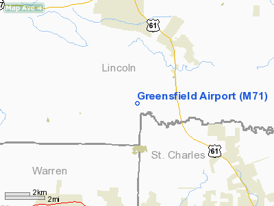
Location & QuickFacts
| FAA Information Effective: | 2008-09-25 |
| Airport Identifier: | M71 |
| Airport Status: | Operational |
| Longitude/Latitude: | 090-57-37.1000W/38-54-06.3900N
-90.960306/38.901775 (Estimated) |
| Elevation: | 549 ft / 167.34 m (Estimated) |
| Land: | 27 acres |
| From nearest city: | 4 nautical miles SW of Moscow Mills, MO |
| Location: | Lincoln County, MO |
| Magnetic Variation: | 02E (1985) |
Owner & Manager
| Ownership: | Privately owned |
| Owner: | Richard Green |
| Address: | 31 Holloway Drive
Lake St. Louis, MO 63367 |
| Phone number: | 636-561-7258 |
| Manager: | Richard Green |
| Address: | 31 Holloway Drive
Lake St. Louis, MO 63367 |
| Phone number: | 636-561-7258 |
Airport Operations and Facilities
| Airport Use: | Open to public |
| Wind indicator: | Yes |
| Segmented Circle: | No |
| Control Tower: | No |
| Sectional chart: | St Louis |
| Region: | ACE - Central |
| Boundary ARTCC: | ZKC - Kansas City |
| Tie-in FSS: | STL - Saint Louis |
| FSS Toll Free: | 1-800-WX-BRIEF |
| NOTAMs Facility: | STL (NOTAM-d service avaliable) |
Airport Communications
Airport Services
Runway Information
Runway 09/27
| Dimension: | 3227 x 50 ft / 983.6 x 15.2 m |
| Surface: | ASPH, Good Condition |
| |
Runway 09 |
Runway 27 |
| Longitude: | 090-57-57.6000W | 090-57-16.7400W |
| Latitude: | 38-54-06.9000N | 38-54-05.8800N |
| Elevation: | 529.00 ft | 559.00 ft |
| Traffic Pattern: | Left | Left |
| Markings: | Nonstandard,
DESIGNATION MARKINGS INCORRECTLY SPACED FM RY THLD. | Nonstandard, Good Condition
DESIGNATION NUMBERS INCORRECTLY SPACED FM RY THLD. |
| Obstruction: | 22 ft trees, 208.0 ft from runway, 120 ft right of centerline
+1-35 FT TREES, 118-200 FT FM RWY END, 70-125 FT R. | 63 ft trees, 227.0 ft from runway, 106 ft left of centerline
+1-6 FT GND & BRUSH, 0-200 FT FM RY END, 42-125 FT R. |
|
Radio Navigation Aids
| ID |
Type |
Name |
Ch |
Freq |
Var |
Dist |
| LM | NDB | Oblio | | 338.00 | 00E | 23.5 nm |
| UUV | NDB | Sullivan | | 356.00 | 02E | 41.2 nm |
| CVM | NDB | Civic Memorial | | 263.00 | 02E | 42.3 nm |
| PPQ | NDB | Pittsfield | | 344.00 | 02E | 45.2 nm |
| FTT | NDB | Guthrie | | 317.00 | 03E | 49.0 nm |
| CSX | VOR/DME | Cardinal | 111Y | 116.45 | 00E | 29.5 nm |
| FTZ | VORTAC | Foristell | 045X | 110.80 | 05E | 12.5 nm |
| STL | VORTAC | St Louis | 121X | 117.40 | 01E | 22.5 nm |
| TOY | VORTAC | Troy | 107X | 116.00 | 04E | 49.8 nm |
| SUS | VOT | Spirit Of St Louis | | 112.20 | | 20.4 nm |
| STL | VOT | St Louis Lambert | | 111.00 | | 29.5 nm |
Remarks
- NTSD RY SAFETY AREA BYND EACH RY END & ALONG RY EDGES; RW 09 END HAS LARGE DROP-OFF; RY 27 INCORRECT TERRAIN GRADES WITH BRUSH & TREES; BRUSH, SMALL TREES, EXCESSIVE EDGE DROPS & DITCHES ALONG PVMT EDGES.
- LAREGE AREAS OF HIGH GND, BRUSH, TREES, AND BLDGS THAT ARE WITHIN PRIMARY AND TRANSITIONAL SURFACES & CLOSE TO RY EDGES.
- WILDLIFE ON & INVOF ARPT.
- MAINTAIN CLEAR 20:1 APCH SLOPE; MAINTAIN CLEAR 7:1 TRANSITIONAL SFC SLOPE.
Images and information placed above are from
http://www.airport-data.com/airport/M71/
We thank them for the data!
| General Info
|
| Country |
United States
|
| State |
MISSOURI
|
| FAA ID |
M71
|
| Latitude |
38-54-06.176N
|
| Longitude |
090-57-47.500W
|
| Elevation |
590 feet
|
| Near City |
MOSCOW MILLS
|
We don't guarantee the information is fresh and accurate. The data may
be wrong or outdated.
For more up-to-date information please refer to other sources.
|
|


