 |
|
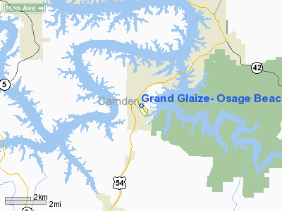
Grand Glaize-Osage Beach Airport |
Location & QuickFacts
| FAA Information Effective: | 2008-09-25 |
| Airport Identifier: | K15 |
| Airport Status: | Operational |
| Longitude/Latitude: | 092-40-49.9650W/38-06-37.6200N
-92.680546/38.110450 (Estimated) |
| Elevation: | 875 ft / 266.70 m (Surveyed) |
| Land: | 71 acres |
| From nearest city: | 1 nautical miles SW of Osage Beach, MO |
| Location: | Camden County, MO |
| Magnetic Variation: | 02E (2000) |
Owner & Manager
| Ownership: | Publicly owned |
| Owner: | Osage Beach |
| Address: | 1000 City Parkway
Osage Beach, MO 65065 |
| Phone number: | 573-302-2000 |
| Manager: | Phil Phillips |
| Address: | 1000 City Parkway
Osage Beach, MO 65065 |
| Phone number: | 573-302-2003 |
Airport Operations and Facilities
| Airport Use: | Open to public |
| Wind indicator: | Yes |
| Segmented Circle: | No |
| Control Tower: | No |
| Lighting Schedule: | DUSK-DAWN
ACTVT MIRL RY 14/32; PAPI RY 32 - CTAF. |
| Beacon Color: | Clear-Green (lighted land airport) |
| Landing fee charge: | No |
| Sectional chart: | Kansas City |
| Region: | ACE - Central |
| Boundary ARTCC: | ZKC - Kansas City |
| Tie-in FSS: | COU - Columbia |
| FSS on Airport: | No |
| FSS Toll Free: | 1-800-WX-BRIEF |
| NOTAMs Facility: | COU (NOTAM-d service avaliable) |
| Federal Agreements: | NGSY |
Airport Communications
| CTAF: | 122.800 |
| Unicom: | 122.800 |
Airport Services
| Fuel available: | 100LL |
| Bottled Oxygen: | NONE |
| Bulk Oxygen: | NONE |
Runway Information
Runway 14/32
| Dimension: | 3205 x 60 ft / 976.9 x 18.3 m |
| Surface: | ASPH, Good Condition |
| Surface Treatment: | Rubberized Friction Seal Coat |
| Weight Limit: | Single wheel: 15000 lbs. |
| Edge Lights: | Non-standard lighting system
INCORRECT SPACING OF THLD LGTS AT RY 32 END. |
| |
Runway 14 |
Runway 32 |
| Longitude: | 092-41-02.2630W | 092-40-37.7570W |
| Latitude: | 38-06-50.1480N | 38-06-25.0680N |
| Elevation: | 875.00 ft | 857.00 ft |
| Alignment: | 127 | 127 |
| Traffic Pattern: | Left | Left |
| Markings: | Basic, Good Condition | Non-precision instrument, Fair Condition |
| Crossing Height: | 0.00 ft | 46.00 ft |
| VASI: | | 4-light PAPI on left side |
| Visual Glide Angle: | 0.00° | 3.50° |
| Obstruction: | 55 ft trees, 218.0 ft from runway, 224 ft right of centerline
RWY 14 1- 47 FT TREES; 25-200 FT FM RY END 160-250 FT R; ACFT TIEDOWN AREA 0-200 FT FM RY END, 150-250 L. | 23 ft trees, 350.0 ft from runway, 140 ft right of centerline, 6:1 slope to clear
RWY 32, +26 FT TREE 130 FT FM RY END; 220 FT L. |
|
Radio Navigation Aids
| ID |
Type |
Name |
Ch |
Freq |
Var |
Dist |
| AIZ | NDB | Kaiser | | 377.00 | 05E | 6.1 nm |
| IEB | NDB | Lebanon | | 414.00 | 03E | 32.4 nm |
| BHN | NDB | Buckhorn | | 391.00 | 03E | 36.9 nm |
| ONH | NDB | Noah | | 515.00 | 03E | 37.7 nm |
| JE | NDB | Algoa | | 397.00 | 03E | 38.9 nm |
| DMO | NDB | Sedalia | | 281.00 | 03E | 42.7 nm |
| GLY | NDB | Golden Valley | | 388.00 | 04E | 49.7 nm |
| TBN | VOR | Forney | | 110.00 | 03E | 33.9 nm |
| SHY | VOR/DME | Sunshine | 021X | 108.40 | 05E | 5.6 nm |
| VIH | VOR/DME | Vichy | 124X | 117.70 | 06E | 46.1 nm |
| COU | VOR/DME | Columbia | 039X | 110.20 | 03E | 47.4 nm |
| JEF | VOT | Jefferson City | | 112.00 | | 38.2 nm |
Remarks
- DEER ON AND INVOF RY & TWYS DUSK AND AFT DARK.
- NTSD RY SAFETY AREA GRADING BEYOND EACH RY END; LARGE DROP OFFS & ROLLING TERRAIN.
Images and information placed above are from
http://www.airport-data.com/airport/K15/
We thank them for the data!
| General Info
|
| Country |
United States
|
| State |
MISSOURI
|
| FAA ID |
K15
|
| Latitude |
38-06-37.620N
|
| Longitude |
092-40-49.965W
|
| Elevation |
875 feet
|
| Near City |
OSAGE BEACH
|
We don't guarantee the information is fresh and accurate. The data may
be wrong or outdated.
For more up-to-date information please refer to other sources.
|
|


