 |
|
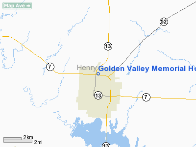
Golden Valley Memorial Hospital Heliport |
Location & QuickFacts
| FAA Information Effective: | 2008-09-25 |
| Airport Identifier: | 90MO |
| Airport Status: | Operational |
| Longitude/Latitude: | 093-46-04.7600W/38-23-21.0700N
-93.767989/38.389186 (Estimated) |
| Elevation: | 797 ft / 242.93 m (Estimated) |
| Land: | 0 acres |
| From nearest city: | 0 nautical miles N of Clinton, MO |
| Location: | Henry County, MO |
| Magnetic Variation: | 04E (1985) |
Owner & Manager
| Ownership: | Privately owned |
| Owner: | Golden Valley Meml Hospital |
| Address: | 1600 North Second
Clinton, MO 64735 |
| Phone number: | 816-885-5511 |
| Manager: | Randy S. Wertz; Admin. |
| Address: | 1600 North Second
Clinton, MO 64735 |
| Phone number: | 816-885-5511 |
Airport Operations and Facilities
| Airport Use: | Private
MEDICAL. |
| Wind indicator: | Yes |
| Segmented Circle: | No |
| Control Tower: | No |
| Lighting Schedule: | PHONE REQ
FOR HELIPAD PERIMETER LIGHTS CALL 816-885-5511. |
| Landing fee charge: | No |
| Sectional chart: | Kansas City |
| Region: | ACE - Central |
| Boundary ARTCC: | ZKC - Kansas City |
| Tie-in FSS: | COU - Columbia |
| FSS on Airport: | No |
| FSS Toll Free: | 1-800-WX-BRIEF |
Runway Information
Helipad H1
| Dimension: | 60 x 60 ft / 18.3 x 18.3 m |
| Surface: | CONC, Good Condition |
| |
Runway H1 |
Runway |
| Traffic Pattern: | Left | Left |
|
Radio Navigation Aids
| ID |
Type |
Name |
Ch |
Freq |
Var |
Dist |
| GLY | NDB | Golden Valley | | 388.00 | 04E | 4.3 nm |
| HCK | NDB | Hawks | | 296.00 | 04E | 17.1 nm |
| DMO | NDB | Sedalia | | 281.00 | 03E | 33.6 nm |
| EAD | NDB | Nevada | | 209.00 | 06E | 40.7 nm |
| LXT | NDB | Lesumit | | 263.00 | 04E | 44.5 nm |
| PUR | NDB | Marshall | | 371.00 | 03E | 47.5 nm |
| SZL | TACAN | Whiteman | 035X | | 04E | 23.2 nm |
| BUM | VORTAC | Butler | 106X | 115.90 | 07E | 34.7 nm |
| ANX | VORTAC | Napoleon | 087X | 114.00 | 07E | 45.7 nm |
Remarks
- CITY FIRE DEPARTMENT PROVIDES FIRE PROTECTION.
- CONDL: PROVIDED APPROACH/DEPARTURE PATHS ARE MAINTAINED FOR A MIN 8:1 GLIDE SLOPE; THE TRANSITIONAL SURFACE BE MAINTAINED FOR A MIN 2:1 SLOPE; INGRESS/EGRESS FROM NORTH IS PROHIBITED; REDUCE LGT STDS ON NE CORNER OF PARKING LOT BY HALF; PROVIDE WINDSOCK NEAR PAD.
Images and information placed above are from
http://www.airport-data.com/airport/90MO/
We thank them for the data!
| General Info
|
| Country |
United States
|
| State |
MISSOURI
|
| FAA ID |
90MO
|
| Latitude |
38-23-21.070N
|
| Longitude |
093-46-04.760W
|
| Elevation |
797 feet
|
| Near City |
CLINTON
|
We don't guarantee the information is fresh and accurate. The data may
be wrong or outdated.
For more up-to-date information please refer to other sources.
|
|


