 |
|
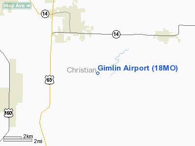
Location & QuickFacts
| FAA Information Effective: | 2008-09-25 |
| Airport Identifier: | 18MO |
| Airport Status: | Operational |
| Longitude/Latitude: | 093-10-14.6530W/36-57-45.1960N
-93.170737/36.962554 (Estimated) |
| Elevation: | 1380 ft / 420.62 m (Estimated) |
| Land: | 0 acres |
| From nearest city: | 4 nautical miles SE of Ozark, MO |
| Location: | Christian County, MO |
| Magnetic Variation: | 04E (1985) |
Owner & Manager
| Ownership: | Privately owned |
| Owner: | Jet Management, Inc. |
| Address: | 102 Aven
Nixa, MO 65714 |
| Phone number: | 417-725-2238
OR 417-485-3616. |
| Manager: | Terry Smith |
| Address: | 102 Aven
Nixa, MO 65714 |
| Phone number: | 417-485-3616 |
Airport Operations and Facilities
| Airport Use: | Private |
| Wind indicator: | Yes |
| Segmented Circle: | No |
| Control Tower: | No |
| Sectional chart: | Kansas City |
| Region: | ACE - Central |
| Boundary ARTCC: | ZKC - Kansas City |
| Tie-in FSS: | COU - Columbia |
| FSS on Airport: | No |
| FSS Toll Free: | 1-800-WX-BRIEF |
Runway Information
Runway 18/36
| Dimension: | 2600 x 60 ft / 792.5 x 18.3 m |
| Surface: | TURF, |
| |
Runway 18 |
Runway 36 |
| Traffic Pattern: | Left | Left |
| Obstruction: | 25 ft pole, 130.0 ft from runway | |
|
Radio Navigation Aids
| ID |
Type |
Name |
Ch |
Freq |
Var |
Dist |
| PLK | NDB | Point Lookout/dcmsnd | | 204.00 | 03E | 20.3 nm |
| AOV | NDB | Bilmart | | 341.00 | 02E | 23.7 nm |
| ILJ | NDB | Willard | | 254.00 | 03E | 24.0 nm |
| IEB | NDB | Lebanon | | 414.00 | 03E | 44.1 nm |
| HRO | VOR/DME | Harrison | 072X | 112.50 | 04E | 38.8 nm |
| DGD | VORTAC | Dogwood | 031X | 109.40 | 06E | 14.6 nm |
| SGF | VORTAC | Springfield | 116X | 116.90 | 04E | 24.9 nm |
Remarks
- PRVDD APCH TO EA RY MAINTAINED FOR A 20:1 GLIDE SLOPE AND TRANSITIONAL SFC FOR A 7:1 SLOPE.
Images and information placed above are from
http://www.airport-data.com/airport/18MO/
We thank them for the data!
| General Info
|
| Country |
United States
|
| State |
MISSOURI
|
| FAA ID |
18MO
|
| Latitude |
36-57-45.196N
|
| Longitude |
093-10-14.653W
|
| Elevation |
1380 feet
|
| Near City |
OZARK
|
We don't guarantee the information is fresh and accurate. The data may
be wrong or outdated.
For more up-to-date information please refer to other sources.
|
|


