 |
|
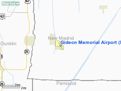
Location & QuickFacts
| FAA Information Effective: | 2008-09-25 |
| Airport Identifier: | M85 |
| Airport Status: | Operational |
| Longitude/Latitude: | 089-54-13.8180W/36-26-37.5210N
-89.903838/36.443756 (Estimated) |
| Elevation: | 268 ft / 81.69 m (Surveyed) |
| Land: | 627 acres |
| From nearest city: | 1 nautical miles SE of Gideon, MO |
| Location: | New Madrid County, MO |
| Magnetic Variation: | 03E (1980) |
Owner & Manager
| Ownership: | Publicly owned |
| Owner: | City Of Gideon |
| Address: | 109 Main St, Po Box 396
Gideon, MO 63848 |
| Phone number: | 573-448-3500 |
| Manager: | Louise Shock
MAYOR |
| Address: | 109 Main St., Po Box 396
Gideon, MO 63848 |
| Phone number: | 573-448-3707 |
Airport Operations and Facilities
| Airport Use: | Open to public |
| Wind indicator: | Yes |
| Segmented Circle: | Yes |
| Control Tower: | No |
| Landing fee charge: | No |
| Sectional chart: | St Louis |
| Region: | ACE - Central |
| Boundary ARTCC: | ZME - Memphis |
| Tie-in FSS: | STL - Saint Louis |
| FSS on Airport: | No |
| FSS Toll Free: | 1-800-WX-BRIEF |
| NOTAMs Facility: | STL (NOTAM-d service avaliable) |
| Federal Agreements: | P1 |
Airport Communications
Airport Services
Runway Information
Runway 15/33
| Dimension: | 4504 x 58 ft / 1372.8 x 17.7 m
WIDTH VARIES FM 58-60 FT. |
| Surface: | ASPH, Poor Condition
HAS AREAS OF UNEVEN ASPH WHERE RY IS ROLLING & UNEVEN, LOOSE AGGREGATE, AND GRASS GROWING IN CRACKS. |
| |
Runway 15 |
Runway 33 |
| Longitude: | 089-54-27.5690W | 089-54-00.0040W |
| Latitude: | 36-26-56.7720N | 36-26-18.2090N |
| Elevation: | 267.00 ft | 269.00 ft |
| Alignment: | 127 | 127 |
| Traffic Pattern: | Left | Left |
| Markings: | Nonstandard, Poor Condition
MARKINGS FADED. | Nonstandard, Poor Condition
MARKINGS FADED. |
| Obstruction: | 32 ft pole, 765.0 ft from runway, 245 ft right of centerline, 17:1 slope to clear
RWY 15 +1-4 FT CROPS AND BRUSH, 0-200 FT FM RWY END, L & R. | 13 ft road, 330.0 ft from runway, 255 ft left of centerline, 10:1 slope to clear
RWY 33 +1-4 FT CROPS, 0-200 FT FM RWY END, L & R. |
|
Radio Navigation Aids
| ID |
Type |
Name |
Ch |
Freq |
Var |
Dist |
| TKX | NDB | Kennett | | 358.00 | 00E | 14.5 nm |
| DXE | NDB | Dexter | | 423.00 | 00E | 20.8 nm |
| FD | NDB | Earli | | 278.00 | 03E | 24.6 nm |
| IUI | NDB | Hicks | | 350.00 | 01E | 30.6 nm |
| MXA | NDB | Manila | | 282.00 | 01E | 35.4 nm |
| CHQ | NDB | Charleston | | 208.00 | 01E | 35.7 nm |
| DNT | NDB | Nally Dunston | | 343.00 | 01W | 36.2 nm |
| PGR | NDB | Paragould | | 383.00 | 01E | 37.3 nm |
| UC | NDB | Obion | | 212.00 | 00E | 44.9 nm |
| BPW | NDB | Osceola | | 239.00 | 02E | 45.5 nm |
| CIR | NDB | Cairo | | 397.00 | 00E | 49.5 nm |
| GOJ | VOR | Gosnell | | 111.80 | 01E | 29.7 nm |
| JBR | VOR/DME | Jonesboro | 023X | 108.60 | 02E | 47.7 nm |
| CGI | VOR/DME | Cape Girardeau | 076X | 112.90 | 01E | 49.7 nm |
| MAW | VORTAC | Malden | 049X | 111.20 | 03E | 6.7 nm |
| DYR | VORTAC | Dyersburg | 115X | 116.80 | 03E | 38.2 nm |
Remarks
- N TWY TO RY 15 THLD CLSD; S TWY N OF RY 33 THLD CLSD.
- CROP DUSTING & ULTRALIGHT ACFT ON & INVOF ARPT.
- RY N/S CLSD; USED FOR FLYING OF MODEL PLANES.
- HAZARDOUS PAVEMENT CONDITIONS EXIST AT THIS AIRPORT AND FARMING OPERATIONS ARE VERY CLOSE TO PAVEMENT EDGES. EXERCISE CAUTION WHEN USING THIS FACILITY.
- ESTABD PRIOR TO OCT 1959.
Images and information placed above are from
http://www.airport-data.com/airport/M85/
We thank them for the data!
| General Info
|
| Country |
United States
|
| State |
MISSOURI
|
| FAA ID |
M85
|
| Latitude |
36-26-37.521N
|
| Longitude |
089-54-13.818W
|
| Elevation |
268 feet
|
| Near City |
GIDEON
|
We don't guarantee the information is fresh and accurate. The data may
be wrong or outdated.
For more up-to-date information please refer to other sources.
|
|


