 |
|
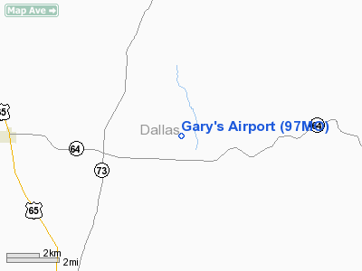
Location & QuickFacts
| FAA Information Effective: | 2008-09-25 |
| Airport Identifier: | 97MO |
| Airport Status: | Operational |
| Longitude/Latitude: | 093-00-58.6720W/37-45-24.1370N
-93.016298/37.756705 (Estimated) |
| Elevation: | 1200 ft / 365.76 m (Estimated) |
| Land: | 25 acres |
| From nearest city: | 7 nautical miles NE of Buffalo, MO |
| Location: | Dallas County, MO |
| Magnetic Variation: | 04E (1985) |
Owner & Manager
| Ownership: | Privately owned |
| Owner: | Gary Routh |
| Address: | Rt 1 Box 150
Tunas, MO 65764 |
| Phone number: | 417-752-3659 |
| Manager: | Gary Routh |
| Address: | Rt 1 Box 150
Tunas, MO 65764 |
| Phone number: | 417-752-3659 |
Airport Operations and Facilities
| Airport Use: | Private |
| Wind indicator: | Yes |
| Segmented Circle: | No |
| Control Tower: | No |
| Landing fee charge: | No |
| Sectional chart: | Kansas City |
| Region: | ACE - Central |
| Boundary ARTCC: | ZKC - Kansas City |
| Tie-in FSS: | COU - Columbia |
| FSS on Airport: | No |
| FSS Toll Free: | 1-800-WX-BRIEF |
Runway Information
Runway 18/36
| Dimension: | 2650 x 100 ft / 807.7 x 30.5 m |
| Surface: | TURF, |
| |
Runway 18 |
Runway 36 |
| Traffic Pattern: | Left | Left |
| Displaced threshold: | 0.00 ft | 150.00 ft |
| Obstruction: | 4 ft fence | 50 ft trees |
|
Radio Navigation Aids
| ID |
Type |
Name |
Ch |
Freq |
Var |
Dist |
| IEB | NDB | Lebanon | | 414.00 | 03E | 20.4 nm |
| AIZ | NDB | Kaiser | | 377.00 | 05E | 30.0 nm |
| ILJ | NDB | Willard | | 254.00 | 03E | 34.1 nm |
| BHN | NDB | Buckhorn | | 391.00 | 03E | 43.5 nm |
| GLY | NDB | Golden Valley | | 388.00 | 04E | 48.1 nm |
| AOV | NDB | Bilmart | | 341.00 | 02E | 50.0 nm |
| TBN | VOR | Forney | | 110.00 | 03E | 41.7 nm |
| SHY | VOR/DME | Sunshine | 021X | 108.40 | 05E | 26.0 nm |
| SGF | VORTAC | Springfield | 116X | 116.90 | 04E | 28.5 nm |
| DGD | VORTAC | Dogwood | 031X | 109.40 | 06E | 44.6 nm |
Remarks
- 30' PLINES BORDERING EAST SIDE.
- PROVIDED APPROACHES ARE MAINTAINED FOR A 20:1 GLIDE SLOPE AND TRANSITIONAL SURFACE FOR A 7:1.
Images and information placed above are from
http://www.airport-data.com/airport/97MO/
We thank them for the data!
| General Info
|
| Country |
United States
|
| State |
MISSOURI
|
| FAA ID |
97MO
|
| Latitude |
37-45-24.137N
|
| Longitude |
093-00-58.672W
|
| Elevation |
1200 feet
|
| Near City |
BUFFALO
|
We don't guarantee the information is fresh and accurate. The data may
be wrong or outdated.
For more up-to-date information please refer to other sources.
|
|


