 |
|
Location & QuickFacts
| FAA Information Effective: | 2008-09-25 |
| Airport Identifier: | MO17 |
| Airport Status: | Operational |
| Longitude/Latitude: | 095-38-45.9650W/40-28-45.0070N
-95.646101/40.479169 (Estimated) |
| Elevation: | 905 ft / 275.84 m (Surveyed) |
| Land: | 0 acres |
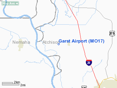
| From nearest city: | 1 nautical miles W of Watson, MO |
| Location: | Atchison County, MO |
| Magnetic Variation: | 06E (1985) |
Owner & Manager
| Ownership: | Privately owned |
| Owner: | Charles L. Garst |
| Address: | 11326 St Hwy A
Watson, MO 64496 |
| Phone number: | 816-993-2350 |
| Manager: | Charles L. Garst |
| Address: | 11326 St Hwy A
Watson, MO 64496 |
| Phone number: | 816-993-2350 |
Airport Operations and Facilities
| Airport Use: | Private |
| Wind indicator: | Yes |
| Segmented Circle: | No |
| Control Tower: | No |
| Landing fee charge: | No |
| Sectional chart: | Omaha |
| Region: | ACE - Central |
| Boundary ARTCC: | ZMP - Minneapolis |
| Tie-in FSS: | COU - Columbia |
| FSS on Airport: | No |
| FSS Toll Free: | 1-800-WX-BRIEF |
Airport Services
| Airframe Repair: | NONE |
| Power Plant Repair: | NONE |
Runway Information
Runway 18/36
| Dimension: | 2150 x 25 ft / 655.3 x 7.6 m |
| Surface: | TURF, |
| |
Runway 18 |
Runway 36 |
| Traffic Pattern: | Left | Left |
| Obstruction: | 3 ft fence | , 50:1 slope to clear |
|
Radio Navigation Aids
| ID |
Type |
Name |
Ch |
Freq |
Var |
Dist |
| AYB | NDB | Auburn | | 430.00 | 05E | 7.7 nm |
| AFK | NDB | Nebraska City | | 347.00 | 05E | 12.4 nm |
| SDA | NDB | Shenandoah | | 411.00 | 05E | 19.7 nm |
| FNB | NDB | Brenner | | 404.00 | 05E | 24.4 nm |
| PMV | NDB | Plattsmouth | | 329.00 | 06E | 30.5 nm |
| ICL | NDB | Clarinda | | 353.00 | 04E | 31.9 nm |
| EVU | NDB | Emville | | 317.00 | 05E | 34.3 nm |
| RDK | NDB | Red Oak | | 230.00 | 04E | 36.9 nm |
| MLE | NDB | Millard | | 371.00 | 06E | 48.0 nm |
| AZN | NDB | Amazon | | 233.00 | 06E | 49.3 nm |
| OFF | TACAN | Offutt | 054X | | 05E | 40.1 nm |
| RBA | VOR/DME | Robinson | 019X | 108.20 | 04E | 39.1 nm |
| PWE | VORTAC | Pawnee City | 071X | 112.40 | 05E | 30.7 nm |
| OVR | VORTAC | Omaha | 110X | 116.30 | 08E | 41.6 nm |
| STJ | VORTAC | St Joseph | 102X | 115.50 | 08E | 45.5 nm |
Remarks
- PRVDD APCH TO EACH RWY IS MAINTD FOR A MIN 20:1 GLIDE SLOPE AND THE TRANSNL SFC BE MAINTD FOR A 7:1 SLOPE.
Images and information placed above are from
http://www.airport-data.com/airport/MO17/
We thank them for the data!
| General Info
|
| Country |
United States
|
| State |
MISSOURI
|
| FAA ID |
MO17
|
| Latitude |
40-28-45.007N
|
| Longitude |
095-38-45.965W
|
| Elevation |
905 feet
|
| Near City |
WATSON
|
We don't guarantee the information is fresh and accurate. The data may
be wrong or outdated.
For more up-to-date information please refer to other sources.
|
|


