 |
|
| Gardner Airport |
| IATA: none – ICAO: none – FAA LID: 39MO |
| Summary |
| Airport type |
Private |
| Owner/Operator |
Roscoe W. Gardner |
| Location |
Springfield, Missouri |
| Elevation AMSL |
1,325 ft / 404 m |
| Coordinates |
37°07′07″N 093°12′18″W / 37.11861°N 93.205°W / 37.11861; -93.205 |
| Runways |
| Direction |
Length |
Surface |
| ft |
m |
| 1/19 |
1,190 |
363 |
Turf |
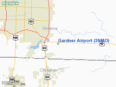
Gardner Airport (FAA LID: 39MO) is a privately owned airport located 8 miles southeast of Springfield, Missouri, United States.
The above content comes from Wikipedia and is published under free licenses – click here to read more.
Location & QuickFacts
| FAA Information Effective: | 2008-09-25 |
| Airport Identifier: | 39MO |
| Airport Status: | Operational |
| Longitude/Latitude: | 093-12-17.6610W/37-07-07.1810N
-93.204906/37.118661 (Estimated) |
| Elevation: | 1325 ft / 403.86 m (Estimated) |
| Land: | 0 acres |
| From nearest city: | 8 nautical miles SE of Springfield, MO |
| Location: | Greene County, MO |
| Magnetic Variation: | 04E (1990) |
Owner & Manager
| Ownership: | Privately owned |
| Owner: | Roscoe W. Gardner |
| Address: | Route 2
Rogersville, MO 65742 |
| Phone number: | 417-887-1376 |
| Manager: | Roscoe W. Gardner |
| Address: | Route 2
Rogersville, MO 65742 |
| Phone number: | 417-887-1376 |
Airport Operations and Facilities
| Airport Use: | Private |
| Wind indicator: | Yes |
| Segmented Circle: | No |
| Control Tower: | No |
| Sectional chart: | Kansas City |
| Region: | ACE - Central |
| Boundary ARTCC: | ZKC - Kansas City |
| Tie-in FSS: | COU - Columbia |
| FSS on Airport: | No |
| FSS Toll Free: | 1-800-WX-BRIEF |
Runway Information
Runway 01/19
| Dimension: | 1190 x 40 ft / 362.7 x 12.2 m |
| Surface: | TURF, |
| |
Runway 01 |
Runway 19 |
| Traffic Pattern: | Left | Left |
| Obstruction: | 25 ft pline, 425.0 ft from runway | 4 ft fence, 10.0 ft from runway |
|
Runway 15/33
| Dimension: | 1190 x 40 ft / 362.7 x 12.2 m |
| Surface: | TURF, |
| |
Runway 15 |
Runway 33 |
| Traffic Pattern: | Left | Left |
| Obstruction: | 25 ft pline, 425.0 ft from runway | 74 ft pline, 85.0 ft from runway |
|
Radio Navigation Aids
| ID |
Type |
Name |
Ch |
Freq |
Var |
Dist |
| ILJ | NDB | Willard | | 254.00 | 03E | 15.7 nm |
| AOV | NDB | Bilmart | | 341.00 | 02E | 26.8 nm |
| PLK | NDB | Point Lookout/dcmsnd | | 204.00 | 03E | 29.5 nm |
| IEB | NDB | Lebanon | | 414.00 | 03E | 37.7 nm |
| HRO | VOR/DME | Harrison | 072X | 112.50 | 04E | 48.1 nm |
| SGF | VORTAC | Springfield | 116X | 116.90 | 04E | 15.5 nm |
| DGD | VORTAC | Dogwood | 031X | 109.40 | 06E | 16.7 nm |
Remarks
- PRVDD APCH TO EACH RY IS 20:1 GLIDE SLOPE & TRANSITIONAL SURFACE IS A 7:1 SLOPE.
Images and information placed above are from
http://www.airport-data.com/airport/39MO/
We thank them for the data!
| General Info
|
| Country |
United States
|
| State |
MISSOURI
|
| FAA ID |
39MO
|
| Latitude |
37-07-07.181N
|
| Longitude |
093-12-17.661W
|
| Elevation |
1325 feet
|
| Near City |
SPRINGFIELD
|
We don't guarantee the information is fresh and accurate. The data may
be wrong or outdated.
For more up-to-date information please refer to other sources.
|
|


