 |
|
Location & QuickFacts
| FAA Information Effective: | 2008-09-25 |
| Airport Identifier: | MU94 |
| Airport Status: | Operational |
| Longitude/Latitude: | 093-21-43.7150W/37-53-37.1210N
-93.362143/37.893645 (Estimated) |
| Elevation: | 968 ft / 295.05 m (Estimated) |
| Land: | 0 acres |
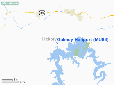
| From nearest city: | 7 nautical miles S of Galmey, MO |
| Location: | Hickory County, MO |
| Magnetic Variation: | 04E (1990) |
Owner & Manager
| Ownership: | Publicly owned |
| Owner: | Galmey Fire Department |
| Address: | Route 2 Box 119
Wheatland, MO 65779 |
| Phone number: | 417-282-6700 |
| Manager: | Howard L Swopes, Fire Chief |
| Address: | Route 2 Box 99
Wheatland, MO 65779 |
| Phone number: | 417-282-5363 |
Airport Operations and Facilities
| Airport Use: | Private
MEDICAL USE. |
| Wind indicator: | Yes |
| Segmented Circle: | No |
| Control Tower: | No |
| Lighting Schedule: | PHONE REQ
FOR PERIMETER LGTS CALL 417-282-5363. |
| Sectional chart: | Kansas City |
| Region: | ACE - Central |
| Boundary ARTCC: | ZKC - Kansas City |
| Tie-in FSS: | COU - Columbia |
| FSS Toll Free: | 1-800-WX-BRIEF |
Runway Information
Helipad H1
| Dimension: | 40 x 40 ft / 12.2 x 12.2 m |
| Surface: | CONC, |
| |
Runway H1 |
Runway |
| Traffic Pattern: | Left | Left |
|
Radio Navigation Aids
| ID |
Type |
Name |
Ch |
Freq |
Var |
Dist |
| GLY | NDB | Golden Valley | | 388.00 | 04E | 31.8 nm |
| ILJ | NDB | Willard | | 254.00 | 03E | 35.9 nm |
| IEB | NDB | Lebanon | | 414.00 | 03E | 38.7 nm |
| AIZ | NDB | Kaiser | | 377.00 | 05E | 40.2 nm |
| EAD | NDB | Nevada | | 209.00 | 06E | 44.7 nm |
| HCK | NDB | Hawks | | 296.00 | 04E | 45.3 nm |
| DMO | NDB | Sedalia | | 281.00 | 03E | 49.5 nm |
| SHY | VOR/DME | Sunshine | 021X | 108.40 | 05E | 37.1 nm |
| SGF | VORTAC | Springfield | 116X | 116.90 | 04E | 32.3 nm |
Remarks
- OWNER DESIRES HELIPAD NOT BE CHARTED.
- PRVDD CLEAR APCH/SEP PATHS FO RAN 8:1 GLIDE SLOPE; CLEAR TRANSITIONAL SURFACE FOR A 2:1 GLIDE SLOPE.
Images and information placed above are from
http://www.airport-data.com/airport/MU94/
We thank them for the data!
| General Info
|
| Country |
United States
|
| State |
MISSOURI
|
| FAA ID |
MU94
|
| Latitude |
37-53-37.121N
|
| Longitude |
093-21-43.715W
|
| Elevation |
968 feet
|
| Near City |
GALMEY
|
We don't guarantee the information is fresh and accurate. The data may
be wrong or outdated.
For more up-to-date information please refer to other sources.
|
|


