 |
|
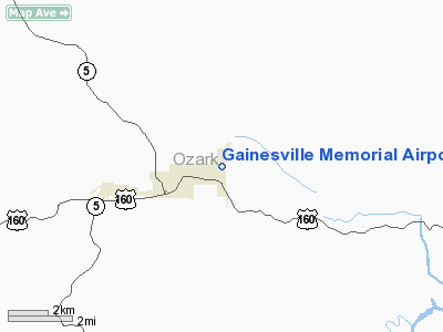
Gainesville Memorial Airport |
Location & QuickFacts
| FAA Information Effective: | 2008-09-25 |
| Airport Identifier: | H27 |
| Airport Status: | Operational |
| Longitude/Latitude: | 092-23-59.5790W/36-36-45.2250N
-92.399883/36.612563 (Estimated) |
| Elevation: | 1070 ft / 326.14 m (Estimated) |
| Land: | 30 acres |
| From nearest city: | 2 nautical miles NE of Gainesville, MO |
| Location: | Ozark County, MO |
| Magnetic Variation: | 04E (1985) |
Owner & Manager
| Ownership: | Publicly owned |
| Owner: | City Of Gainesville |
| Address: | 4th & Harlin Box 355
Gainesville, MO 65655 |
| Phone number: | 417-679-4858 |
| Manager: | Jerry Luna |
| Address: | Hcr 3 Box 847
Gainesville, MO 65655 |
| Phone number: | 417-679-2967 |
Airport Operations and Facilities
| Airport Use: | Open to public |
| Wind indicator: | Yes |
| Segmented Circle: | No |
| Control Tower: | No |
| Lighting Schedule: | DUSK-DAWN
ACTVT LIRL RY 01/19 - CTAF. |
| Beacon Color: | Clear-Green (lighted land airport)
ROTG BCN LCTD 3700 FT SW OF RY 34 THLD. |
| Landing fee charge: | No |
| Sectional chart: | Kansas City |
| Region: | ACE - Central |
| Boundary ARTCC: | ZME - Memphis |
| Tie-in FSS: | COU - Columbia |
| FSS on Airport: | No |
| FSS Toll Free: | 1-800-WX-BRIEF |
| NOTAMs Facility: | COU (NOTAM-d service avaliable) |
Airport Communications
Airport Services
Runway Information
Runway 01/19
| Dimension: | 1895 x 100 ft / 577.6 x 30.5 m |
| Surface: | TURF, Fair Condition |
| Edge Lights: | Low
BOUNDARY LGTS. |
| |
Runway 01 |
Runway 19 |
| Traffic Pattern: | Left | Left |
| Displaced threshold: | 640.00 ft | 400.00 ft |
| Obstruction: | 45 ft trees, 250.0 ft from runway, 105 ft right of centerline, 5:1 slope to clear
21:1 TO DSPLCD THLD; 1-45 FT BRUSH & TREES 0-285 FT 85-150 FT R; 0:1 BASED ON DSPLCD THLD; +55 FT TREE 710 FT 180 FT L ; 13:1 BASED ON DSPLCD THLD. | 62 ft trees, 282.0 ft from runway, 188 ft right of centerline, 4:1 slope to clear
RY 19 APCH SLOPE 11:1 TO DSPLCD THLD; 60 FT TREES 710 FT 165 FT R; 11:1 BASED ON DSPLCD THLD; 1-10 FT BRUSH 0-125 FT 110-125 FT L; 0:1 BASED ON DSPLCD THLD. |
|
Runway 16/34
| Dimension: | 1645 x 60 ft / 501.4 x 18.3 m |
| Surface: | TURF, Fair Condition |
| |
Runway 16 |
Runway 34 |
| Traffic Pattern: | Left | Left |
| Displaced threshold: | 945.00 ft | 400.00 ft |
| Obstruction: | 45 ft trees, 100.0 ft from runway, 50 ft right of centerline, 2:1 slope to clear
RWY 16 APCH SLOPE 23:1 TO DSPLCD THLD; 1-65 FT BRUSH, TREES, & MOBILE HOME TRAILER 0-250 FT, 50-165 FT L, 0:1 TO DSPLCD THLD; +47-65 FT TREES 700-1500 FT, 100-245 FT R, 0-245 FT L; 0:1 BASED ON DSPLCD THLD. | 45 ft trees, 271.0 ft from runway, 60 ft left of centerline, 6:1 slope to clear
RY 34 APCH SLOPE 14:1 TO DSPLCD THLD; 1-43 FT BRUSH, TREES & BLGDS 0-300 FT 80-140 FT R 0:1 BASED ON DSPLCD THLD. |
|
Radio Navigation Aids
| ID |
Type |
Name |
Ch |
Freq |
Var |
Dist |
| AOV | NDB | Bilmart | | 341.00 | 02E | 25.3 nm |
| UNO | NDB | Pomona | | 335.00 | 02E | 28.8 nm |
| PLK | NDB | Point Lookout/dcmsnd | | 204.00 | 03E | 40.1 nm |
| MNF | NDB | Mountain View | | 365.00 | 03E | 40.2 nm |
| AJX | NDB | Ash Flat | | 344.00 | 03E | 46.3 nm |
| VLX | NDB | Wilcox | | 348.00 | 02E | 47.2 nm |
| FLP | VOR/DME | Flippin | 075X | 112.80 | 03E | 19.0 nm |
| HUW | VOR/DME | Hutton | 053X | 111.60 | 02E | 28.7 nm |
| HRO | VOR/DME | Harrison | 072X | 112.50 | 04E | 43.1 nm |
| DGD | VORTAC | Dogwood | 031X | 109.40 | 06E | 33.7 nm |
Remarks
- ULTRALIGHT & CROP DUSTING ACFT ON & INVOF ARPT.
- ALL RYS HAVE BRUSH, TREES, ROADS, BLDGS, UTILITY POLES & LINES & MANY OTHER OBJECTS IN APCH AREAS AND RY SAFETY AREAS. VERY SHORT ROLL OUT DSTCS FM DSPLCD THLDS TO RY ENDS. MOBILE HOME TRAILERS AND +4' METAL FENCE POSTS ALONG EAST RWY EDGE FOR THE FIRST HALF OF RY 16/34.
- PRIOR TO 1959.
Images and information placed above are from
http://www.airport-data.com/airport/H27/
We thank them for the data!
| General Info
|
| Country |
United States
|
| State |
MISSOURI
|
| FAA ID |
H27
|
| Latitude |
36-36-45.225N
|
| Longitude |
092-23-59.579W
|
| Elevation |
1070 feet
|
| Near City |
GAINESVILLE
|
We don't guarantee the information is fresh and accurate. The data may
be wrong or outdated.
For more up-to-date information please refer to other sources.
|
|


