 |
|
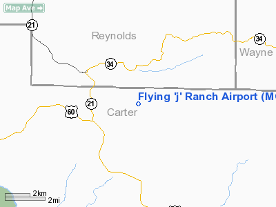
Location & QuickFacts
| FAA Information Effective: | 2008-09-25 |
| Airport Identifier: | MO72 |
| Airport Status: | Operational |
| Longitude/Latitude: | 090-52-00.4440W/37-02-25.1810N
-90.866790/37.040328 (Estimated) |
| Elevation: | 690 ft / 210.31 m (Estimated) |
| Land: | 0 acres |
| From nearest city: | 9 nautical miles NE of Van Buren, MO |
| Location: | Carter County, MO |
| Magnetic Variation: | 03E (1985) |
Owner & Manager
| Ownership: | Privately owned |
| Owner: | John J. Cournoyer |
| Address: | Rt 1, Box 251
Ellsinore, MO 63937 |
| Phone number: | 573-739-3800 |
| Manager: | Pappy Cournoyer |
| Address: | Rte 1 Box 244
Ellsinore, MO 63937 |
| Phone number: | 573-739-3800 |
Airport Operations and Facilities
| Airport Use: | Private |
| Wind indicator: | Yes |
| Segmented Circle: | No |
| Control Tower: | No |
| Landing fee charge: | No |
| Sectional chart: | Kansas City |
| Region: | ACE - Central |
| Boundary ARTCC: | ZME - Memphis |
| Tie-in FSS: | STL - Saint Louis |
| FSS on Airport: | No |
| FSS Toll Free: | 1-800-WX-BRIEF |
Airport Communications
Runway Information
Runway 08/26
| Dimension: | 1900 x 100 ft / 579.1 x 30.5 m |
| Surface: | TURF, |
| |
Runway 08 |
Runway 26 |
| Traffic Pattern: | Left | Left |
|
Radio Navigation Aids
| ID |
Type |
Name |
Ch |
Freq |
Var |
Dist |
| FD | NDB | Earli | | 278.00 | 03E | 34.2 nm |
| MNF | NDB | Mountain View | | 365.00 | 03E | 40.7 nm |
| DXE | NDB | Dexter | | 423.00 | 00E | 47.0 nm |
| PRI | NDB | Perrine | | 367.00 | 02E | 48.3 nm |
| FAM | VORTAC | Farmington | 104X | 115.70 | 01E | 48.6 nm |
Images and information placed above are from
http://www.airport-data.com/airport/MO72/
We thank them for the data!
| General Info
|
| Country |
United States
|
| State |
MISSOURI
|
| FAA ID |
MO72
|
| Latitude |
37-02-25.181N
|
| Longitude |
090-52-00.444W
|
| Elevation |
690 feet
|
| Near City |
VAN BUREN
|
We don't guarantee the information is fresh and accurate. The data may
be wrong or outdated.
For more up-to-date information please refer to other sources.
|
|


