 |
|
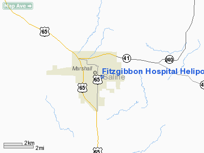
Fitzgibbon Hospital Heliport |
Location & QuickFacts
| FAA Information Effective: | 2008-09-25 |
| Airport Identifier: | 9MO2 |
| Airport Status: | Operational |
| Longitude/Latitude: | 093-11-20.7320W/39-06-45.0790N
-93.189092/39.112522 (Estimated) |
| Elevation: | 744 ft / 226.77 m (Estimated) |
| Land: | 0 acres |
| From nearest city: | 1 nautical miles SW of Marshall, MO |
| Location: | Saline County, MO |
| Magnetic Variation: | 04E (1985) |
Owner & Manager
| Ownership: | Privately owned |
| Owner: | Fitzgibbon Hospital |
| Address: | 2305 S 65 Highway
Marshall, MO 65340-0250 |
| Phone number: | 816-886-7431 |
| Manager: | Ronald A Ott, Ceo |
| Address: | 2305 S 65 Highway
Marshall, MO 65340-0250 |
| Phone number: | 816-886-7431 |
Airport Operations and Facilities
| Airport Use: | Private
MEDICAL USE. |
| Wind indicator: | Yes |
| Segmented Circle: | No |
| Control Tower: | No |
| Lighting Schedule: | DUSK-DAWN |
| Sectional chart: | Kansas City |
| Region: | ACE - Central |
| Boundary ARTCC: | ZKC - Kansas City |
| Tie-in FSS: | COU - Columbia |
| FSS on Airport: | No |
| FSS Toll Free: | 1-800-WX-BRIEF |
Runway Information
Helipad H1
| Dimension: | 30 x 30 ft / 9.1 x 9.1 m |
| Surface: | CONC, |
| |
Runway H1 |
Runway |
| Traffic Pattern: | Left | Left |
|
Radio Navigation Aids
| ID |
Type |
Name |
Ch |
Freq |
Var |
Dist |
| PUR | NDB | Marshall | | 371.00 | 03E | 4.3 nm |
| DMO | NDB | Sedalia | | 281.00 | 03E | 24.5 nm |
| VER | NDB | Viertel | | 347.00 | 02E | 25.5 nm |
| HCK | NDB | Hawks | | 296.00 | 04E | 34.2 nm |
| BZK | NDB | Brookfield | | 383.00 | 03E | 39.3 nm |
| CHT | NDB | Chillicothe | | 375.00 | 03E | 42.4 nm |
| SZL | TACAN | Whiteman | 035X | | 04E | 28.3 nm |
| BQS | VOR/DME | Braymer | 049X | 111.20 | 03E | 44.6 nm |
| MCM | VOR/DME | Macon | 076X | 112.90 | 06E | 46.2 nm |
| COU | VOR/DME | Columbia | 039X | 110.20 | 03E | 48.9 nm |
| ANX | VORTAC | Napoleon | 087X | 114.00 | 07E | 43.8 nm |
| HLV | VORTAC | Hallsville | 089X | 114.20 | 06E | 49.5 nm |
Remarks
- OWNER DESIRES HELIPORT NOT BE CHARTED.
- PRVDD APCH/DEP HAS A MIN 8:1 GUIDE SLOPE, CLEAR TRANSITIONAL SFC FOR 2:1 SLOPE.
Images and information placed above are from
http://www.airport-data.com/airport/9MO2/
We thank them for the data!
| General Info
|
| Country |
United States
|
| State |
MISSOURI
|
| FAA ID |
9MO2
|
| Latitude |
39-06-45.079N
|
| Longitude |
093-11-20.732W
|
| Elevation |
744 feet
|
| Near City |
MARSHALL
|
We don't guarantee the information is fresh and accurate. The data may
be wrong or outdated.
For more up-to-date information please refer to other sources.
|
|


