 |
|
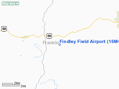
Location & QuickFacts
| FAA Information Effective: | 2008-09-25 |
| Airport Identifier: | 16MO |
| Airport Status: | Operational |
| Longitude/Latitude: | 091-09-26.5300W/38-24-20.1820N
-91.157369/38.405606 (Estimated) |
| Elevation: | 755 ft / 230.12 m (Estimated) |
| Land: | 0 acres |
| From nearest city: | 2 nautical miles SE of Beaufort, MO |
| Location: | Franklin County, MO |
| Magnetic Variation: | 03E (1985) |
Owner & Manager
| Ownership: | Privately owned |
| Owner: | William E Findley |
| Address: | 847 Laurel Lane
Beaufort, MO 63013 |
| Phone number: | 573-484-3776 |
| Manager: | William E Findley |
| Address: | 847 Laurel Lane
Beaufort, MO 63013 |
| Phone number: | 573-484-3776 |
Airport Operations and Facilities
| Airport Use: | Private |
| Wind indicator: | Yes |
| Segmented Circle: | No |
| Control Tower: | No |
| Lighting Schedule: | RDO-CTL
ACTVT LIRL RY 04/22 - UNICOM. |
| Landing fee charge: | No |
| Sectional chart: | Kansas City |
| Region: | ACE - Central |
| Boundary ARTCC: | ZKC - Kansas City |
| Tie-in FSS: | STL - Saint Louis |
| FSS on Airport: | No |
| FSS Toll Free: | 1-800-WX-BRIEF |
Airport Communications
Runway Information
Runway 04/22
| Dimension: | 1900 x 60 ft / 579.1 x 18.3 m |
| Surface: | TURF, |
| Edge Lights: | Low |
| |
Runway 04 |
Runway 22 |
| Traffic Pattern: | Left | Left |
| Obstruction: | , 50.0 ft from runway | 50 ft trees, 150.0 ft from runway |
|
Radio Navigation Aids
| ID |
Type |
Name |
Ch |
Freq |
Var |
Dist |
| UUV | NDB | Sullivan | | 356.00 | 02E | 10.2 nm |
| UBX | NDB | Cuba | | 380.00 | 01E | 24.1 nm |
| FES | NDB | Festus | | 269.00 | 01E | 38.4 nm |
| LM | NDB | Oblio | | 338.00 | 00E | 39.9 nm |
| JE | NDB | Algoa | | 397.00 | 03E | 43.9 nm |
| FTT | NDB | Guthrie | | 317.00 | 03E | 47.7 nm |
| VIH | VOR/DME | Vichy | 124X | 117.70 | 06E | 30.0 nm |
| CSX | VOR/DME | Cardinal | 111Y | 116.45 | 00E | 42.8 nm |
| FTZ | VORTAC | Foristell | 045X | 110.80 | 05E | 19.4 nm |
| STL | VORTAC | St Louis | 121X | 117.40 | 01E | 41.9 nm |
| SUS | VOT | Spirit Of St Louis | | 112.20 | | 28.3 nm |
| STL | VOT | St Louis Lambert | | 111.00 | | 42.7 nm |
| JEF | VOT | Jefferson City | | 112.00 | | 47.9 nm |
Remarks
- (42) TRAFFIC CONES
- PRVDD EACH APCH IS MAINT FOR MIN 20:1 GLIDE SLOPE &TRSNL SFC MAINT FOR 7:1 SLOPE.
Images and information placed above are from
http://www.airport-data.com/airport/16MO/
We thank them for the data!
| General Info
|
| Country |
United States
|
| State |
MISSOURI
|
| FAA ID |
16MO
|
| Latitude |
38-24-20.182N
|
| Longitude |
091-09-26.530W
|
| Elevation |
755 feet
|
| Near City |
BEAUFORT
|
We don't guarantee the information is fresh and accurate. The data may
be wrong or outdated.
For more up-to-date information please refer to other sources.
|
|


