 |
|
Location & QuickFacts
| FAA Information Effective: | 2008-09-25 |
| Airport Identifier: | MO88 |
| Airport Status: | Operational |
| Longitude/Latitude: | 092-00-33.6380W/39-06-00.1490N
-92.009344/39.100041 (Estimated) |
| Elevation: | 890 ft / 271.27 m (Estimated) |
| Land: | 6 acres |
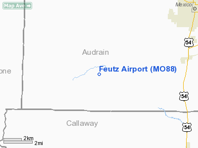
| From nearest city: | 5 nautical miles NE of Hatton, MO |
| Location: | Audrain County, MO |
| Magnetic Variation: | 03E (1985) |
Owner & Manager
| Ownership: | Privately owned |
| Owner: | E. B. Feutz |
| Address: | Box 234, Rr 1
Mexico, MO 65265 |
| Phone number: | 314-581-4675 |
| Manager: | E. B. Feutz |
| Address: | Box 234, Rr 1
Mexico, MO 65265 |
| Phone number: | 573-581-4675 |
Airport Operations and Facilities
| Airport Use: | Private |
| Segmented Circle: | No |
| Control Tower: | No |
| Sectional chart: | Kansas City |
| Region: | ACE - Central |
| Boundary ARTCC: | ZKC - Kansas City |
| Tie-in FSS: | COU - Columbia |
| FSS on Airport: | No |
| FSS Toll Free: | 1-800-WX-BRIEF |
Runway Information
Runway 08/26
| Dimension: | 2600 x 100 ft / 792.5 x 30.5 m |
| Surface: | TURF, |
| |
Runway 08 |
Runway 26 |
| Traffic Pattern: | Left | Left |
|
Radio Navigation Aids
| ID |
Type |
Name |
Ch |
Freq |
Var |
Dist |
| FTT | NDB | Guthrie | | 317.00 | 03E | 15.5 nm |
| ONH | NDB | Noah | | 515.00 | 03E | 29.9 nm |
| VER | NDB | Viertel | | 347.00 | 02E | 32.8 nm |
| JE | NDB | Algoa | | 397.00 | 03E | 33.3 nm |
| HAE | NDB | Hannibal | | 411.00 | 03E | 45.8 nm |
| COU | VOR/DME | Columbia | 039X | 110.20 | 03E | 19.9 nm |
| MCM | VOR/DME | Macon | 076X | 112.90 | 06E | 39.9 nm |
| HLV | VORTAC | Hallsville | 089X | 114.20 | 06E | 5.6 nm |
| JEF | VOT | Jefferson City | | 112.00 | | 31.4 nm |
Remarks
- PRVDD APCH TO EACH RWY MAINTAINED FOR A 20:1 GLIDE SLOPE AND THE TRANSITION SFC MAINTAINED FOR A 7:1 SLOPE.
Images and information placed above are from
http://www.airport-data.com/airport/MO88/
We thank them for the data!
| General Info
|
| Country |
United States
|
| State |
MISSOURI
|
| FAA ID |
MO88
|
| Latitude |
39-06-00.149N
|
| Longitude |
092-00-33.638W
|
| Elevation |
890 feet
|
| Near City |
HATTON
|
We don't guarantee the information is fresh and accurate. The data may
be wrong or outdated.
For more up-to-date information please refer to other sources.
|
|


