 |
|
Location & QuickFacts
| FAA Information Effective: | 2008-09-25 |
| Airport Identifier: | FES |
| Airport Status: | Operational |
| Longitude/Latitude: | 090-23-07.5350W/38-11-41.7950N
-90.385426/38.194943 (Estimated) |
| Elevation: | 433 ft / 131.98 m (Surveyed) |
| Land: | 72 acres |
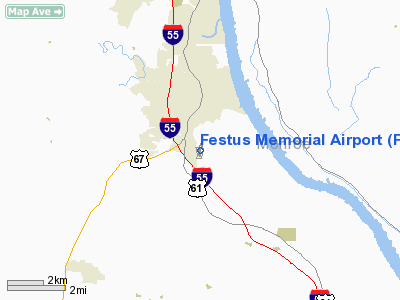
| From nearest city: | 2 nautical miles S of Festus, MO |
| Location: | Jefferson County, MO |
| Magnetic Variation: | 01E (1990) |
Owner & Manager
| Ownership: | Publicly owned |
| Owner: | City Of Festus |
| Address: | 711 W Main
Festus, MO 63028 |
| Phone number: | 314-937-4694 |
| Manager: | Steve Vogt |
| Address: | 900 Arpt Rd
Festus, MO 63028 |
| Phone number: | 636-937-2228 |
Airport Operations and Facilities
| Airport Use: | Open to public |
| Wind indicator: | Yes |
| Segmented Circle: | No |
| Control Tower: | No |
| Lighting Schedule: | DUSK-DAWN
ACTVT MIRL RY 18/36; REIL RY 36 - CTAF. VASI RYS 18 & 36 OPERATES 24 HRS. |
| Beacon Color: | Clear-Green (lighted land airport) |
| Landing fee charge: | No |
| Sectional chart: | St Louis |
| Region: | ACE - Central |
| Boundary ARTCC: | ZKC - Kansas City |
| Tie-in FSS: | STL - Saint Louis |
| FSS on Airport: | No |
| FSS Toll Free: | 1-800-WX-BRIEF |
| NOTAMs Facility: | STL (NOTAM-d service avaliable) |
| Federal Agreements: | Y1 |
Airport Communications
| CTAF: | 122.700 |
| Unicom: | 122.700 |
Airport Services
| Fuel available: | 100LL
24 HR. CREDIT CARD. |
| Airframe Repair: | MINOR |
| Power Plant Repair: | MAJOR |
| Bottled Oxygen: | NONE |
| Bulk Oxygen: | NONE |
Runway Information
Runway 18/36
| Dimension: | 2202 x 49 ft / 671.2 x 14.9 m |
| Surface: | ASPH, Poor Condition
PAVEMENT HAS GRASS GROWING IN CRACKS & LOOSE AGGREGATE. |
| Surface Treatment: | Aggregate Friction Seal Coat |
| Weight Limit: | Single wheel: 8000 lbs. |
| Edge Lights: | Non-standard lighting system
NSTD MIRL; INCORRECT SPACING OF THLD LGTS & EDGE LIGHTS IN MIDDLE SECTION OF RY. |
| |
Runway 18 |
Runway 36 |
| Longitude: | 090-23-05.7070W | 090-23-09.3850W |
| Latitude: | 38-11-52.5600N | 38-11-30.9820N |
| Elevation: | 432.00 ft | 430.00 ft |
| Alignment: | 127 | 8 |
| Traffic Pattern: | Left | Left |
| Markings: | Nonstandard, Fair Condition
NSTD NPI MARKINGS; INCORRECT SPACING OF MARKINGS. OBSTRUCTED BY GRASS AND WEEDS. | Nonstandard, Fair Condition
NSTD NPI MARKINGS; INCORRECT SPACING OF MARKINGS. |
| VASI: | 2-box SAVASI on left side
VASI OTS INDEF. | 2-box SAVASI on left side |
| Runway End Identifier: | | Yes
REIL TOO CLOSE TO RY EDGE. |
| Obstruction: | 18 ft trees, 239.0 ft from runway, 97 ft left of centerline, 2:1 slope to clear
1-28 FT TREES; BRUSH & ROAD 0-200 FT FM RY END 185-200 FT L; 1- 45 FT TREES & BRUSH 0-200 FT FM RY END 133-250 FT R. | 28 ft trees, 313.0 ft from runway, 159 ft right of centerline, 4:1 slope to clear
1-20 FT BRUSH & TREES 0-35FT FM RY END 190-250 FT R.; +1-12 FT BRUSH, 0-200 FT FM RY END, 65-200 FT L. |
|
Radio Navigation Aids
| ID |
Type |
Name |
Ch |
Freq |
Var |
Dist |
| FES | NDB | Festus | | 269.00 | 01E | 0.1 nm |
| PRI | NDB | Perrine | | 367.00 | 02E | 25.9 nm |
| SAR | NDB | Sparta | | 239.00 | 01E | 32.4 nm |
| BL | NDB | Belleville | | 362.00 | 02E | 33.8 nm |
| LM | NDB | Oblio | | 338.00 | 00E | 36.6 nm |
| UUV | NDB | Sullivan | | 356.00 | 02E | 36.8 nm |
| CVM | NDB | Civic Memorial | | 263.00 | 02E | 44.7 nm |
| UBX | NDB | Cuba | | 380.00 | 01E | 49.9 nm |
| SKE | TACAN | Scott | 059X | | 02E | 32.8 nm |
| CSX | VOR/DME | Cardinal | 111Y | 116.45 | 00E | 33.5 nm |
| FAM | VORTAC | Farmington | 104X | 115.70 | 01E | 32.2 nm |
| TOY | VORTAC | Troy | 107X | 116.00 | 04E | 39.4 nm |
| STL | VORTAC | St Louis | 121X | 117.40 | 01E | 40.3 nm |
| FTZ | VORTAC | Foristell | 045X | 110.80 | 05E | 40.8 nm |
| SUS | VOT | Spirit Of St Louis | | 112.20 | | 30.8 nm |
| STL | VOT | St Louis Lambert | | 111.00 | | 33.3 nm |
Remarks
- NTSD RY SAFETY AREA BYND EACH RY END; RY 18 HAS LARGE DROP OFF 118 FT FM RY END; RY 36 HAS ROLLING & STEEP TERRAIN.
Images and information placed above are from
http://www.airport-data.com/airport/FES/
We thank them for the data!
| General Info
|
| Country |
United States
|
| State |
MISSOURI
|
| FAA ID |
FES
|
| Latitude |
38-11-41.795N
|
| Longitude |
090-23-07.535W
|
| Elevation |
433 feet
|
| Near City |
FESTUS
|
We don't guarantee the information is fresh and accurate. The data may
be wrong or outdated.
For more up-to-date information please refer to other sources.
|
|


