 |
|
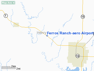
Ferros Ranch-aero Airport |
Location & QuickFacts
| FAA Information Effective: | 2008-09-25 |
| Airport Identifier: | 0MO0 |
| Airport Status: | Operational |
| Longitude/Latitude: | 093-51-00.7750W/38-24-37.0710N
-93.850215/38.410297 (Estimated) |
| Elevation: | 775 ft / 236.22 m (Estimated) |
| Land: | 49 acres |
| From nearest city: | 1 nautical miles NW of Clinton, MO |
| Location: | Henry County, MO |
| Magnetic Variation: | 04E (1985) |
Owner & Manager
| Ownership: | Privately owned |
| Owner: | Lawrence Ferro |
| Address: | Box 261
Clinton, MO 64735 |
| Phone number: | 816-885-5757 |
| Manager: | Lawrence Ferro |
| Address: | Box 261
Clinton, MO 64735 |
| Phone number: | 816-885-4408 |
Airport Operations and Facilities
| Airport Use: | Private |
| Wind indicator: | Yes |
| Segmented Circle: | No |
| Control Tower: | No |
| Landing fee charge: | No |
| Sectional chart: | Kansas City |
| Region: | ACE - Central |
| Boundary ARTCC: | ZKC - Kansas City |
| Tie-in FSS: | COU - Columbia |
| FSS on Airport: | No |
| FSS Toll Free: | 1-800-WX-BRIEF |
Airport Services
| Fuel available: | 80 |
| Airframe Repair: | NONE |
| Power Plant Repair: | NONE |
Runway Information
Runway 12/30
| Dimension: | 1685 x 120 ft / 513.6 x 36.6 m |
| Surface: | TURF, |
| |
Runway 12 |
Runway 30 |
| Traffic Pattern: | Left | Left |
|
Radio Navigation Aids
| ID |
Type |
Name |
Ch |
Freq |
Var |
Dist |
| GLY | NDB | Golden Valley | | 388.00 | 04E | 8.4 nm |
| HCK | NDB | Hawks | | 296.00 | 04E | 18.5 nm |
| DMO | NDB | Sedalia | | 281.00 | 03E | 36.3 nm |
| EAD | NDB | Nevada | | 209.00 | 06E | 39.4 nm |
| LXT | NDB | Lesumit | | 263.00 | 04E | 41.1 nm |
| PUR | NDB | Marshall | | 371.00 | 03E | 48.8 nm |
| SZL | TACAN | Whiteman | 035X | | 04E | 24.1 nm |
| OJC | VOR/DME | Johnson County | 077X | 113.00 | 06E | 49.0 nm |
| BUM | VORTAC | Butler | 106X | 115.90 | 07E | 31.2 nm |
| ANX | VORTAC | Napoleon | 087X | 114.00 | 07E | 43.2 nm |
Images and information placed above are from
http://www.airport-data.com/airport/0MO0/
We thank them for the data!
| General Info
|
| Country |
United States
|
| State |
MISSOURI
|
| FAA ID |
0MO0
|
| Latitude |
38-24-37.071N
|
| Longitude |
093-51-00.775W
|
| Elevation |
775 feet
|
| Near City |
CLINTON
|
We don't guarantee the information is fresh and accurate. The data may
be wrong or outdated.
For more up-to-date information please refer to other sources.
|
|


