 |
|
Location & QuickFacts
| FAA Information Effective: | 2008-09-25 |
| Airport Identifier: | 12MO |
| Airport Status: | Operational |
| Longitude/Latitude: | 093-35-40.7620W/38-34-50.0590N
-93.594656/38.580572 (Estimated) |
| Elevation: | 990 ft / 301.75 m (Estimated) |
| Land: | 0 acres |
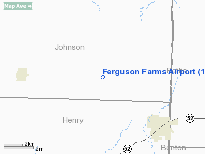
| From nearest city: | 4 nautical miles NW of Windsor, MO |
| Location: | Johnson County, MO |
| Magnetic Variation: | 04E (1985) |
Owner & Manager
| Ownership: | Privately owned |
| Owner: | Bob Ferguson |
| Address: | Rr 1
Windsor, MO 65360 |
| Phone number: | 660-647-2787 |
| Manager: | Bob Ferguson |
| Address: | Rr 1
Windsor, MO 65360 |
| Phone number: | 660-647-2787 |
Airport Operations and Facilities
| Airport Use: | Private |
| Wind indicator: | Yes |
| Segmented Circle: | No |
| Control Tower: | No |
| Landing fee charge: | No |
| Sectional chart: | Kansas City |
| Region: | ACE - Central |
| Boundary ARTCC: | ZKC - Kansas City |
| Tie-in FSS: | COU - Columbia |
| FSS on Airport: | No |
| FSS Toll Free: | 1-800-WX-BRIEF |
Airport Services
| Airframe Repair: | NONE |
| Power Plant Repair: | NONE |
Runway Information
Runway NE/SW
| Dimension: | 3000 x 50 ft / 914.4 x 15.2 m |
| Surface: | TURF, |
| |
Runway NE |
Runway SW |
| Traffic Pattern: | Left | Left |
|
Radio Navigation Aids
| ID |
Type |
Name |
Ch |
Freq |
Var |
Dist |
| HCK | NDB | Hawks | | 296.00 | 04E | 3.1 nm |
| GLY | NDB | Golden Valley | | 388.00 | 04E | 14.0 nm |
| DMO | NDB | Sedalia | | 281.00 | 03E | 21.0 nm |
| PUR | NDB | Marshall | | 371.00 | 03E | 33.4 nm |
| LXT | NDB | Lesumit | | 263.00 | 04E | 43.0 nm |
| VER | NDB | Viertel | | 347.00 | 02E | 48.1 nm |
| SZL | TACAN | Whiteman | 035X | | 04E | 9.6 nm |
| ANX | VORTAC | Napoleon | 087X | 114.00 | 07E | 39.8 nm |
| BUM | VORTAC | Butler | 106X | 115.90 | 07E | 46.0 nm |
Remarks
- CATTLE ON FLD FROM TIME TO TIME.
Images and information placed above are from
http://www.airport-data.com/airport/12MO/
We thank them for the data!
| General Info
|
| Country |
United States
|
| State |
MISSOURI
|
| FAA ID |
12MO
|
| Latitude |
38-34-50.059N
|
| Longitude |
093-35-40.762W
|
| Elevation |
990 feet
|
| Near City |
WINDSOR
|
We don't guarantee the information is fresh and accurate. The data may
be wrong or outdated.
For more up-to-date information please refer to other sources.
|
|


