 |
|
Location & QuickFacts
| FAA Information Effective: | 2008-09-25 |
| Airport Identifier: | 61MU |
| Airport Status: | Operational |
| Longitude/Latitude: | 094-47-01.7620W/39-35-17.4860N
-94.783823/39.588191 (Estimated) |
| Elevation: | 1054 ft / 321.26 m (Estimated) |
| Land: | 35 acres |
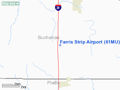
| From nearest city: | 1 nautical miles SE of Faucett, MO |
| Location: | Buchanan County, MO |
| Magnetic Variation: | 05E (1985) |
Owner & Manager
| Ownership: | Privately owned |
| Owner: | Farris Brothers |
| Address: |
Faucett, MO 64448 |
| Phone number: | 816-238-1584 |
| Manager: | Floyd Mc Elwain |
| Address: | P O Box 187
Faucett, MO 64448 |
| Phone number: | 816-238-5277 |
Airport Operations and Facilities
| Airport Use: | Private |
| Wind indicator: | Yes |
| Segmented Circle: | No |
| Control Tower: | No |
| Lighting Schedule: | PHONE REQ
FOR ROTG BCN PHONE 816-238-5277. |
| Beacon Color: | Clear (unlighted land airport)
STROBE LIGHT. |
| Landing fee charge: | No |
| Sectional chart: | Kansas City |
| Region: | ACE - Central |
| Boundary ARTCC: | ZKC - Kansas City |
| Tie-in FSS: | COU - Columbia |
| FSS on Airport: | No |
| FSS Toll Free: | 1-800-WX-BRIEF |
Airport Services
| Airframe Repair: | NONE |
| Power Plant Repair: | NONE |
| Bottled Oxygen: | NONE |
| Bulk Oxygen: | NONE |
Runway Information
Runway 16/34
| Dimension: | 2100 x 20 ft / 640.1 x 6.1 m |
| Surface: | ASPH, Poor Condition |
| |
Runway 16 |
Runway 34 |
| Traffic Pattern: | Left | Left |
| Markings: | Numbers only, Poor Condition | , |
| Runway End Identifier: | No | No |
| Centerline Lights: | No | No |
| Touchdown Lights: | No | No |
| Obstruction: | 15 ft ant, 480.0 ft from runway, 18:1 slope to clear
+16' SIGN 160' FROM RWY END 95' LEFT. | 22 ft trees, 200.0 ft from runway, 100 ft left of centerline
+25' TREES AT RWY END TO 200' FROM RWY END 70' TO 120' LEFT. |
|
Radio Navigation Aids
| ID |
Type |
Name |
Ch |
Freq |
Var |
Dist |
| AZN | NDB | Amazon | | 233.00 | 06E | 18.7 nm |
| DO | NDB | Dotte | | 359.00 | 05E | 22.1 nm |
| EZZ | NDB | Cameron | | 394.00 | 03E | 25.1 nm |
| GPH | NDB | Mosby | | 284.00 | 03E | 26.5 nm |
| GQ | NDB | Norge | | 517.00 | 05E | 32.2 nm |
| GKB | NDB | Norge | | 517.00 | 05E | 32.2 nm |
| LXT | NDB | Lesumit | | 263.00 | 04E | 42.3 nm |
| EVU | NDB | Emville | | 317.00 | 05E | 46.1 nm |
| FNB | NDB | Brenner | | 404.00 | 05E | 47.3 nm |
| RIS | VOR/DME | Riverside | 051X | 111.40 | 05E | 29.4 nm |
| RBA | VOR/DME | Robinson | 019X | 108.20 | 04E | 33.5 nm |
| BQS | VOR/DME | Braymer | 049X | 111.20 | 03E | 42.1 nm |
| OJC | VOR/DME | Johnson County | 077X | 113.00 | 06E | 45.0 nm |
| MCI | VORTAC | Kansas City | 079Y | 113.25 | 05E | 18.3 nm |
| STJ | VORTAC | St Joseph | 102X | 115.50 | 08E | 23.3 nm |
| ANX | VORTAC | Napoleon | 087X | 114.00 | 07E | 42.5 nm |
| TOP | VORTAC | Topeka | 125X | 117.80 | 05E | 44.7 nm |
| MKC | VOT | Kansas City Downtown | | 108.60 | | 29.3 nm |
Remarks
- BROKEN PAVEMENT AND LOOSE ROCK ON RWY.
Images and information placed above are from
http://www.airport-data.com/airport/61MU/
We thank them for the data!
| General Info
|
| Country |
United States
|
| State |
MISSOURI
|
| FAA ID |
61MU
|
| Latitude |
39-35-17.486N
|
| Longitude |
094-47-01.762W
|
| Elevation |
1054 feet
|
| Near City |
FAUCETT
|
We don't guarantee the information is fresh and accurate. The data may
be wrong or outdated.
For more up-to-date information please refer to other sources.
|
|


